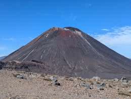
(Bernie) Most of yesterday the mountain tops had been wreathed in cloud but during the evening the clouds cleared revealing our first view of the conical mountain Ngaruhoe and the snowy peak of Ruapehu. Clear skies meant a chilly night but we were snug in our sleeping bags and slept well. We woke at 6am to beautiful clear skies, made coffee, cooked up our porridge and were set to go by 7.15.
The first part of the day overlaps with the famous Tongariro Alpine Crossing – a day walk rightly billed as one of the best day walks in the world. It is an end to end walk so shuttle buses collect walkers from the end and deliver them to a car park just below the Mangetepopo hut. We were told the first shuttle buses drop walkers off at the start carpark, which is half an or so down from the campsite; so if you want to avoid the crowds you needed to leave at either 6am or 10am. We didn’t want to do either of those so decided just to go with the flow. Although there were plenty of people on the track it did not feel oppressive and the landscape was so awesome (taking the literal meaning of the word) nothing could detract from the day. It was one of the best day’s walking I have ever done.
The first part of the day took us up a gentle valley with the steep climb out of the valley ahead of us. We had our first good views of the amazing Ngaruhoe volcano as we crossed the old, and not so old, lava fields. Signs warned us that we were entering an active volcanic area. The volcanos in Tongariro erupt with reasonable regularity – luckily mostly small eruptions are limited to steam or ash, although these can still do a good deal of damage. The last eruption experienced on the track was in the 1970’s and described as a very near miss for a walking group – so not so very long ago. Huge boulders told of the massive eruptions of times past.
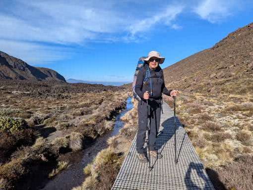
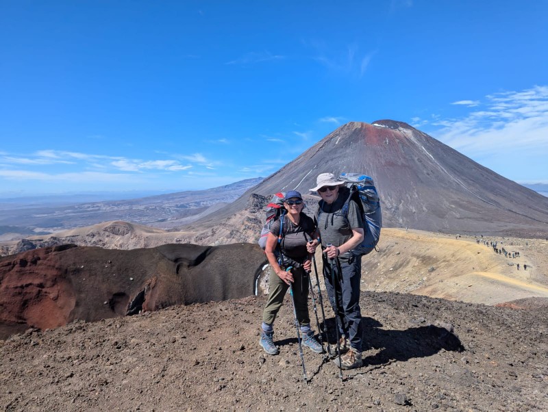
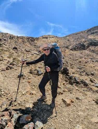
At the base of the climb further signs gave warnings that people should turn back if the weather looked bad or they were feeling unfit. We learned that about two people a week are airlifted off the track during the summer season. However, today the skies were clear blue, the air was still and we were feeling invigorated; so we started the combination of steps and steeper path up to the first crater. We got into a steady pace and although not as fast as the youngsters overtaking us, we were not as slow as others and felt rather smug that we were making our way up with our heavy packs while others had day packs (small pleasures, ridiculous of course!). The ever expanding, stunning views begged for frequent stops to gape in any case and to capture in photos.
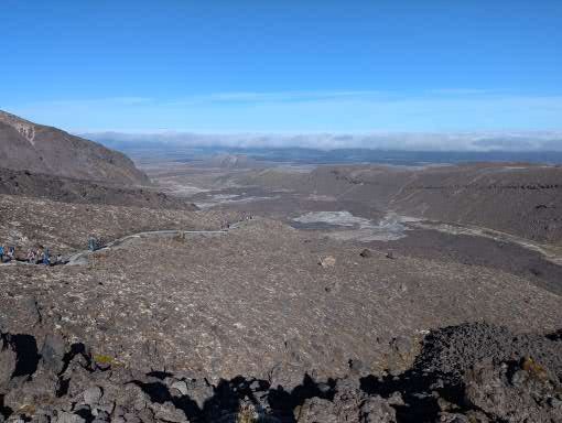
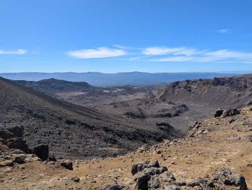
Suddenly we were stepping into the South Crater with a pancake flat base. We stopped for a break overlooking a smaller side crater with views up the red and black side of the volcano. A climb out of the far side of the crater to the Mangatepopo saddle opened up the views on the other side to the Oturere valley.
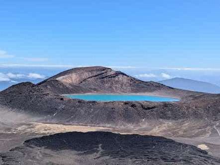
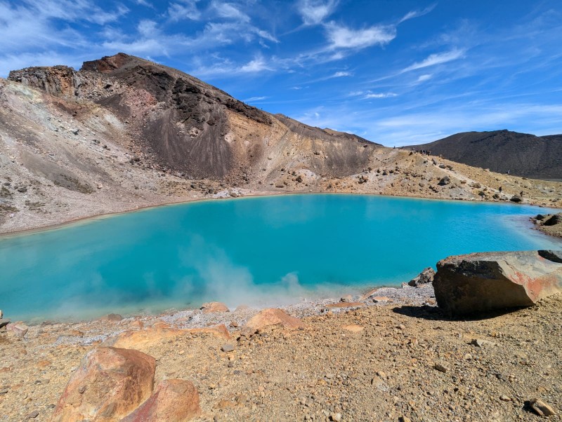
A last fairly steep climb took us to the highest point of the walk (1867m) with breathtaking views over the Red Crater, Tongariro mountain, the Blue Lake and Emerald lakes with their steaming fumeroles. I hope the photos do it justice.
We realised how lucky we were when we met the guide we were chatting to at the campsite the previous evening. He guides teenagers on their Duke of Edinburgh hikes (yes, DofE is in NZ) and had done the trail numerous times. He said he had never seen it so good – usually the top is on cloud. A ranger later described the weather as “one in a hundred day weather”. The summits of the mountains are sacred to the Maori (you are therefore not allowed to climb to the summits); for some reason the Maori gods were smiling on us today.
(David) I get the easier bit to write about – going down! But the first stretch was quite tricky, as we descended a steep shoulder with drops on either side. Underfoot it was moving sand and small rocks, and a bit like descending a scree with very small stones. Bernie took it easy and at one point stopped to allow a woman behind her to pass – but was told “No – I am following you – you are doing this descent so elegantly!”. Wholly unsurprisingly, no one complimented me on my descending technique as I staggered down trying not too lose my footing – when many did. No one tumbled off the sides – at least as far as we could see.
We stopped at the bottom by the fumeroles (wispy volcanic smoke coming from ground indicating activity just below the surface) in a small gap which was not overwhelmed by the stench of rotting eggs for our lunch – Ryvita, peanut butter and cheese! Whilst I accept this combination is not offered in the best restaurants, it was high calorie and delicious after 4 hours walking. Mary (one half of the Tasmanian couple joined us) whilst her partner, Polly, mooched around the volcanoes. They have a daughter who teaches geography in a tough school in Tassie, and were under strict instructions to take photos to bring life to her classes.
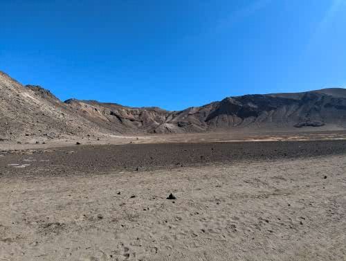
The paths split at this point – with the day packers on the TAC heading north to the end of their walk at Ketetahi car park and the TNC multi-day walkers heading towards Oturere hut. Suddenly the valley was deserted as we climbed down a section called the dragon’s tail. The Oturere Valley is high altitude desert with stunning rock formations. For those who have seen the Lords of the Rings films, this is the set for Mordor. By this point we were a tad tired, but met a jolly face coming the other way with a spade, clearing the track. This was Sally the Oturere hut ranger who told us we only had an hour to go, and all would be well! She was roughly right – it was about an hour but it stretched out as tiredness set in. But soon we went over a small ridge and there was the hut, nestling just below a ridge.
Sally had advised us to camp up on the ridge as she said the dawn was lovely from there. 90% of the time this is good advice; we were in the 10% when wiser heads would have pitched below the ridge line. But, in the calm of the afternoon, there seemed no reason not to take her advice.
Once the tent was pitched and a brew revived us, we ambled over to a stream for a wash and paddle. Mary had said she had “wallowed” in the water but she is clearly made of sterner stuff than me as I managed it up to my knees before screaming from the cold. But it did leave us cleaner than we had been for 48 hours.
Supper, reading, chat, brew, reading, more chat, funny stories, and early bed. That is the way of life on a trek and it is super enjoyable. I was stuck into a crappy book, loved the scenery and wished it could go on for ever. However, as the evening drew on, the wind got up and the lack of wisdom of our chosen campsite became clear. It was dry but blew a gale all night, with the sound of the wind trying to keep us awake – mainly unsuccessfully I can report. However the only reason the tent did not blow away down the valley was that it was weighed down our bodies! At one stage I got up to see if the guy ropes were holding – they were – and then went back to sleep. The woman in the next tent was on her own and claimed not to have slept a wink all night!

I enjoyed the photos. That is an interesting place. Thanks for sharing, David.