All posts by David Lock

Trip to the Osa Peninsular

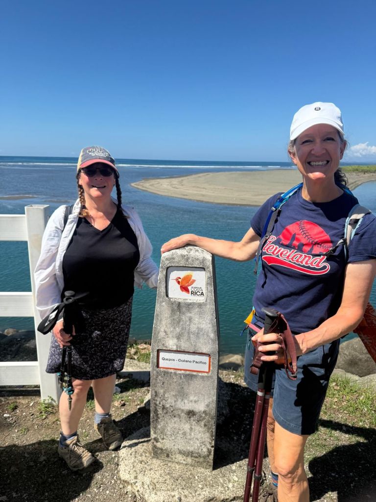
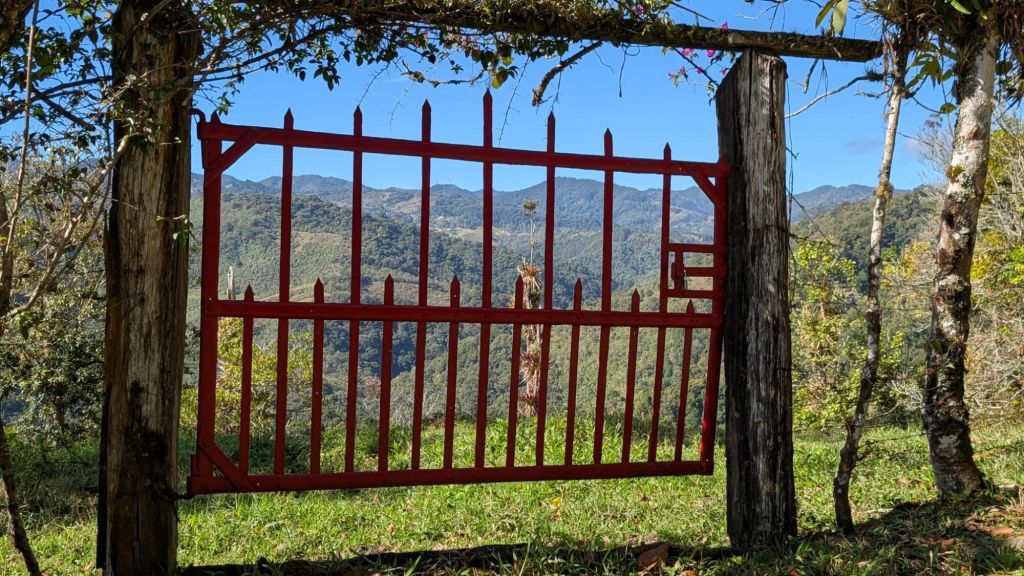
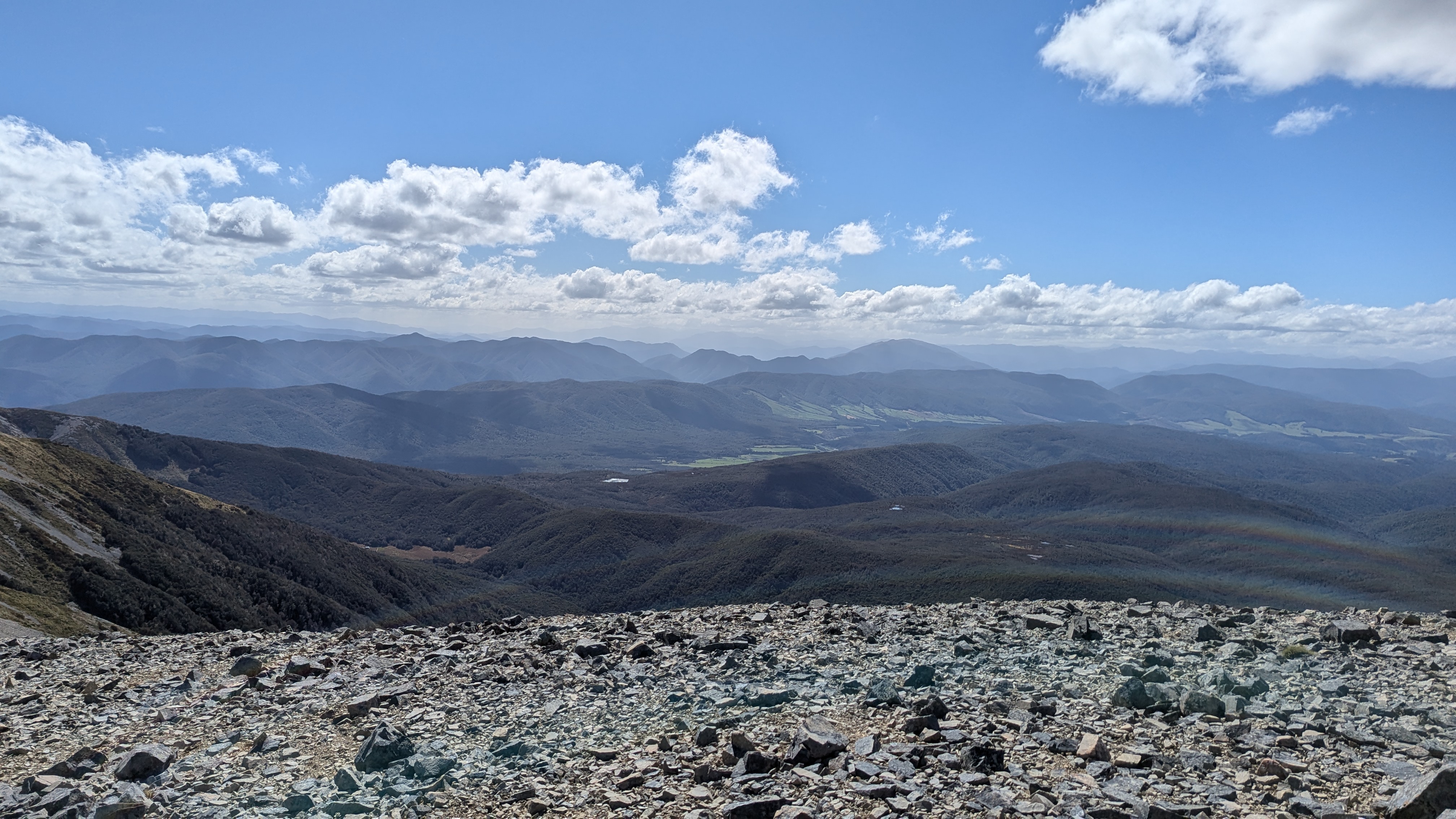
For those not well acquainted with Costa Rica (or who do not follow this blog with an open atlas), the Osa Peninsular is on the South Western coast of Costa Rica, about 210km south of Quepos (where the walk ended).  It is a classic “peninsular”, jutting out from the main landmass of the country and largely uninhabited.

We arrived by bus to Puerto Jiminez a few days ago late in the evening.  This small town, which is on the eastern side of the peninsula, is the southern gateway to Corcovado national park and was described as being less touristy than the northern gateway at Bahia Drake, which is on the pacific coast. It’s a pleasant, sleepy little town which lived up to its billing. Just 5 minutes or so to walk from one end of the main street to the other.  We did not see many tourists and, although tourism was clearly it’s main industry, it also feels like a proper, working town. We spent the next day sorting, planning and relaxing.  Then we set the alarm for 4.20am (yes – not a typo) and got up to walk the short distance to the pier to join an overnight trip to the Corcovado National Park, leaving at 5.30am. 

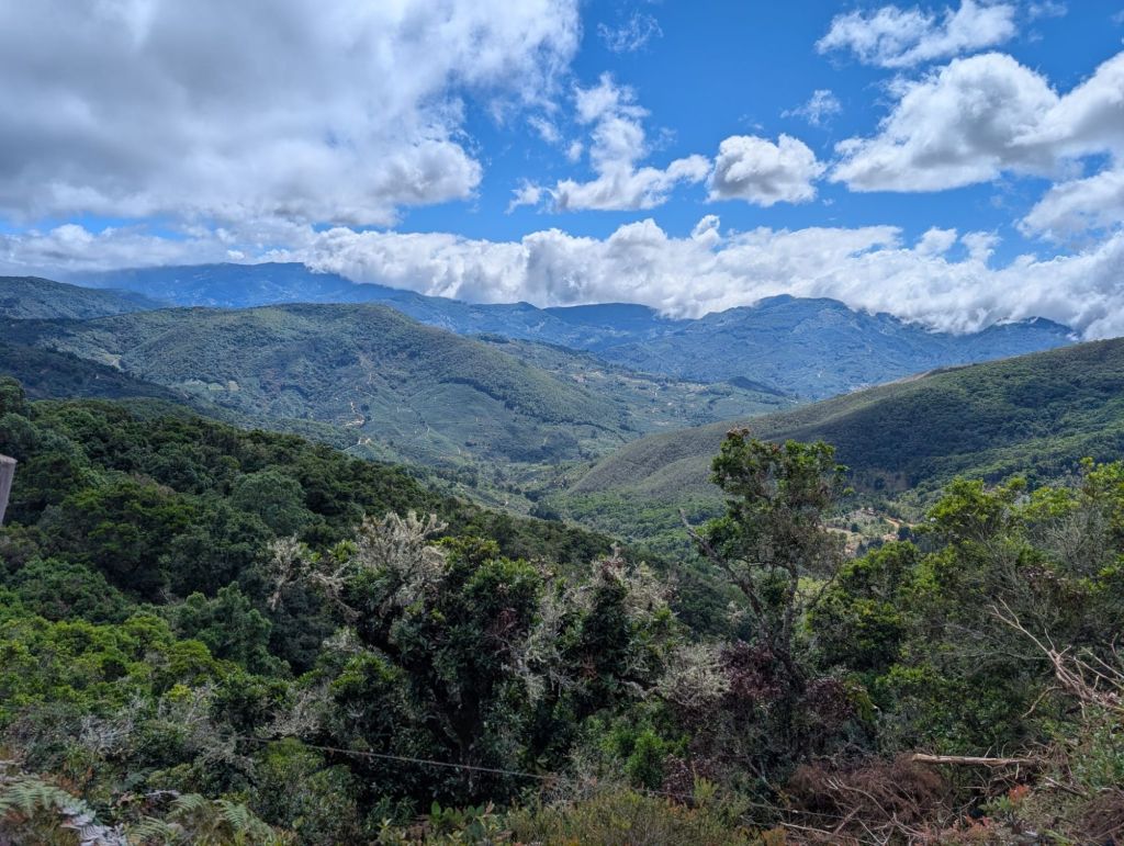
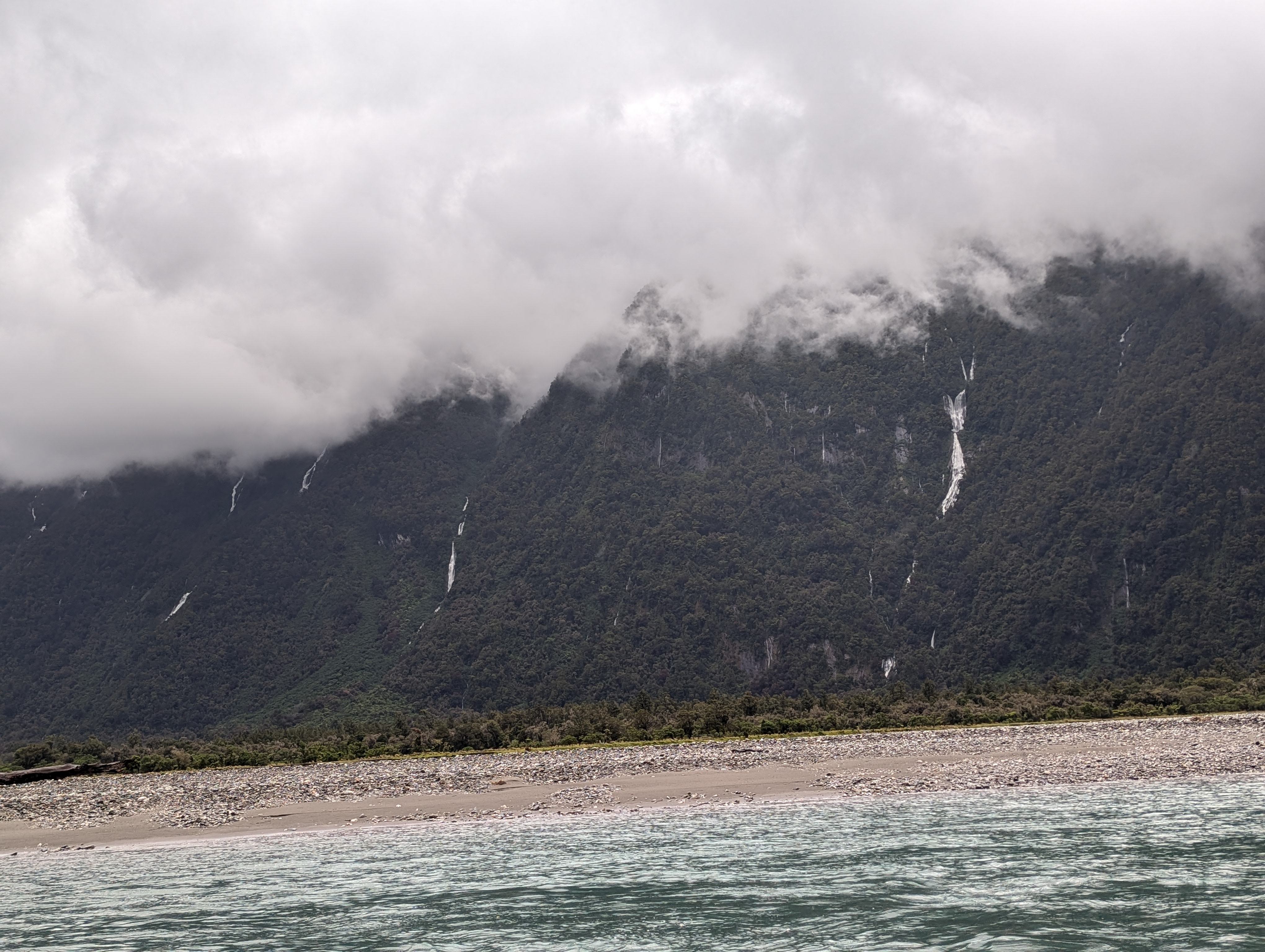
The current national park has a facinating and complex history, with competition between three groups in the 1960s and 1970s, namely a company that owned the land and wanted to exploit it for forestry and agriculture, squatters who had come to the land and were prospecting for gold and about a thousand scientists who realised the unique biodiversity of the area and campaigned to ensure that it could remain as a national park with unspoilt forest, resplendent with huge amounts of wildlife.  In short (and fortunately for today’s visitors) the scientists won.  They used their political connections to argue that this was too important a resource to be exploited and that Costa Rica’s future lay in eco-tourism.  The President supported them and the company did a major land swap with the government, which enabled a national park to be created in 1976.  It still took several years, lots of money and some force to eject the squatters (who had political support from the Costa Rican Communist Party – and that may not have wholly helped their cause), but the vast majority of the primary forest was saved for nature, science and eco-tourism.  Today, secondary forest has grown up in the last 50 years around the coast which had been cleared for either agriculture or prospecting, and the wildlife is just as abundant there is deeper in the jungle.

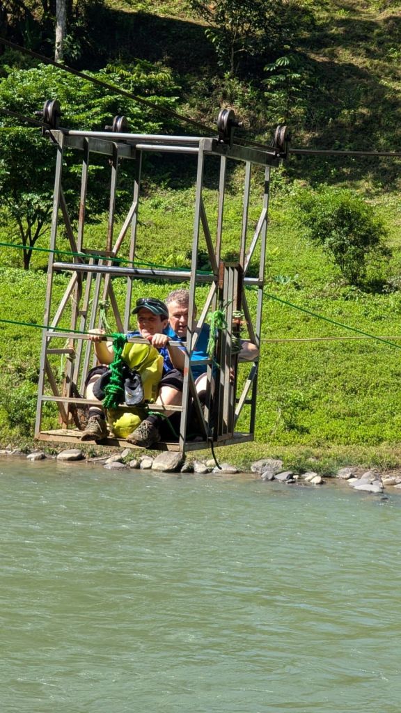
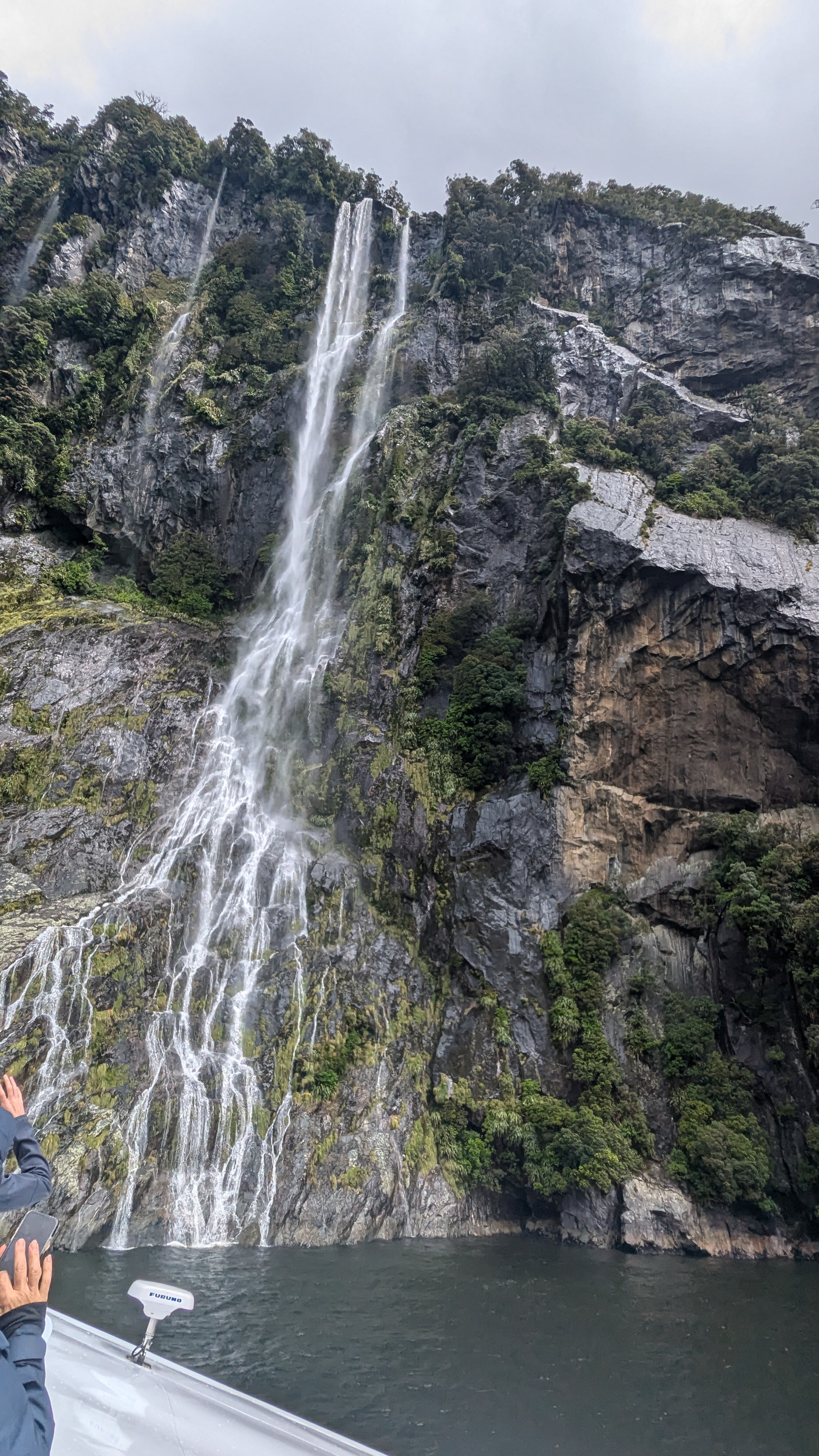
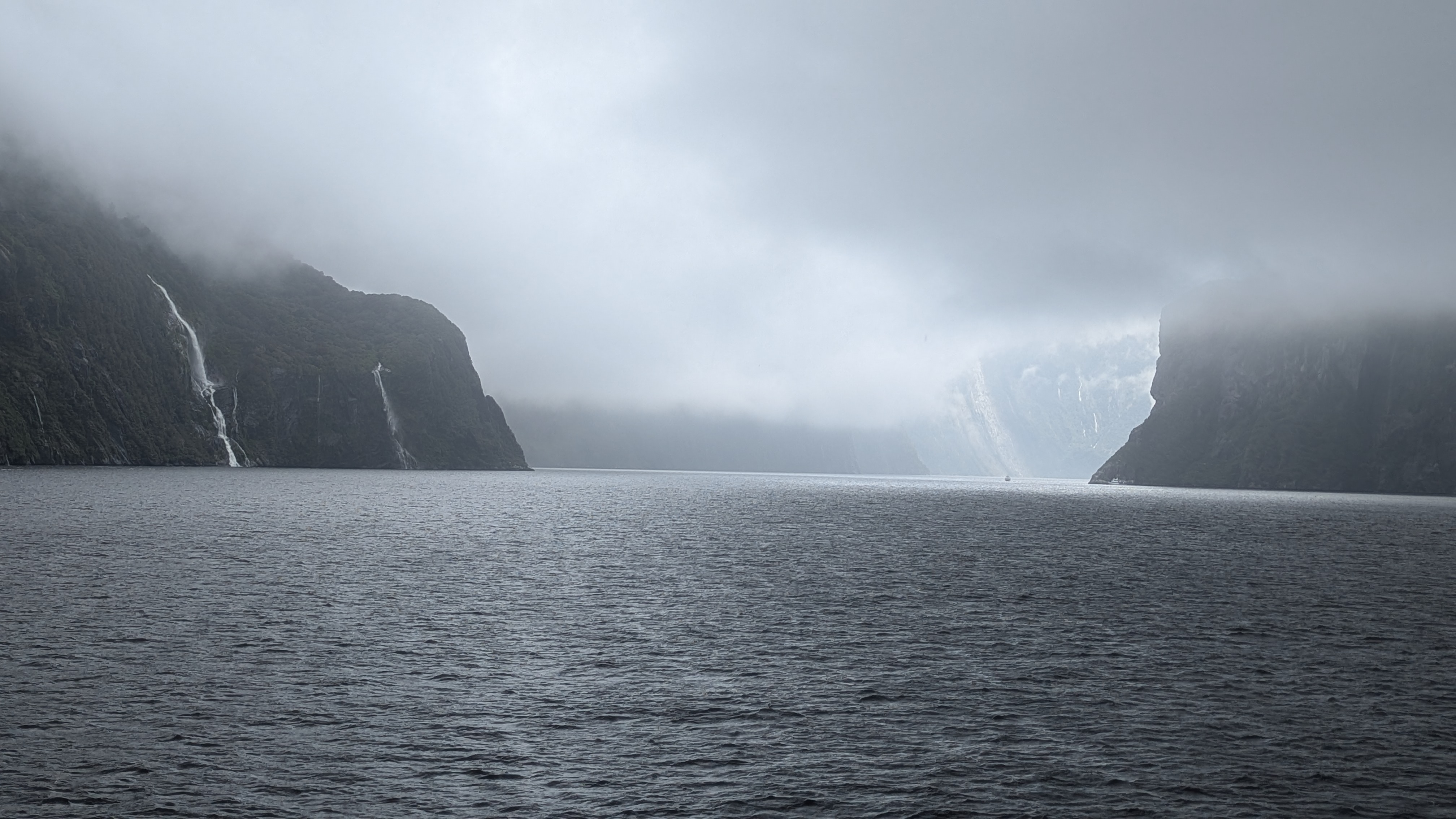
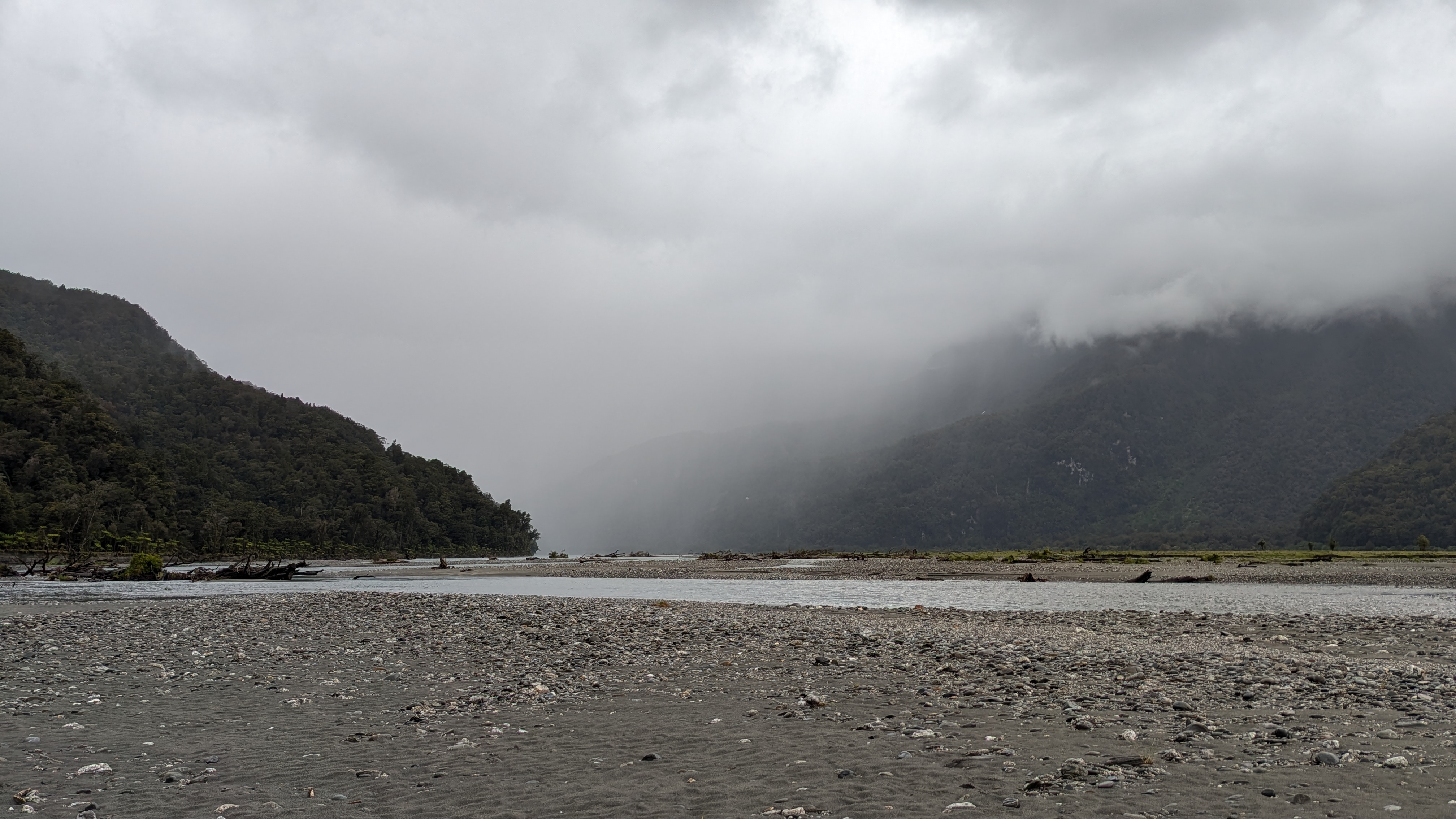
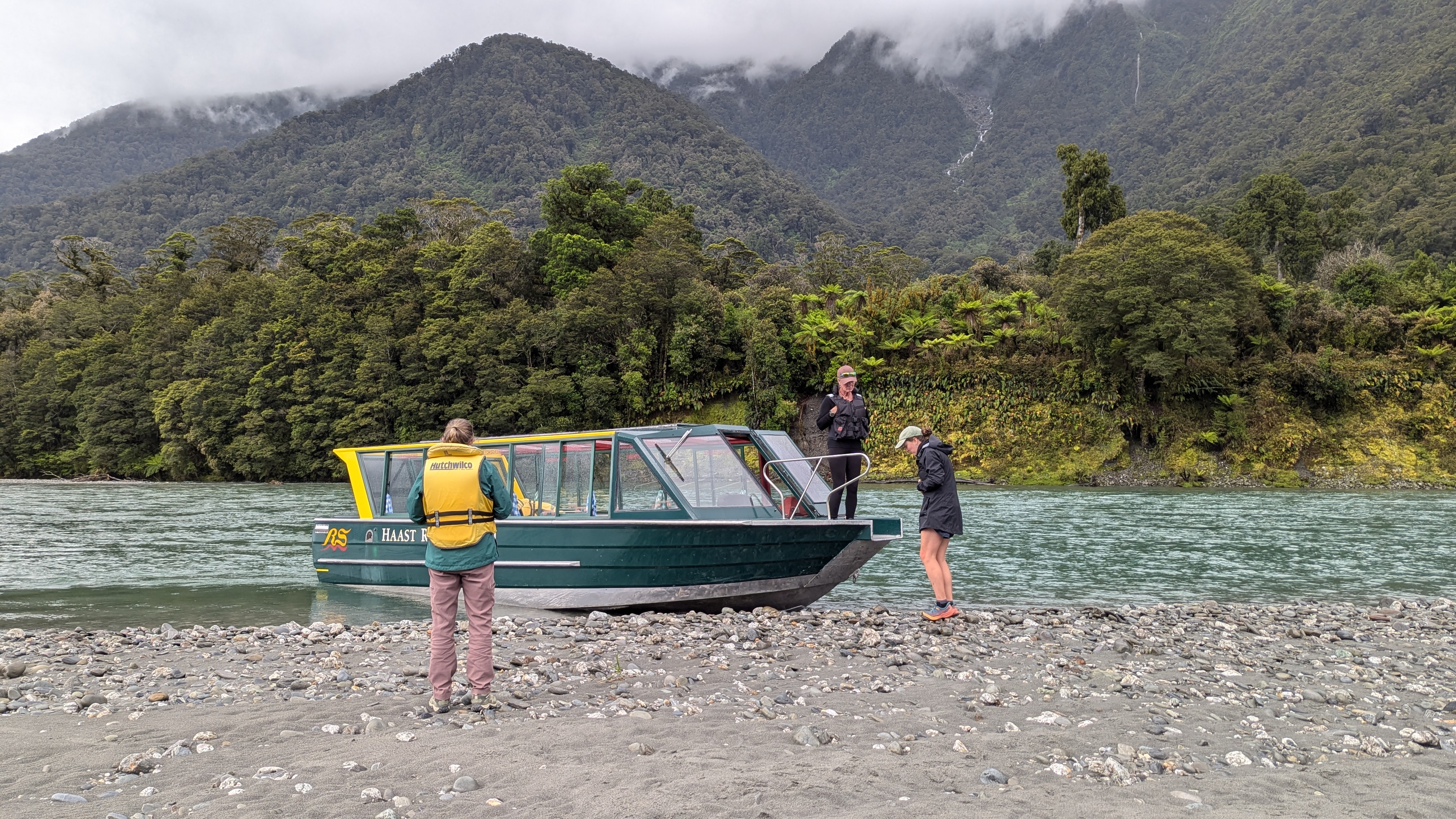
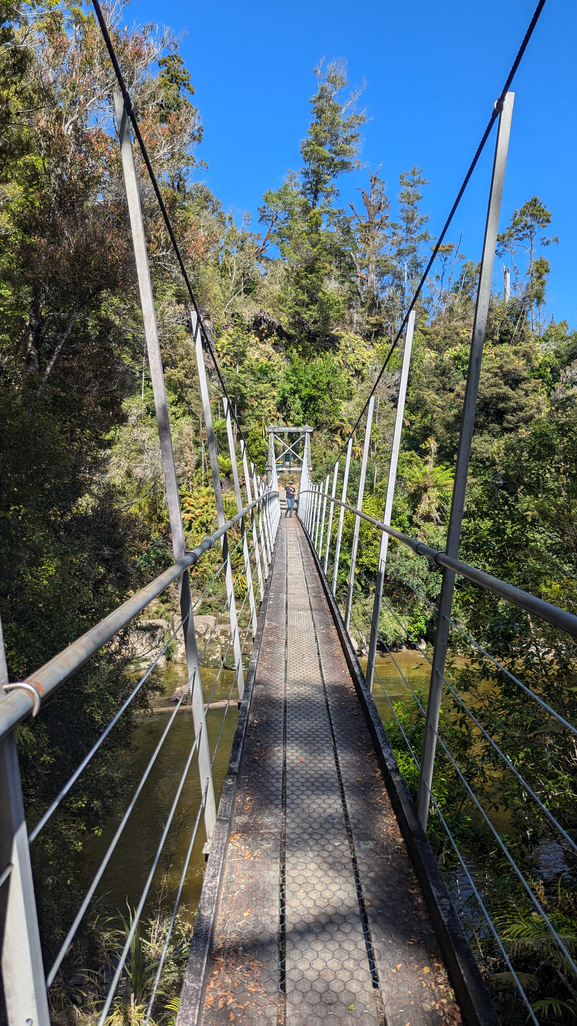
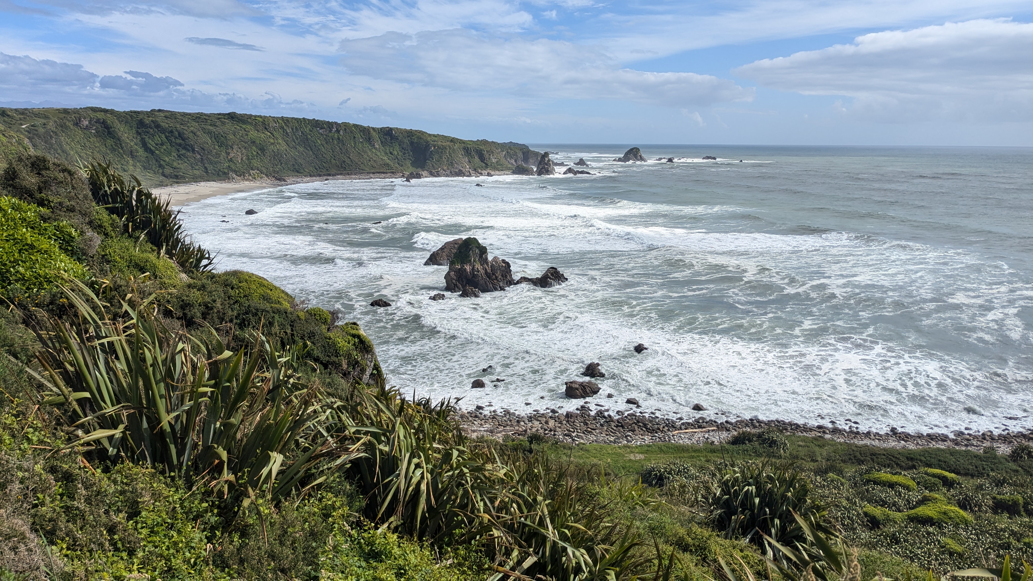
There are no roads to the park so we caught a fast boat – with two impressive outboard motors – from Puerto Jiminez to the ranger station area on the western side of the peninsular.  The boat ride was fine in the bay area but it got a bit bumpy when we got around the point and out to the main sea.  We saw dophins close up and sea turtles, with the boat stopping whenever there was anything interesting to see.  After an hour and a half we got to the coast but there is no jetty, so it was a case of getting off the back of the boat into the water, and wading to the shore.  There were about 20 tourists in our boat and several other boats as well, so it was all a bit of a scrum to get to the beach.

Once ashore, we changed into our boots, got our bags checks for impermissible items (such as food or single use plastic) and then met up with our guide, Fraser.   Then he began the first of 4 walkabouts in the forest.  Becoming an approved forest wildlife guide in Coast Rica is a serious business.   They study for years and develop a range of skills before being allowed loose on tourists like us.  The guides are astonishingly knowledgeable about the animals, birds, reptiles and the flora, as they lead small groups around the well marked trails.  The vast majority of the forest is off limits to tourists, although there is lots of science done here.  The tourists as given a small glimpse into the world of the jungle in exchange for paying (not small amounts) for the privilege – and it is a privilege.  This pays to create local jobs, but also pays to ensure the remainder of the forest is protected.  The economics are complicated but appear to work reasonably well.

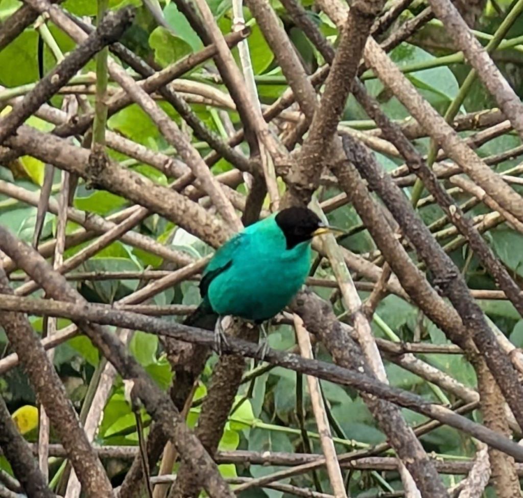
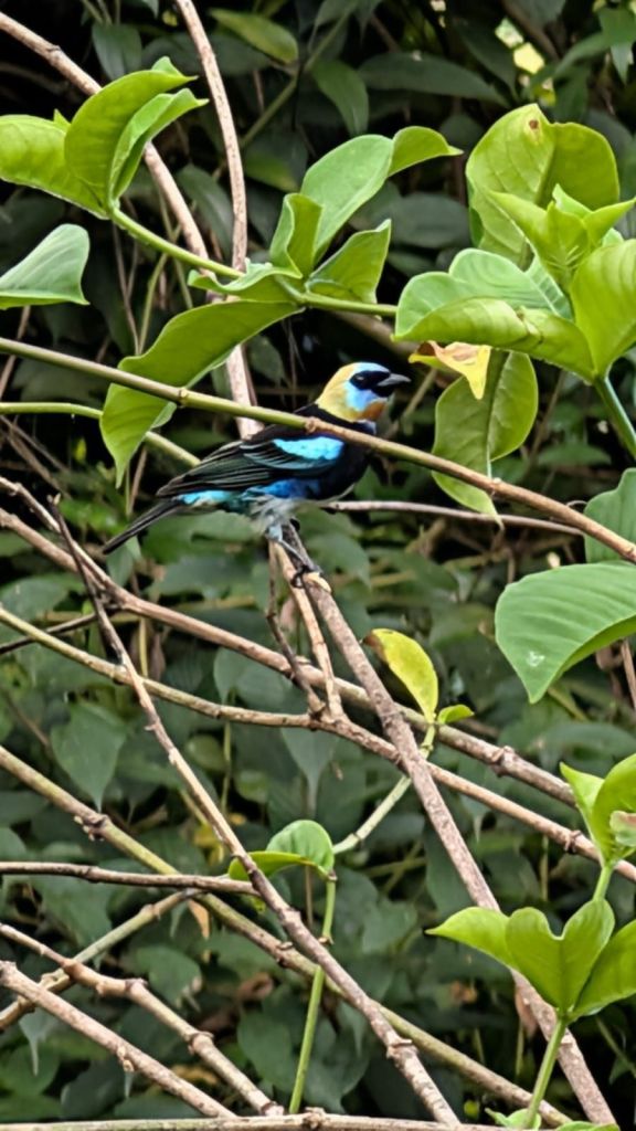
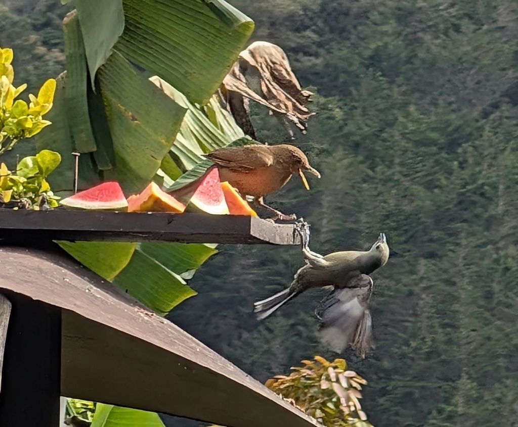
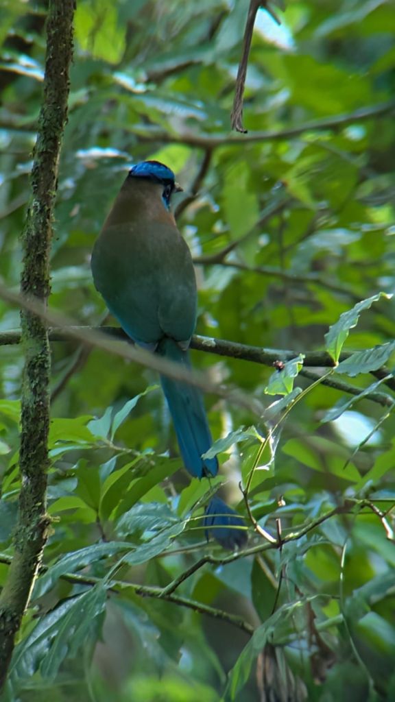
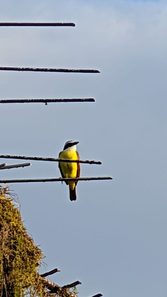
Fraser (like all the guides) carried a birders’ “scope” with him at all times, mounted on top of a tripod.  This meant that when he heard a bird sound he would listen carefully, locate the bird amongst the dense foliage, set up the scope pointing at the bird and then allow us to peer through the scope to see the birds.  I am in awe at this skill because the birds were nearly always impossible to see with the naked eye and I found it hopeless to look for them with my binoculars – all I could see was trees.  But with his assistance, we saw a vast range of colourful birds including Flycatchers, woodpeckers and humming birds. 

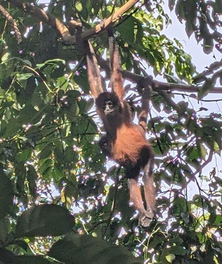
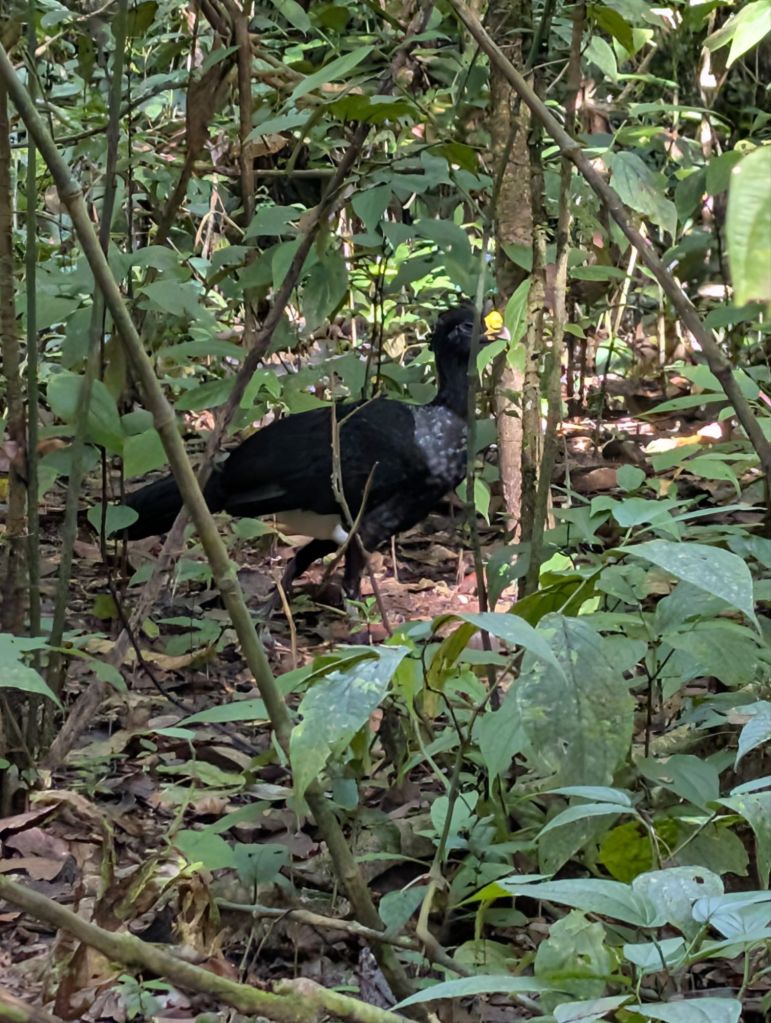
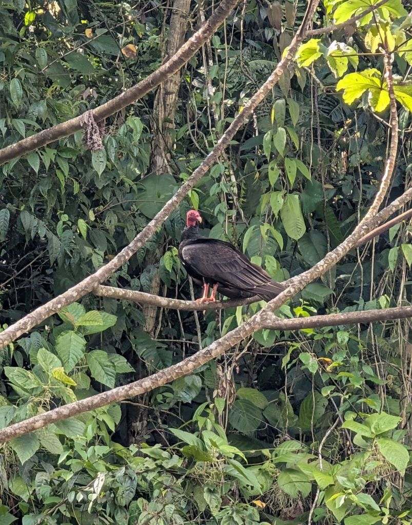
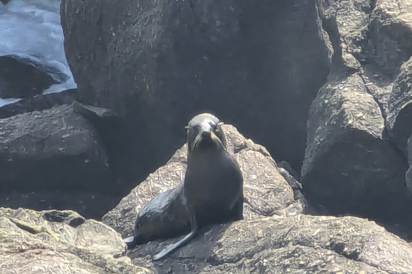
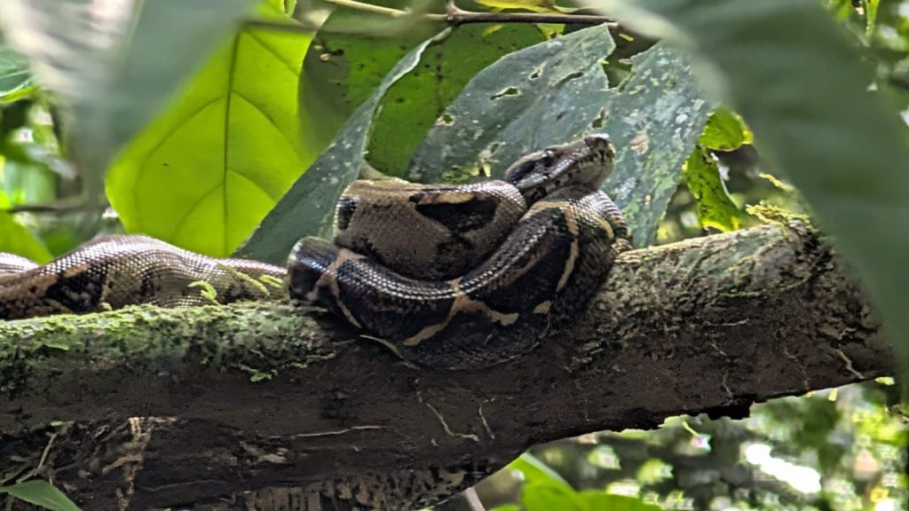
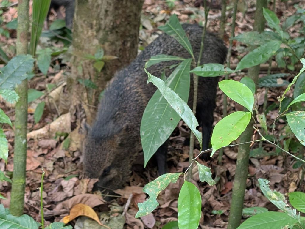
We also saw a variety of animals on the floor including agoutis, wild boar (native species), spotted wood quail, various types of hens, and many more.  We saw a ‘baby’ Boa Constrictor, perched on a branch next to the path which was ‘only’ a meter long – we were jolly glad not to see a full size adult! I think we saw all of the four types of monkeys in Costa Rica (the Mantled Howler, the Capuchin, the Squirrel Monkey and Spider Monkey).  The Howlers lived up to their names with loud calls which they get by having an internal reverberation system (a hole in the hyoid bone, which sits behind the vocal cords, which amplifies their calls 20 fold)

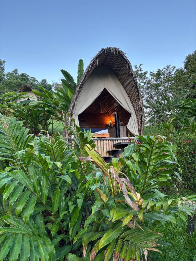
By 11am we were sweating buckets and tired, and Fraser took us along a path to the ranger station, where we were due to eat and spend the night.  The arrangements here were “primative” to say the least.  There were “showers”; cold water coming out of a pipe with no nossle.  Hugely welcome nonetheless and extremely refreshing in the hot humid environment!  The large bunk rooms could house up to 100 people overnight but were surprisingly comfortable, in the open air and each with its own mosquito net.

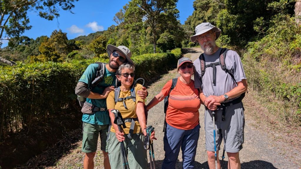
We had lunch, snoozed after our early start and then went out again at 2.30pm. The day trippers had left by then so we were down to just 4 people with Fraser, our guide – ourselves and a delightful honeymooning young couple from Boston.  Myrthe was from the Netherlans but doing a PhD in the colon cancer centre at Harvard and David was a Brazilian/American working for a start up.  We got to know them a bit over the couple of days and learned lots from them.

The small group meant we could go at a more leisurely pace, pausing to allow time for the animals to amble through the trees or on the forest floor and taking our time over the things we were interested in.

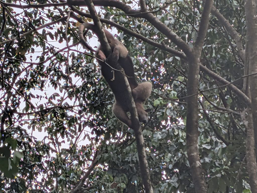
The highlight of the afternoon was following an anteater’s progress through the trees and then watching it descend to the floor.  It was a beautiful creature, maybe a metre long, and totally at ease in the high trees, going from branch to branch. Then it elegantly descended, totally ignoring about 20 tourists who were following its progress with camera phones. 

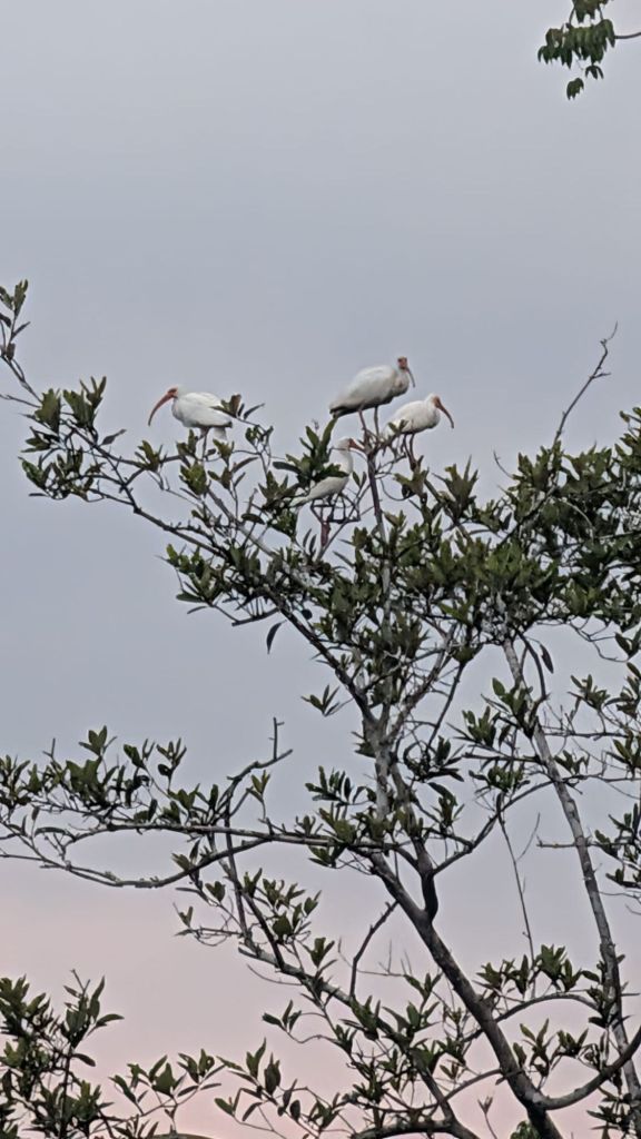
We watched the sun go down over the water and saw spoonbills and white ibis wading in the water and ‘formation flying’ from flocks of pelicans. Then we ambled back to the ranger station in the encircling gloom.  Supper was ready when we got back and we were in bed by 7.30pm, with all the centre lights going out at 8. 

The sense of lights out at 8 made sense as the first alarms in the bunk room started at 4am, with most people getting up in the next half hour.  Coffee was available at 4.30 (at exhorbitant cost but we were happy to view this as a contribution to the work of the national park – and a necessary caffeine boost). At 5am we were off again with Fraser – this time in the dark. The four of us paced behind in the eirie forest, with the noise of the Howler’s echoing in the distance, following Frasers powerful torch beam. We were on the trail of the elusive Tapir – a shy, noturnal inhabitant of the forest. Our destination the river where we had ended the previous day, in the hope that we would see a Tapir coming down to drink.  We arrived just as the first glimmers of light shone on the clouds. As it got lighter and ligher, more and more groups arrived, but we were all to be disappointed on this occasion as the Tapirs weren’t playing ball. In a ‘good’ week only 2 or 3 sightings are made so not altogether surprising. We tramped back to the lodge for a welcome breakfast.

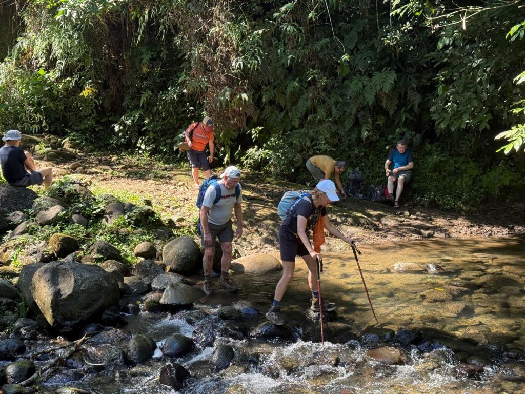
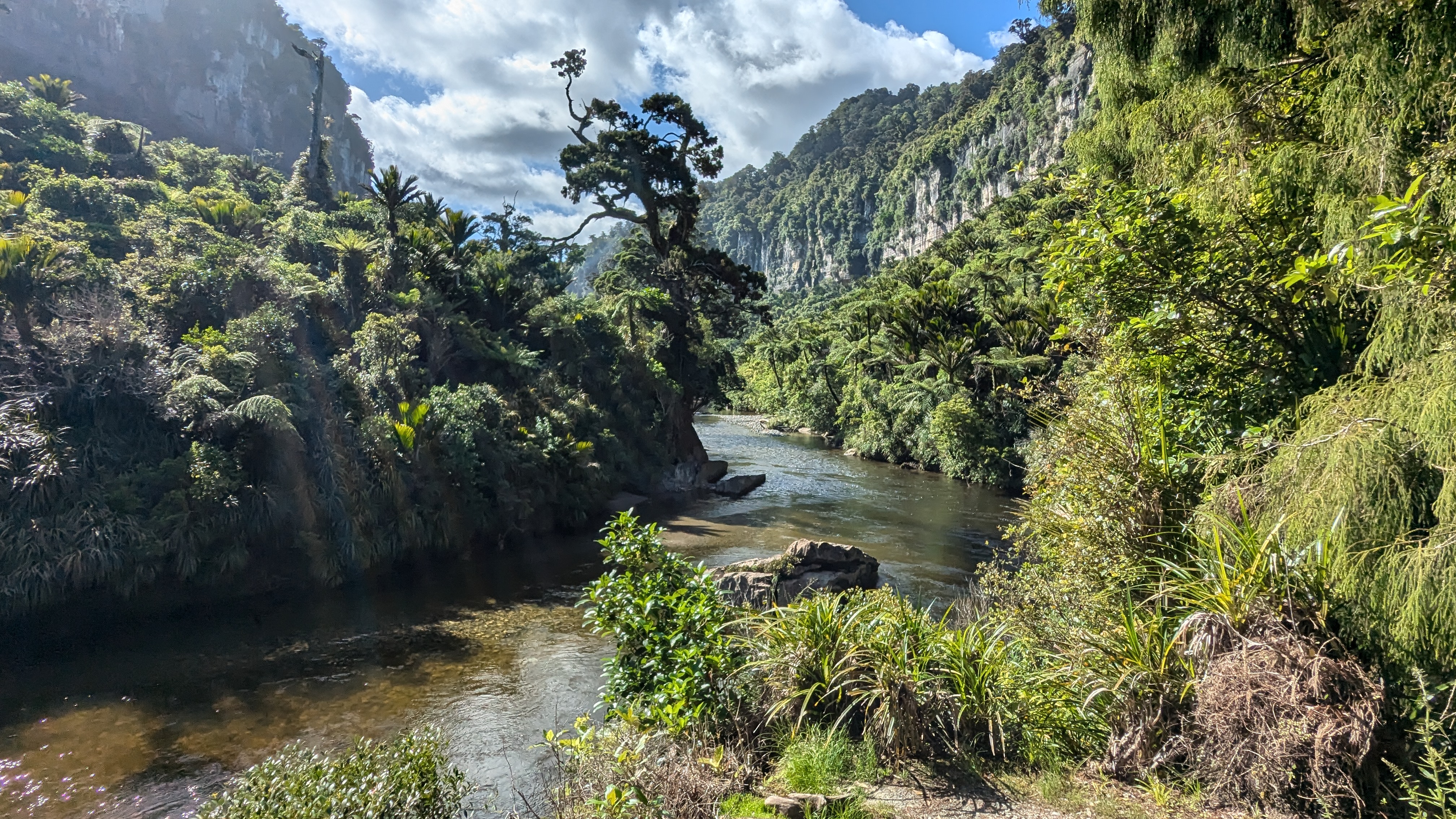
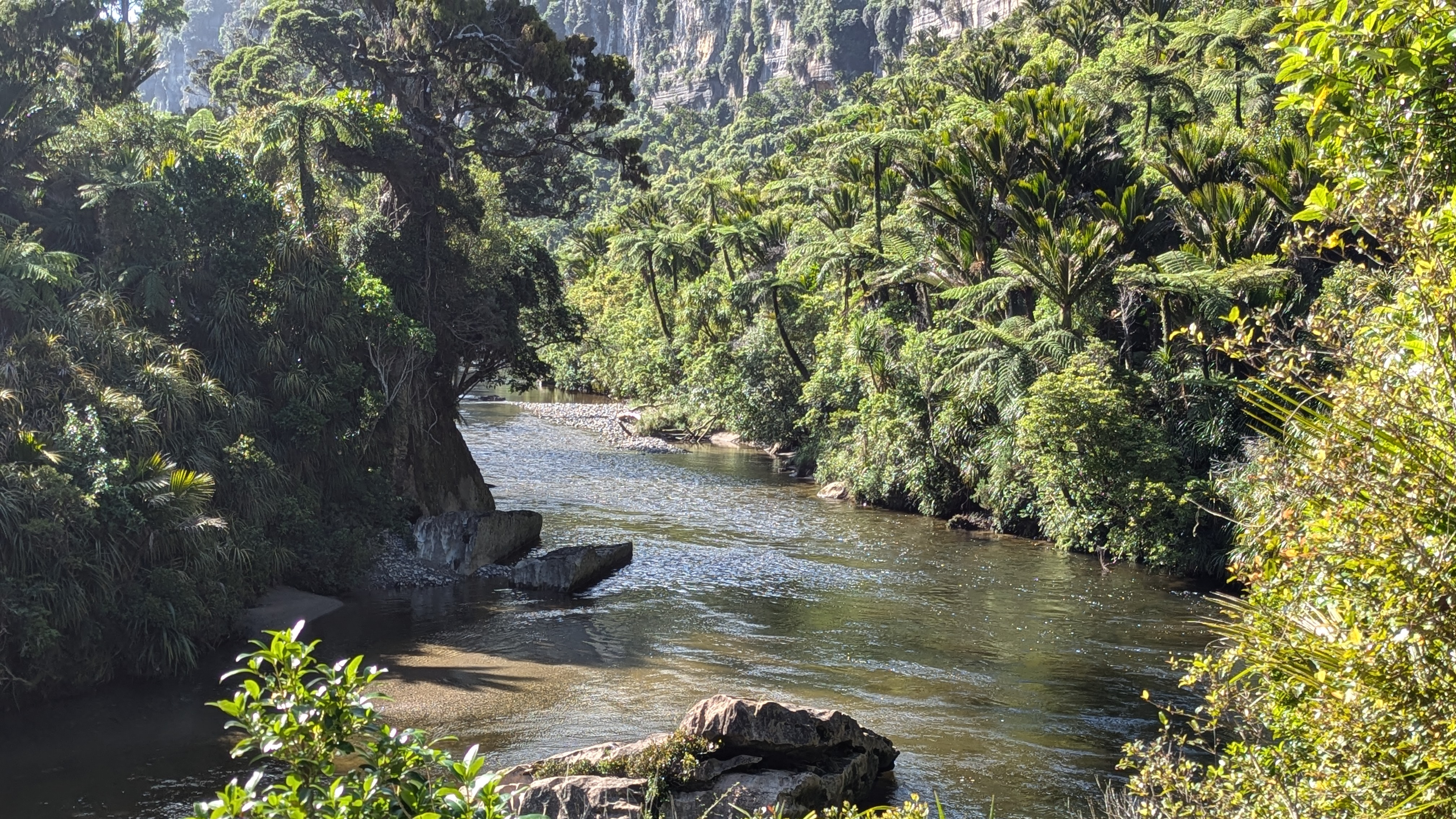
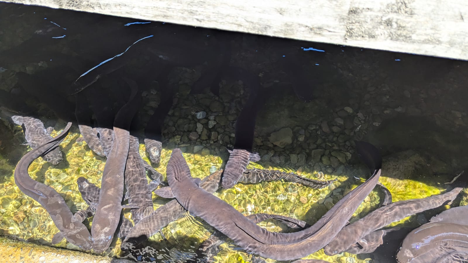
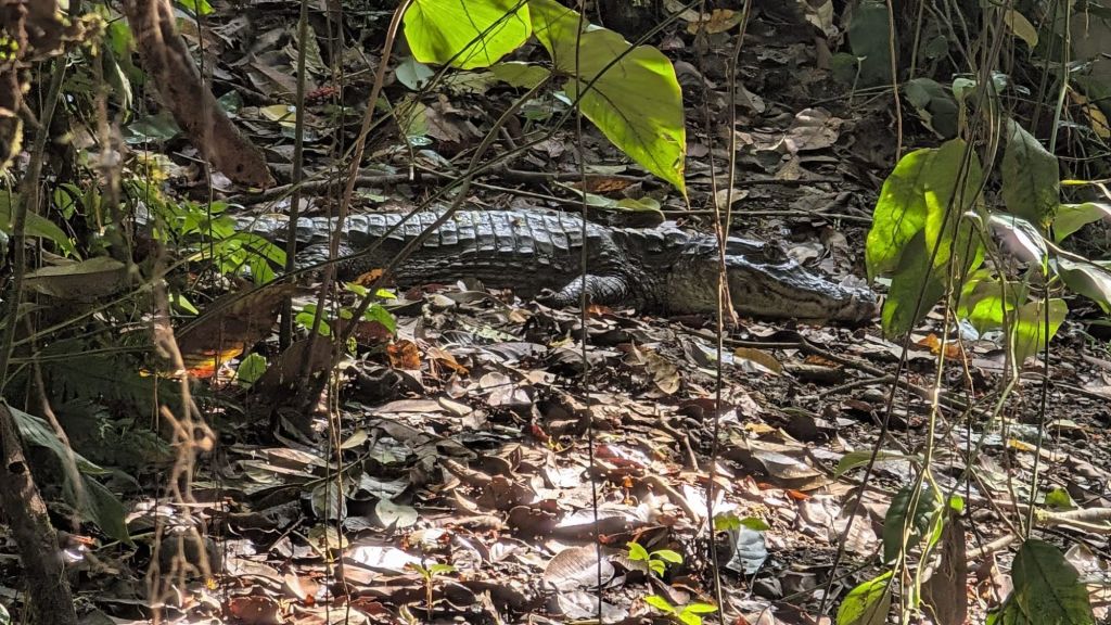
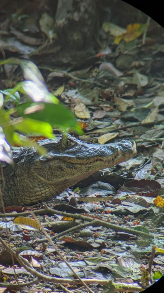
8.30 saw the start of the day’s main hike – this time in primary forest (ie forest that has never been cut down or planted by humans). This was much denser forest, with a huge variety of trees and other plants – and a very muddy trail. Near the start we watched a stationary Caiman – a “small” form of crocodile but still over a metre long.  This is croc-country and swimming in the creeks is discouraged for obvious reasons.

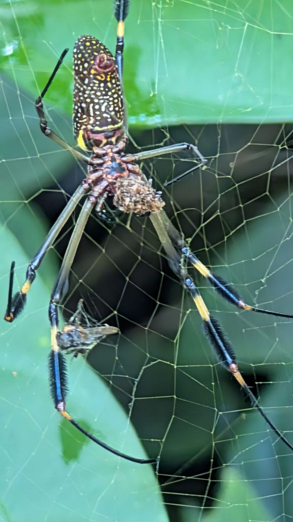
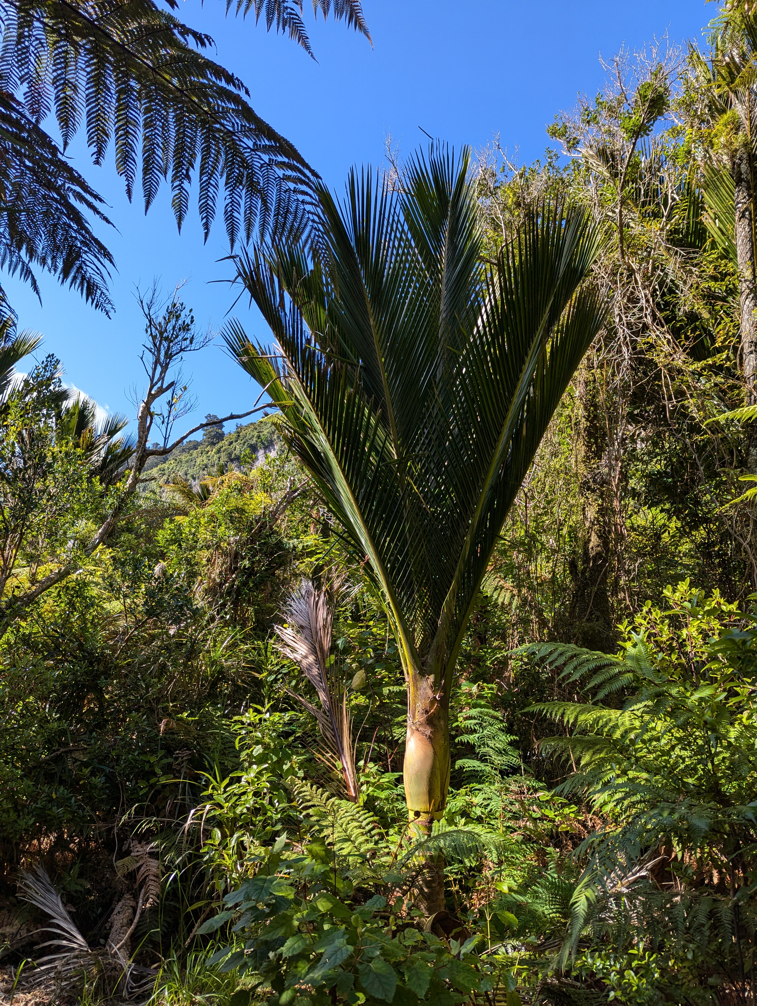
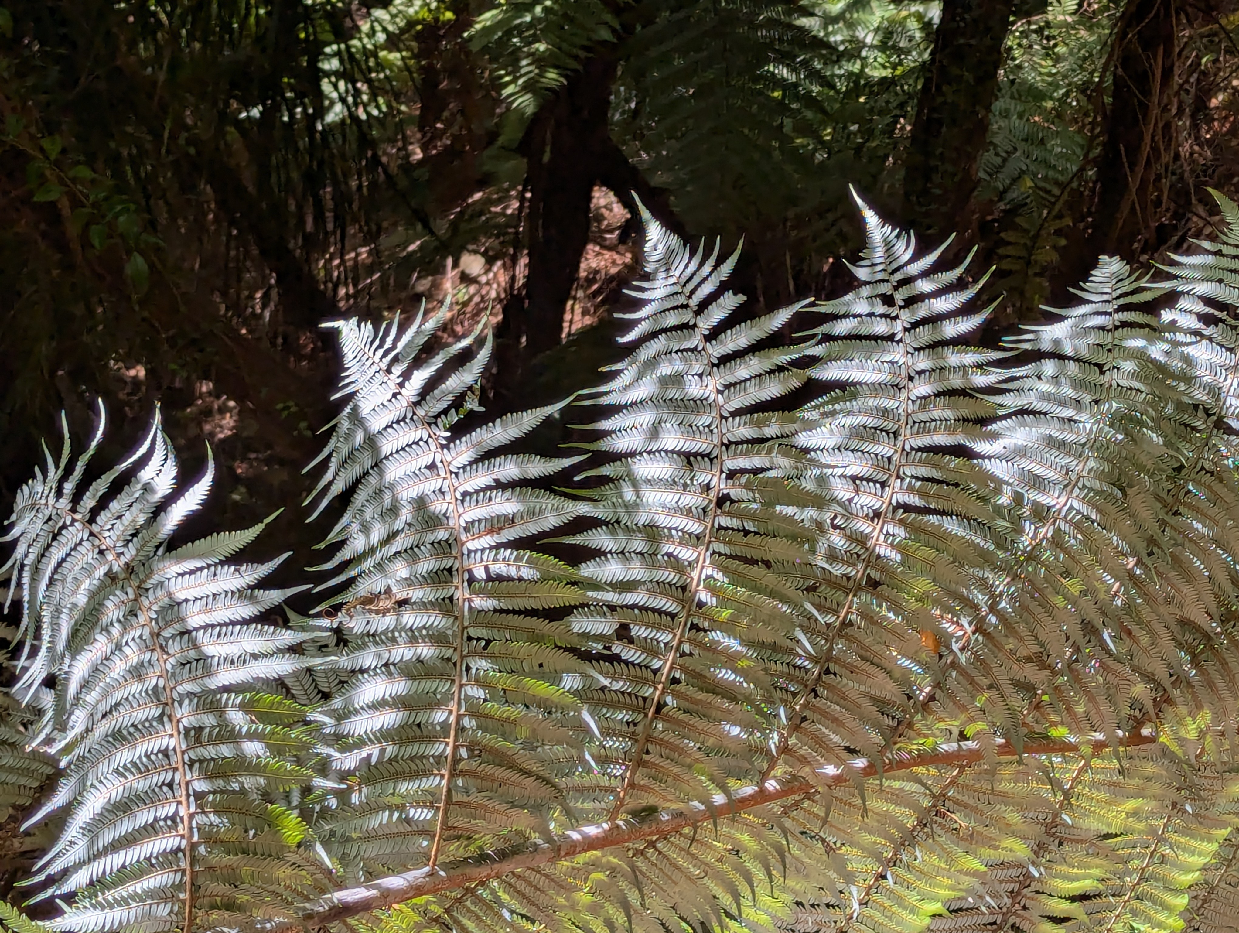
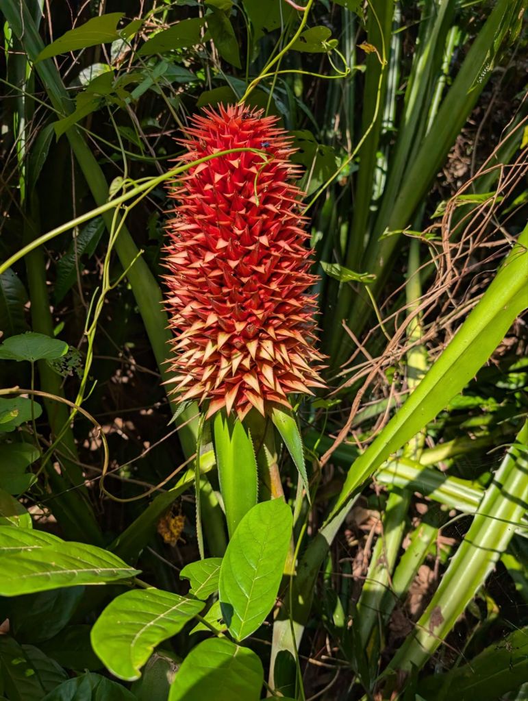
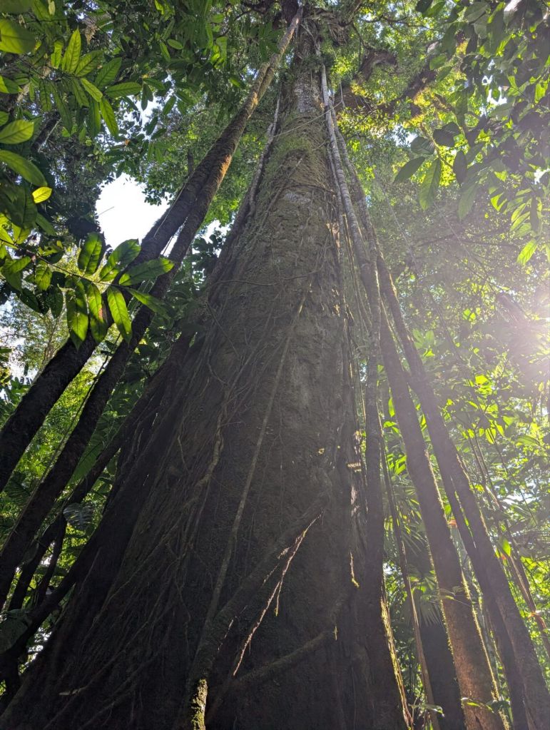
Wildlife sightings in primary forest are much less frequent because of the density of the flora but we still saw squirrel monkeys, several birds, including woodpeckers and hummingbirds, a beautiful golden orb spider on a web and a less beautiful tarantula deep within a hollow tree trunk (thank goodness). Fraser was a fount of knowledge about the vegetation and trees.  In the secondary forest, the fast growing Ficus (Fig) species have grown into large trees over the 50 years sine the start of the national park but in the primary forest we saw 1000 year old Espavales trees – often entwinned with huge giant Ficus vines that were almost as old.

The end of the hike brought us back to the Lodge for a brief rest and to pick up the rest of the luggage before the short stroll back to the boats to take us out of the park. Just before we got there we had another view of an anteater high in the trees.

The scrum to get back on the boats  was even worse than the arrival – all tour groups, from both Bahia Drake ad Puerto Jiminesz, are scheduled to leave at the same time. As the boats backed onto the shallows the different groups were trying to identify which boat they should be wading out to. In spite of the chaos, we all managed to clamber on to the right boat for the bouncy speed boat ride back to Puerto Jiminez.

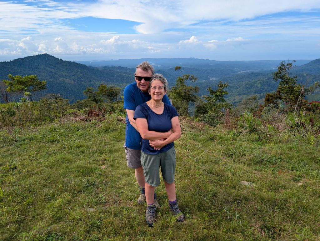
This was a couple of days that will stay in our memories for a very long time.  We have proved to ourselves that we are not too old or soft to rough it (a bit) and the rewards are immense.

Camino Day 8:  Arriving in Quepos

Jairo said “breakfast at 6”, and so the sound of 5.30 phone alarms resounded across the site from each of the lovely little “pods” in which we were sleeping.  Awaking in the half-light we packed up and got our stuff down for breakfast at 6.  But this was 6am Costa Rica time, so it was nearer 6.20 before the food arrived.  I only mention this because of 2 reasons. 

First, the group (of westerners) have pretty much stuck to time.  In contrast, Jairo assured us that the overall approach to time-keeping in Costa Rica is far more relaxed, which is consistent with the more relaxed approach to time across most of the world.  In fact, those working with the Urritrek team have been very good to date and this was the first experience of “Costa Rican” time keeping, and only to a limited extent.  It is perhaps illustrative of where Costa Rica is in economic terms – not quite a fully paid up member of the group of developed nations but a long way ahead of the economic positions occupied by its neighbours to the North, Nicaragua and Guatamala. 

The Glamping Pod

We started the walk in the cool of the morning, along a dirt track leading from the campsite towards the town of Quepos.  This was not supposed to be a strenuous day but I (David) started to feel the heat as the day warmed up.  The vegetation gradually changed as we dropped towards occupied areas, with more coffee and palm oil areas and less virgin jungle.  The birds and monkeys were plentiful (we saw squirrel monkeys, meaning we have seen all 4 native costa rican monkey species now) were and the trees were alive in the relative cool of the morning.

After about an hour and a half we reached a paved road and were picked up by the minibus.  Doing the full camino (EFI – “Every F’ing Inch”) inevitably requires quite a lot of walking on paved roads.  The huge and developed networks of publicly accessible paths we have developed in the UK over centuries don’t generally exist in Costa Rica (or possibly anywhere else in the world) so the route is mainly on dirt roads but ocasionally on paved ones.  One advantage of our “cheat’s camino” is that we can avoid the asphelt walking and enjoy walking on surfaces that have some give under the foot and have less traffic.

After a stop for coffee and buns – and Costa Rica does really great coffee (or course) – we were dropped on another dirt road and walked towards the coast.  This was palm oil country and we saw bullocks working as beasts of burden, pulling carts through the planted palm oil forests.  These trees look good but they are a bit rubbish for biodoversity as they cannot support the abundance of wildlife which existed before the forests were cleared.  It is a world-wide problem but palm oil is a lucrative crop and so the fight (and maintaining the balance) between biodiversity and economic progress is a real issue here.  Generally Costa Rica has a better record on this than almost anywhere else, but Jairo has his concerns that the “environment first” philosophy may be slipping in practice.  There are elections next month and it will be interesting to see who comes out on top.

After another hour or so we reached the bus that allowed us to skip another part of the route on paved roads, stopping a nominal 700m before the end of the camino.  We then filed out of the bus and walked “single file” under Jairo’s strict instructions towards the formally marked end of the coast to coast route.  We soon saw the sea, reached the end marker and took obligatory photos with our white Urritrek Camino T shirts.  The sense of achievement was, of course, mooted by the fact that we had not walked EFI!  But the group has melded over the 8 days and it felt the end of an adventure.

Final Group Photo

We then went down to the beach.  Bernie and I had a delightful swin in the salty water, along with Heather and Laura.

We adjourned to a restaurant for a final meal and goodbyes.  I have no idea if we will meet up with any of our fellow walkers again (apart from Laura of course).  That is the nature of these trips – quite intense friendships evolving from shared experiences and then separation.  If any are reading this, they all will have a warm welcome in rural Shropshire, England but we recognise that it’s a long way out of any tourist itinerary.  But, just as this walk allowed us to see the “real” Costa Rica, having a pint at Stanton Lacy Village Hall on a Wednesday night or sharing chat and coffee there on a Saturday morning is about as authentically English as you can get.

Menu for the Winter Warmer Soups at the Village Hall

We said our farewells and got a taxi 3km out of town to a bus stop to wait in the afternoon heat for the bus going south to the small town of Puerto Jiminez where we start the next leg of our great Costa Rican adventure. We were to pick up the long distance bus from San Jose, so the arrival time was a bit vague and we had been told that if the bus was full we wouldn’t be able to get on – but this was the only possiblity of arriving the same day (apart from a 280 dollar taxi fare!!). We therefore had a plan B and C, which involved an overnight stay along the way. Time ticked by and at 3.45 there was no appearance of the San Jose bus (due vaguely 3-3.30). A fellow traveller from California started to get highly anxious (especially after I had enlightened her that we may not be able to get on the bus).  Our plan B bus arrived, but we decided to risk it and wait. A few minutes later the San Jose bus arrived and there was loads of space – all anxieties unecessary but such is the nature of independent travel on publlic transport. The tour had been brilliant and a fantastic experience that we would not have been able to do on our own (and we highly recommend Urritrek) but we were excited to cut loose to do our own thing – experience tells is it nearly always works out!

Camino day 7:  Towards the coast

The route today gradually dropped from the mountains towards the coast.  It followed a gravel road, travelling through some spectacular scenery.  The vegetation alternated between unspoiled jungle and planted fields of coffee.  This is the coffee picking season and the berries are picked when they are red; but (like blackberries but with reverse colours) the berries start green and then develop their red colour gradually, with the time to reach the perfect redness varying on a plant. So a single bush has be picked 3 or 4 times across the picking season.

The bushes grow on slopes which are astonishingly steep, and the picking here is all done by hand.  Workers come up from Panama or down from Nicaragua to pick the berries – earning about $3 per full sack.  Costa Rican workers supervise but generally leave the actual picking to these migrant workers. They get paid on a piece work basis; a skilled and quick worker can fill up to 10 sacks a day, and so earn up to $30, depending on the state of the bushes. It looks back breaking work and yet, even at these low rates, gives migrant workers the chance to earn more in a day than they can earn at home in a week.   

We started the day in a small town of San Marcos, which is dominated by coffee roasting factories.  The smell was incredible, with the whole town being enveloped in a mist of roast coffee. We were told proudly that most of the coffee from here goes to Starbucks.  So next time you sip a coffee from Starbucks, give a thought to the Panamanian migrant workers who travelled to Costa Rica for the picking season, the Costa Ricans who tend the plants through the year and operate the coffee roasters, and then transport the product from Costa Rica to whereever Starbucks have their coffee shops.  Needless to say, Starbucks probably shifts its profits to pay tax somewhere else.

From the town we had about an hour’s journey to the starting point of our hiking. The initial bus was rejected by Jairo as he insisted on two four wheel drive jeeps.  We soon found out why when we turned off the tarmac road and as bumped along a dirt road, being thrown about like pebbles. We were driving along the Camino route with spectacular views. Although in one way it would have been incredible to hike the track, it would have been 2 extremely tough days. In any event the ride was an adventure in itself. We got our first views of the Pacific Ocean and stopped at a viewpoint looking down on our final distination tomorrow, the town of Quepos on the coast.

Eventually we tumbled out of the jeeps to start out hiking. Our brilliant guide, Jairo, has adjusted the length of the days to the capabilities of the group – which mainly means reducing the length of the walks for everyone to allow me to ope with the walking.  I (David) feel mightily guilty about this to be honest but the next slowest member of the group is not far ahead of me.  There is inevitably a range of abilities in any group and I was keen for Jairo not to reduce walks to accommodate me, but ultimately he has to make the call and I have to respect his judgement. I have been pretty tired after the walks and so I guess, at least for me, he has got these calls right.

The photos of the day tell their own story, but they do not show the constant and loud background noise of the cicardias, the anthem of the jungle here. The diversity of vegetation was immense.

We ended our walk at about lunchtime at a campsite in beautiful rain forest surroundings. We then ambled down to a river to eat our pack lunches, wrapped in banana leaves.  We swam in a tributary and had our shoulders pummelled by water under a waterfall (and it was not too, too cold).  Then back to the campsite where we decided to upgrade to a “tepee” for the night – a soft bed, spectacular view and importantly a fan. We have been surprised at the cold nights we have had, especially in the mountains but even on the Caribbean coast.  We are now in HOT country.  More acclimatisation to go and no doubt we will soon be craving the cold nights we were complaining about!

Camino Day 6.  Hotel Guatape to Tarrazu

Hotel Guatape was the highlight acomodation so far on this tour. Comfortable rooms, plenty of hot water, a beautiful setting and fabulous food. It was run by a Colombian woman who was just getting started with the hotel. All the staff were gracious and lovely.

I didn’t expect high quality food to be such a feature of this trip but it has been amazing. Every lunch stop and night stop have been places run by local people with home cooked food. We’ve not had a bad meal (or one where we wanted greater quantities). Often simple but always delicious and to top it off super healthy – lots of rice and beans, oodles of fruit, vegetables and salad, simple chicken and fish with tasty dressings.

So after another tasty breakfast (omelette and cheesy empanadas) we had a later start, as we needed to wait for vehicles to drop off other groups.  Urritrek have 4 groups on the road at the moment doing 8, 14 and 16 days treks, all along broadly the same route (but covering different distances each day). It must take a large spreadsheet to track where everyone is, where they should be stopping for lunch and where they are staying, especially as all the groups have different numbers of guests. It mostly worked swimmingly – like a swan – but there must be lots of paddling going on underneath.

This morning’s departure was a little less “swanlike” but we finally set off in 2 cars to be driven to where we were to start the walk.  But halfway up the first hill, the car we were in got a flat tyre.  Everyone out and after a bit of scratching of heads Martin, our swiss farmer, strode forward and took charge.  He soon had the car jacked up, the wheel off and the new tyre on (and probably could have milked a few cows at the same time as well). As well as being fantastically practical, Martin is also an excellent photographer and has a highly infectious laugh.  One of the great things about this trip has been the amount of laughing; with everyone joining in and contributing the the wise cracks, even us – although the wierd British sense of humour means there can be a slight gap before the others get the joke.

So on our way again we got to the top of the hill and turned onto the Panamerican highway. The road went up and up until we turned off the main road at the continental divide – we were now officially on the pacific side. Shortly after, we piled out of the cars and started the day’s hike (at a village with a hurch, school and football field). The first part was on a ridge with fantastic views on either side.  We then curved round Cerro La Roca and descended through steep sided coffee plantations. The weather was still on our side with bright sunshine and blue skies, the heat tempered by a cool breeze (we started at 2100m elevation).

The last section was on tarmac and then on a fairly busy road. The temperature had risen but at least we were tramping downhill. The wisecracks had dried up as we plodded through the heat but after 20 minutes or so we turned off the road and into the Hotel Palenque.  Not as picturesque as last night but large rooms and a huge inviting pool.

After lunch some of the group went on a coffee tour, but as we had done this before (in India or Cuba I think) we elected to rest up and lounged around and enjoyed the pool (cold – but refreshing once you got in).

Camino Day 5:  Muneco to Verdesana – another big hill!

Today was Sunday and our route took us just south of the city of Cartago,  a city of 170,000 people, with the shrine of the Black Madonna (which we did not visit).  This is a prosperous area and almost everyone from the city seemed to be out on bikes or walking in the sunshine this morning.  We took a short bus ride from our hotel to the village of Muneco and then started a walk which Jairo had warned would be steeply up.  He was not joking – although this was a “road”, there was a warning sign at the bottom advising people in colourful language (and in English) not to use it for vehicles and we soon saw why. 

Large parts were a slope of 30 degrees or more and it was tough going.  The trick to climbing these slopes is to treat the body as if it is a bike, and to stick solidly in bottom gear.  Small steps, lots of breaks and keep looking at the scenery to convince yourself that the effort is worth it – and it was. 

Gradually the valley emerged in its full beauty.  The land is mostly forest but small parts have been cleared for cultivation at various points, with small clusters of cattle or coffee fields co-existing with the jungle. 

David was doing pretty well and making excellent progress, even chatting with fellow trekkers as we climbed.  Eventually we got to the top and started the descent.  Large houses started to appear on both sides of the road.  This is an affluent area with “farms” for the wealthy from Cartago.  We stopped at a cafe for a coffee and then ambled downhill to the guesthouse where we were stopping for the night.  This is a delightful venue, run by some Columbians set in a beautiful garden and surrounded by a forested hillsides. By this stage David’s head was spinning a bit but he revived after lying down.  Then we spent a relaxing afternoon in the garden, watching the birds and reading.

Camino Day 4: Over the mountain through cloud forest.

We warmed ourselves with coffee and breakfast, served again by the amazing gold medalist Katia. It was odd to leave a campsite without having to pack up the tent, but soon we were on our way. A short bus ride took us along the valley road, to the beginning of today’s hiking, and then we started the climb.

It was a simple route – the first half of the day was up, and the second half down. Although it was forecast to be rainy, it stayed dry.   The sky was overcast it was humid; but we were glad not to be in blazing sunshine but instead were able to climb the hill in reasonable temperatures as the route took us winding up to a pass at about 1650m.

Like all mountain climbs, much of the pleasure was in the ever evolving and more spectacular views over the heavily forested and diverse hillsides. Looking out at one viewpoint Jairo estimated there were probably more than a hundred different species of trees in view.

This was a much more prolonged climb than our previous days so we had frequent stops for photos and admiring the views and surrounding forest.  David also needed to pace himself as he was very conscious not to push things too hard. 

At one point we saw a tiny hummingbird flitting from flower to flower for nectar. What was the hurry after all. The last plod up seemed to stretch out but then we were at the top and were soon cruising down into the next valley with views over Tapanti national park.

At the bottom of the hill, the minibus picked us up for a short drive to lunch.  The ‘full’ camino walkers would walk every step but we were happy to take the ride after the 660m climb. This ‘highlights’ tour meant we could do everything at a more relaxed pace rather than having to battle through the kilometers. It has still been a fantastic way to get deep into rural Costa Rica and see areas that we would not do if we had stuck to the main tourist routes.  We have had the chance to savour the beauty and enormous diversity of this county, as well as engage with the hugely friendly locals.  Like many places in the world, locals here are proud of where they live and wanted us to appreciate their homeland.  We have seen this all over the world and, at times, it has been challenging to find positive things to say about the local environment (although we always did – sometimes fearful that our noses would grow).  In contrast, in Costa Rica it is easy to share the locals’ enthusiasm for where they live.

Lunch was the end of the hiking day and another short minibus ride took us to an actual hotel for tonight – felt like luxury with boiling hot showers and even a laundry service. Some of the group went off for the afternoon to some hot springs but we decided to stay behind to start planning for ‘after the Camino’ as time is flying by and in 4 days time we will be at the Pacific coast.

Camino day 3: Walking to and from Pejibaye

We woke early and read our books, then had a delicious breakfast – quality and quantity being confirmed again.  We then sat on the bus as it went up a bit along the camino route – which went south west at this point towards the town of Pejibaye.  Near the top of the hill the bus stopped and decanted the group.  We then ambled down the hill, looking over to the spectacular valley below.  We did 3 separate bits of walk today – adding up to maybe 12 miles – with bus rides in between.  This was stages 6, 7 and 8 of the camino (for those following on a map (probably not that many to be honest).  The first notable place we passed was a self contained “smurf village”.  There were distinct religious connertations and who knew that the smurfs were responsible for world peace, love tanquility and mindfulness.  Now we know!  The garden was lovely and it was clearly someone’s private (or not so private) passion.

The next section of the walk was through sugar cane fields.  The promised mud never appeared and the walk was reasonably flat, so it was easy walking.  The highlight of this part were two flame of the forest trees – with brilliant orange leaves.  We see these magnificant trees across the forests, with their bright orange leaves standing out against a green background.

Then we reached our lunch stop – plentiful gallo pinto; the national dish of rice and red beans (that we might just have had enough of by the end of the month), but also fresh salad and fried fish.  We are gradually getting to know the fellow members of the group and they are all very different and come from different backgrounds, but are melding as a group really well.  You might think that a Californian criminal defence appeal lawyer and a Swiss dairy farmer would have little in common but they both get excited by seeing colourful birds, have a common commitment to hiking and are determined to have fun on this trip.  As the Irish would say “the craic is good”.

We walked through the small town of Pejibaye, which had the largest bicycle in the main square I have ever seen. 

There was also a low key memorial to women who had been killed by men.  Domestic violence is reported to be increasingly recognised as a serious issue in thie country, and rates of domestic violence are rapidly increasing. Covid is reported as a factor, as in the UK, but also it may well be that greater recognition and publicity of this serious issue has created a climate where there are more reports as opposed to this reflecting a real increase in the level of violence.

Every Costa Rican town seems to have three things – a church, a school and a football field – all in the centre of town.  I irreverently speculated that the relative priority is shown by the space occupied by these iconic symbols of each town.  The church is generally the smallest, then the school and of course the football field dominates.  The country is in mourning because, despite being in a group that did not contain Brasil or Argentina, Costa Rica failed to qualify for this year’s world cup.  For a football mad nation this seems to have been a matter of national shame.  We kept quiet about the fact that England (and even Scotland) had qualified.  Apologies to Scottish readers for that “even” but they understand – I hope.

After the town the camino followed a road up and then above the Rio Pejbaye river valley.  The sun was out, we had walked for about 12 miles and it all felt very good as we ambled along.  The views over the valley and to the dense jungle beyond were stunning.  It was a magic couple of hours.

Then we reached our stopping point for the night, an ecological school where tents were set up for us inside the very basic buildings.  A cold shower and a cup of coffee improved our outlook and we played yet another few games of backgammon (a purchase in San Jose and taking up far too much room in the rucksack).  Then dinner prepared by Katia and a colleague who were not only superb cooks but also have just achieved a gold medal in the world rafting championships (senior category).  The competition took place in Malaysia and the Costa Rican team had to fund most of their own costs.  The rivers here are wonderful for pratising rafting, which operates in a similar way to white water canoeing, including gates they have to go into upstream.    They were two seriously impressive althletes!

Then to bed – which was quite cold with only a flimsy sleeping bag – so we were both fully clothed and still a bit cold.  But not anythign like as cold as our friends and family in the UK who had to endure Storm Goretti.  We feel for you – honestly!

Camino Day 2: Into the indigenous areas.

We woke in the lovely setting of Casa Tamandua.  A cockrel of very small stature but very loud crow woke most of us at 4am but luckily he did not crow continuously so I could sleep on and off until six.

We were provided with a delicious breakfast (quantity of food is not a problem on this trip). We are a very well behaved group so we were in the bus by 7.30 as instructed with no stragglers! The bus then mirrored the drive we took along the road to where we started rafting.  This time we parked at the top of the hill rather than going all the way by bus down to the river Pacuare. The sun was bright, the sky was blue and and views spectacular.

We all set off in good spirits. Soon we turned off the track into the indigenous area around the Pacuare river, home of the Cebecar tribe.  There are 5 protected areas in Costa Rica for the main indigenous tribes and their clans. Jairo, our guide, explained that if the people remained in the protected areas they were pretty autonomous and did not need to pay taxes but if they left to live outside the tribal areas, they were subject to the normal government regulations and taxes of the rest of Ticos.

The route we were taking today was the main path that the Cebecar people used to walk in and out of the reserve to get supplies. We were going to take several hours, kitted out in our walking boots, hiking poles etc, while they galloped up and down in their wellies! Everyone we passed was very friendly with waves and greetings.
It had rained a lot recently, as we knew from the previous couple of days, so even though the weather today was fantastic, the path was extremely muddy (home from home for us). The first section took us down a steep, slippery path through the verdent green.

At a small tributary we changed into our water sandles to wade across with only one casualty, who didn’t bother to change and got a boot full of water for his confidence.

Some tried to cross on the stones – with mixed results!
David in a basket!

A little further on we reached the beautiful Pacuare river, where we had had a fantastic rafting experience the previous day.  There are 52 rapids along about 36km back to Siquirres and we saw groups experiencing this delight for the first time. We had passed under a cable that our rafting guide had told us the indigenous people used to cross the river and here our fun began.


We met Leo at the bank, our indigenous guide (a requirement when in the reserve) and a young lad specfically recruited to help us across the river. Two at a time we were loaded into a metal cage high on the river bank.  A graceful slide along the cable took us to mid river – then the cage was hauled up the side by rope. Hard work for them, great fun for us!  Normally tribe members pull themselves across the river – all part of the fun of going to the shops.

After we all safely reached the other side there was a steep 3km climb up a muddy path through beautiful jungle. David had his heart monitor on to keep his heart rate under 140 bpm but he climbed steadily at pretty much the same pace as the rest of the group.  We all needed to catch our breath from time to time.

The path opened out onto a flattish green plateau to Leo’s village. Here was a mixture of traditional building of wood and rush walls and roof and government provided homes with the standard corrugated iron rooves. The village had 85 inhabitants and included a school for the 20 or so children. Being on the route of the Camino it also had a restaurant where we were to have lunch. Part of the ethos of the Camino, which was devised over a number of years and had opened 6 years ago, was to bring ecotourism into the rural areas of Costa Rica to provide jobs and tourist dollars more equitably in the country. The tribe members probably survived on subsistance farming and products from the forest before the tourists arrived, but now walkers provide a steady income for the village.

Before lunch, Leo gave us an informative talk about his tribe, their systems and beliefs etc (translated for us by Jairo). This was the largest village in this reserve but others were scattered across a wide area defined by river boundaries. We had walked in 6km and were going to back track the way we came.  If we were following the full Camino we would have had another 17km before getting to a road and the exit of the reserve. Leo said he could do that in 3 hours if he was in a hurry and it had been known to be done in 2 hours 20 minutes! They are pretty fit people as this was not flat terrain or smooth paths!

Leo’s wife cooked us lunch – chicken, rice, beans, cassava, plantain and really delicious. It was her birthday the previous day and we all sung her happy birthday – although I doubt she spoke any English.  She looked ot be in her early twenties with 3 young children in tow, the older ones of which seemed wholly comfortable with the strangers who turned up with rucksacks hiking poles and the like. 

We then retraced our steps, slithering down the steep muddy trail, back over the river in the cage and up the other side.  The weather gods shined on us all day.

We picked up the bus at the top of the hill again and then it was a 40 minute drive or so to Rita’s House – our accomodation for the night. I’m really loving Costan Rican cooking as another delicious meal was served.  We are not going to lose weight on this holiday!

We were tired, as much as by adjusting to walking in heat and humidity as by the steep track, but fell into bed early after a very satisfying day.

El Camino de Costa Rica (the best bits): Day 1Title

This is the first time we have blogged for a long time and apologies to those who were expecting a two-wheeled account.  A great deal has happened in the months since we last put fingers to keyboards and we are not sure how much cycling in far flung places we will be able to do again.  In summery, David (who is now 65) has been diagnosed with Ischemic Coronary Heart Disease and had a bypass in January 2024. Unfortunately we discovered in the summer of 2025 that 2 out of the 4 grafts had failed.  The brilliant cardiologists at Wolverhampton managed to stent one of the defective grafts (to improve the blood flow through that artery, but David has been left with only a partially functioning heart.  So he has to be a bit careful about where he goes and, for example, cycling in Laos with its limited hospital facilities maybe off limits now.

Having said that, we have focused on what we can do and not on what we have to rule out.  We are slowly working out things, and inching towards an understanding as to what we can do.  That “working out” process has taken us to Costa Rica for 4 weeks. 

The first thing we did – gently our limits testing so to speak – was grade 3 and 4 white water rafting along the Rio Pacuare.  Our guide said this river was one of the best rafting rivers in the world and who were we to question that.  Later Mrs Google, that font of all wisdom and seriel repeater of prejudices, more or less confirmed this, suggesting that the Zambezi is no 1 and that the river Futaleufu in Chile is number 2, with Rio Pacuare as the third best.  Good enough to start we felt.  It was great fun – not too frightening unless you were unfortunate enough to be in the front of the raft.  That was where David was sat – of course.  We got wet on the first of 30 miles of rapids and never got dry after that.  We also saw some great wildlife along the way.  Sorry but no photos yet (to be added later) as we bought a memory stick with the pictures of our boat but have no way of converting that into digital pictures for the blog until we get home.

In 2017 the Costa Rica government (which is astonishingly stable and environmentally responsible compared to its neighbours) designated a 280km long route from the Caribbean Coast to the Pacific Coast as “El Camino de Costa Rica”.  Urritrek are one of the companies that organise treks along the camino and we have joined the “8 days Essentials Hike”, which covers about half of the route.  It allows us to walk the best bits of the camino, and get a bus along the boring parts.

Although this is referred to as a “camino”, it is not a religious route.  No days off purgatory are on offer for those that complete the route, but it luxuriates in nature along its whole route and so is religious in that sense.  The word “camino” means “road” in Spanish and that is the origin – even though most of it is on tracks rather than roads.

We are a group led by an amusing, hugely knowledgeable 28 year old tico (the name for Costa Ricans) called Jairo (pronounced “Hairo” – sort of like “a hairy hero” which I suppose he is).  We have 2 couples from the United States, a couple from Switzerland and the wonderful Laura, and American living in Costa Rica, who we met trekking in New Zealand last year and who we stayed with when we arrived in the country.  Many thanks to Laura and Doug for their wonderful hospitality.  A mention must also go to our bus driver, Eddie, who is so skilful in avoiding pot holes that he could get a job driving in Shropshire.  I am sure autonomous self driving cars will never be as good as Eddie!

Anyway, we met up with the rest of the group yesterday in Siquirres, a friendly town half way between San Jose and the Caribbean coast.  The bus took us to a tiny place called Goschen where we loaded onto a small flat bottomed boat to drive through the mangrove swamps and jungle to the sea.  We saw all manner of birdlife on the way, as the photos confirm.  One of the great things about an organised tour is that someone else does the organising (of course).  And so we just turned up at this waterside house and lunch miraculously appeared.  There was a pretty large crocodile sunning himself in the garden of the house, which was a little disconcerting.  The owner said that he was their “mascot” and peaceful; happy playing with the house dogs.  The dogs did not seem to be missing limbs and were quite happy to go up to the croc, but we left them to it rather than seeing whether the croc was equally friendly with humans.  The owners said it disappeared from time to time for a few months but always came back.  When we revisited the house later the croc was nowhere to be seen, but it was a good incentive not to dangle hands over the side of the boat.

After lunch the boat took us to the mouth of the river, so we could see out to sea.  We docked and walked across the isthmus to the sea and symbolically paddled in the Caribbean.  This is the area turtles hatch in the sand.  We were not there in turtle season but could see the nest holes.  It must be an amazing site when the sand shivers and a tiny turtle chick emerges to struggle towards the beach, assuming that it has not been eaten by a racoon beforehand of course. 

Then we ambled around for a while along the beach chatting to our fellow trekkers and starting to get to know the people in the group.  We are not the oldest – despite out near geriatric status – but there is a small age range as everyone is retired or near (or a bit away from) retirement age.  They are a great group – with a few typical national characteristics coming through (without naming names of course).  Having said that we are probably seen by them as typical Brits – not the loudest, with a dry, verbal sense of humour and less than brilliant taste in clothing.

We got back to the boat and were driven back to the bus, and then taken to our overnight accommodation – huts in a development by the Urritrek owners (I think).  If you are doing the full “every f’ing inch” type walk, then this is about 30km – largely flat – from the coast and is the end of day 1.  The “every f’ing inch” reference is to the title of a book about walking the length of New Zealand where that was the aim of the authors – spoiler – they succeeded.

 We had only walked about 3km and then got a bus.  This felt a tad like cheating but we can put up with the humiliation. 

Then we had a pleasant dinner – with the group relaxing into each other’s company – learning to laugh together and telling travelling tales from previous trips.  A really encouraging start to this trip.

The wonders of wet walks and Milford Sound

We are heading towards the end of our trip around Aotearoa, as we are now learning to call New Zealand.  Today we started from our accommodation and drove from Te Anau to walk the beginning of the Routeburn Track.  The clouds were building and it was raining fairly hard by the time we started the walk.   

The route goes over the mountains and comes out not too far from Queenstown, but we were only doing the first couple of hours of the track, but it looks a great walk to put on the list for a return.  We slowly climbed through ancient rain forest – in the rain. 

Walking up a track in a forest with no views with continuous water running underfoot does not sound too attractive, but actually it was very pleasant.  By this stage our fitness had improved, the forest protected us from the wind and so walking uphill was not a real effort as we were constantly conversation with people who were now friends, distracted by birds and plants.  When we emerged out of the forest, the wind and rain hit us, and the rain turned to something near hail. 

We carried on walking up and got to a “viewpoint” but, of course, there was no view – just clouds and rain.  We still felt a small measure of elation at reaching the top of our final walk of this trip with all our group. 

What we might have seen on a clear day

The amble down the hill was, of course, easier but felt longer.  The rain continued and we got out of our wet weather gear at the bottom.  Then we were driven over the mountain, through a tunnel and into the valley leading the town, Milford Sound, which is at the start of the glacial valley called the “Milford Sound”.

What we could see!!

We tried to find out if there was a difference between a “sound” and a “fjord” (or its less common spelling of “fiord”).  A fiord is a narrow inlet of the sea between cliffs or steep slopes, which results from marine inundation of a glaciated valley.  In contrast a “sound” is formed by the flooding of a river valley, not a glacial valley.  Milford Sound is an amazing glacial valley, where the force of the ice has carved out spectacular walls hundreds of metres high, creating a valley leading to the sea.  So, of course, it is a fjord and not a sound.  So why is the most famous fjord in the Southern Hemisphere misdescribed as a “sound”.  Only a pedant would ask that question, he says in a self-revealing comment.

The area was well known to the mauri who fished the area.  Early European settlers did not explore Milford Sound by boat, not realising that inside its narrow entrance there was such a beautiful region to explore. In fact, it is so well hidden that the famous explorer Captain Cook managed to miss the entrance to the fiord twice! In 1823 a sealer called John Grono was the first European settler to visit. He named it Milford Sound after Milford Haven.  Milford Haven is an inlet on the Welsh coast, but there is frankly little comparison between the magnificence of Milford Sound and Milford Haven!

We felt a bit “processed” as we lined up to take a boat up the sound, but that feeling soon disappeared as we gazed at the awesome rocks.  The fjord is 10 miles long so it was a pleasant couple of hours cruising up and down, looking up at the rock formations.  There were numerous waterfalls – but they come and go depending on the rain (and it rains a lot here- about 7m of rain a year).  These waterfalls start within a couple of hours of rain, and then stop within a day of the rain ceasing.  It had been really wet in the hours before we visited so they were all in full flow, even though it was largely dry when we were on the boat. 

The only way to describe the place is with pictures and so I’ll let the pictures do the describing.

Then it was back in the bus and a return to Te Anau.  That trip brought an effective end to our New Zealand odyssey.  Thanks for taking the time to read – please respond or subscribe if you want to read about future travels.

Great memories of an amazing trip

A Jetboat trip up the Haast river and on to Makarora

We started the day on the bus to get through before the road closed.  There had been a landslip and the road was closing at midday – so we went early to pick up our boat at the mouth of the Haast river. We were directed onto the jet boat by our driver and guide – a formidable huntin’ shootin’ and fishin’ woman – for the 36km ride upstream. She described how she lived in the tiny township of Haast, proudly told us the entire population numbered 259 and that the nearest supermarket was 2 hour drive away in Wanaka.  She said the locals were hugely self-supporting and largely made do with what they could hunt or forage from the sea – mainly fish and crayfish.  She said she could take her boat home and in half an hour put on her dive stuff and come back up with 6 crayfish and 10 abalone (a type of sea snail) – the allowed daily quotas. These were not crayfish as we knew them but in her photos looked like enormous lobsters.  She told us that she could also shoot dear from her from gate. We decided she was not to be messed with – but she was also informative and great fun.

The Haast is a braided river – a glacial river formed of many channels. The jet boat was invented in New Zealand she claimed to allow navigation through the sometimes very shallow channels.  When the boat is at full speed and rising above the water, she only needed 4 inches clearance (she also said the Japanese had stolen the idea to develop jet skis).  The river channels can change after every rainfall and we marvelled at her skill as she wove through the river threads at considerable speed.

The Haast river is located along the Alpine Fault, where the Pacific and Australian tectonic plates clash against each other.  These plates are responsible for forming the Southern Alps. We were shown the valley where the Pacific plate is on one side and the Australian plate on the other – a rare event on land apparently.  They appeared quiet as we passed over.

She stopped the boat after half an hour or so to land on a large stony sandbar, and invited us to disembark to look for Douglas Jade – a rare form of the green stone that is famous in NZ.  Needless to say none of us made out fortune by finding any real jade, but we did find a lot of pretty stones!

We got back on the jet boat and zipped up the river, passing numerous waterfalls which formed whenever there was recent rain. ‘Do you want to spin’ she said?  As “no” didn’t appear to be an acceptable answer, we were told to hold on tight with both hands and after picking up speed she did the equivalent of a handbrake turn, which had us all squealing like kids on a rollercoaster (with much the same feeling). After four of these, the final turn brought us up opposite the largest waterfall – and with some relief the journey was over!

 We continued up the narrowing river valley in the minibus and over the Haast pass. We stopped for a short, wet walk through the forest to a lookout point – but it was rainy and foggy and not much was seen.

We ended the day at the Wonderland Lodge on Lake Makarora – a complex of toy-town like A framed houses. The clouds were clearing so we could see the mountain tops from our bed.  Our guides cooked us a delicious barbeque to end the day.

Paparoa National Park, Pancake Rocks and kayaking on Lake Mapourika.

Although we had been warned that the West Coast of the South Island is extremely wet, we woke to another sunny day. A short drive took us to Paparoa National Park along the coast road (actually the only road) with dramatic coastline on our right and towering mountains, covered in green on our left.

At Paparoa we had a gorgeous walk along the Paparoa river track. The bubbling river was clear but stained brown with the tanins leaching into the water from the surrounding forest, and edged with towering limestone cliffs and luxurious vegetation.   

On the way back to the start we spied a wild goat in the vegetation just up from the river.  There are numerous goats in this area and they are a threat to native species – so are hunted with the aim of eliminating them.  However, they have proven elusive and difficult to catch and so, at this point, the ecological threat remains.

A little further along the coast we reached Pancake Rocks – a promontory of eroded cliffs made up of layers of limestone and compressed mud so that they looked like stacks of pancakes. Large holes, bridges and caves had been made from the waves crashing in from the Tasman Sea. We’ve seen lots of cliffs but none that looked like this.

We then had a longer drive to Lake Mapourika and the village of Franz Joseph Glacier.  The famed rain swept through from time to time, clouds wreathing the green mountains, but it had largely cleared by the time we arrived. There had been a hasty change of schedule as the guides had received notification that the coast road (which is the only road) was going to be closed completely the following afternoon for a few hours.  Thus, if we wanted to make our way south, we would need to drive through the following morning. The planned kayaking trip on the lake for the morning had therefore been transferred to this evening.

Kitted up with double kayaks, aprons and life jackets, and dosed up with sandfly repellent,  we had a serene and instructive guided kayak on the lake. After almost 40 years of marriage David and I managed to paddle our double canoe in (almost) perfect unison; at one stage we were told we had to slow down!!

The lake was surrounded by untouched verdant forest. The soil layer was extremely thin so the trees grew very slowly.  The average age of the tree canopy was 800 years, with the largest trees being 1400 years old. The dense forestation was incredible to observe close up. There were 5 species of kiwi in the forest and a very active programme of kiwi conservation that was successfully increasing numbers after a period of decline. There was also a very active programme of eradication of mammals, which were introduced species to New Zealand by the colonisers over the last 100+ years (including goats – see above). The area was hoping to become mammal free by 2025 (just a few weeks away) by trapping and poisoning the invaders.  Some of the techniques were a bit hit and miss, and were controversial but overall the programme was working- albeit millions of dollars was invested to achieve that outcome. The last amazing fact was that although the lake was just below the mountain glaciers but was entirely fed by rainwater, and the water temperature was 18-20 degrees.  This is because it is a kettle lake – formed by a huge lump of glacier ice that had become separated from the main glacier and gradually melted.  The lake was therefore not fed by a glacier river but by the massive rainfall (up to 5 meters a year). The lake was almost black in colour from the tanins and therefore absorbed heat from the sun.  It could have provided fantastic swimming except for the very pesky swarms of biting sandflies (every inch of showing skin was smothered in bug repellent). The late hour and hunger also deterred us from swimming and so we all left the water more or less unbitten.

Return walk from Bushline Hut and Coastal Walk to Seal Colony

(David) The night was quite cold and the wind blew under our tent. I felt it blowing right onto an exposed patch of my body; one where the sleeping bag appeared to have no effective covering.  Adjustments to clothing mostly sorted this and eventually we both slept well – or fairly well at least.  We woke, ambled into the hut and were greeted by tea, coffee and breakfast!  We could get used to being catered for.

After breakfast we packed up and ambled down the mountain.  I have been resistant to out and back walks in the past but we have done quite a few this holiday and my resistance is crumbling.  The views are different going the other way, the weather is different and we see the mountains at a different time of the day.  It was a delightful hour plod down the hill, with great views of the lake and then back to the minibus.

We put this in because it made us laugh!

We had a bit of free time at Lake Rotoiti again. We and saw again the long finned eels around the jetty and read about their incredible lifecycle.  The eels can live up to 100 years of age and only spawn once in their lifetime. Before spawning they leave the lake and head to the Pacific and swim 1000s of miles to near to Tonga where they mate, spawn and die.  The baby eels spend 7-10 months drifting back to New Zealand on the ocean currents and as they develop, swim upstream to the lake.

Leaving the lake we had  another (tedious) drive of a few hours, heading to the west coast, where we reached the wonderfully named “Cape Foulwind”.  We were booked into mini-cabins at this seaside resort.  The area was a former quarrying centre where granite was discovered as part of the cliffs, and so these were blasted away to make roads and the like during the C19 and early C20. 

The stone was used in a concrete plant which operated here as late as 2016, but there is no evidence of the plant now.  Instead, there is a coastal area with some modern (expensive looking) houses probably being second homes for Christchurch’s elite.  We walked along the road and then joined a cliff walk at a lighthouse.  It was a great walk for a couple of hours to see a seal colony.  In typical DOC style, the path was well marked with barriers and signs preventing anyone being tempted to go too close to the cliffs. 

This was the Tasman Sea, with waves rolling in every few seconds.  It was a peaceful, sunny afternoon but the storms here must be impressive. 

The seals were New Zealand fur seals (known as kekeno in maori).  They were lolloping about on the rocks, having an occasional spat and then gliding into the sea. 

We ambled back to the accommodation feeling we had had a good day.

Nelson Lakes National Park. Overnight hike to Bushline Hut.

Our day off in Nelson was cloudy and rainy – so much for being the sunniest place on the South Island. It gave us the excuse to do very little for the day; so we were raring to go the next morning, which did dawn bright and sunny.

After a tasty breakfast (best coffee so far), a shortish drive took us to the beautiful setting of Lake Rotoiti in Nelson Lakes National Park. We did a short walk through the forest, learning about the key part played in the local ecology of the honeydew from the scale insect that lives in the bark of the beech trees. Unfortunately, invasive wasps were gobbling up the honeydew, so as in most parts of NZ, there was a programme to get rid of the invasive species to restore endemic species.

Lake Rotoiti
Eels below the jetty – they live for up to 100 years!

After an early lunch by the lake we set off on the hike proper for the day – a two hour tramp with packs up to Bushline Hut on Mount Robert, where we were staying overnight. We had elected to camp, rather than squash into the rows of mattresses in the hut, so were back to carrying full packs.  This paled into insignificance when we saw what out guides carried up –  their kit and all the food for 11 people for the evening meal and breakfast.  Their loads included 2 bottles of wine – I fear we set a precedent.

Back to the hike – this was a perfect climb. Nothing was too steep. The views over the blue lake were stunning.  As we climbed, the lake got smaller but the views over the mountains got greater, then we were rewarded with views over to distant mountain ranges. 

The setting of the hut was stunning – as the name suggests it was right on the bushline (or tree line as we would call it).

We set up our tent in the trees behind the hut where we would be relatively sheltered as the mountain was famed for its strong winds.  We then emptied the rest of our packs apart from a few layers and some water to prepare for the next part of the day.  The more energetic in the group (including us) decided to hike up to the main ridge and then along the ridge for a while.  This route would eventually lead to the Angelus hut though that was not for us today; it was four and a half hours further on from our hit. Six of us set off, reaching the edge of the ridge about half an hour later.  We then walked along the ridge, gradually climbing as the vista opened up even more views.  It was windy but fortunately the forecast winds of 55-70km an hour did not materialise.

After about an hour we got to a lookout spot and the rest of the group decided to turn back.  David and I were keen to carry on a bit longer so we agreed we would do another half an hour max, and then turn around so as to ensure we were back in time for dinner. The sun was getting lower and we were walking in the lovely golden light of late afternoon. We could see a high point ahead and now there were only the two of we could move faster.  We set ourselves a brisk pace and managed to get to ‘Flagpost’ summit, one of the highest points on the ridge, about half an hour later. Our stay at the top was necessarily brief as we were hit by the famed strong winds. So we about-turned and walked equally briskly down. Our legs were beginning to tire following our exertions but, having checked the time, we got to the last turn off down to the hut as predicted.  We then allowed ourselves to slow down a bit and got to the hut bang on time – to find cheese and wine ready and waiting for us, followed by a delicious meals cooked by our guides. Tired but elated we were tucked into out sleeping bags by 8.30pm and soon asleep.

Nydia track back to Kaiuma Bay, then by minibus to Nelson.

The day dawned bright again and after breakfast and a final look at the bay, we retraced our steps back to Kaiuma Bay.  We had felt a bit dubious about repeating the track rather than continuing north on the trail, but the logistics of getting the minibus to the other end were too great and we were told the track was not that good.  In fact, it didn’t feel repetitive and the trail through the forest, with different perspectives, was still beautiful. Everyone was going well and it seemed no time before we were back at the van (although it was 5 hours).

On the way on to Nelson we stopped at an unscheduled swimming spot at a bridge over the Pelorus river, which was known to one of our guides. Fantastically clear water flowed through a bit of a rocky gorge with deep pools. It felt so refreshing in the cool water after our hike. 

Then the jumping began again….First from the higher rocks, then from the bridge –  a terrifying 20m above the river.

In a bit of a testosterone fuelled competition, both the guides did the jump and then one of our fellow travellers.  I could hardly bare to watch and I jokingly threatened David with divorce if he dared it – which he did not; but they all came out alive! After everyone had cooled off literally and metaphorically, it was back on the minibus for the last hour to Nelson. 

This town is supposed to be the sunniest place on the South Island.  Here the guides left us to have a day off tomorrow to do our own thing. It felt a welcome break not be part of a group with the day pre-ordered for us.  On the other hand, it had been great not to have to think about or decide anything for ourselves for a week!

Long way down…