Our day off in Nelson was cloudy and rainy – so much for being the sunniest place on the South Island. It gave us the excuse to do very little for the day; so we were raring to go the next morning, which did dawn bright and sunny.
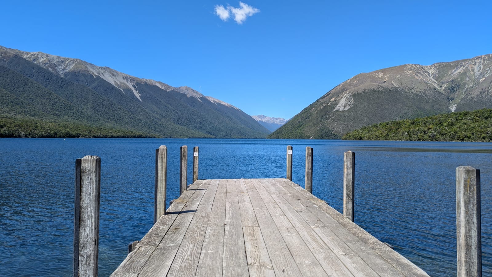
After a tasty breakfast (best coffee so far), a shortish drive took us to the beautiful setting of Lake Rotoiti in Nelson Lakes National Park. We did a short walk through the forest, learning about the key part played in the local ecology of the honeydew from the scale insect that lives in the bark of the beech trees. Unfortunately, invasive wasps were gobbling up the honeydew, so as in most parts of NZ, there was a programme to get rid of the invasive species to restore endemic species.
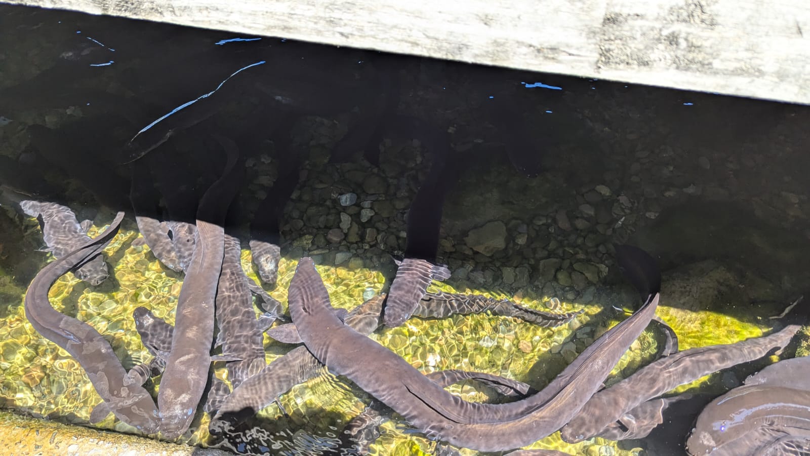
Lake RotoitiEels below the jetty – they live for up to 100 years!
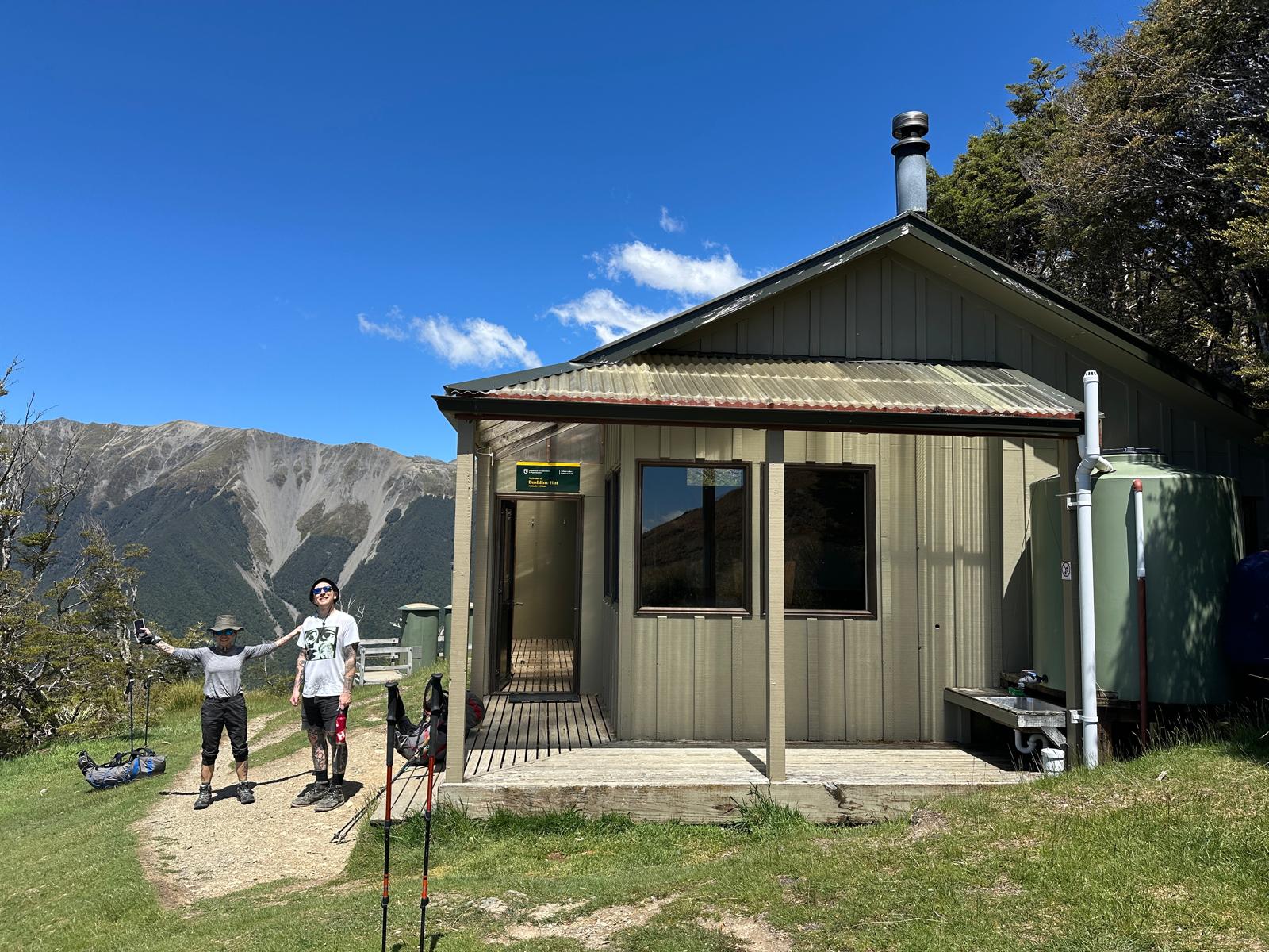
After an early lunch by the lake we set off on the hike proper for the day – a two hour tramp with packs up to Bushline Hut on Mount Robert, where we were staying overnight. We had elected to camp, rather than squash into the rows of mattresses in the hut, so were back to carrying full packs. This paled into insignificance when we saw what out guides carried up – their kit and all the food for 11 people for the evening meal and breakfast. Their loads included 2 bottles of wine – I fear we set a precedent.
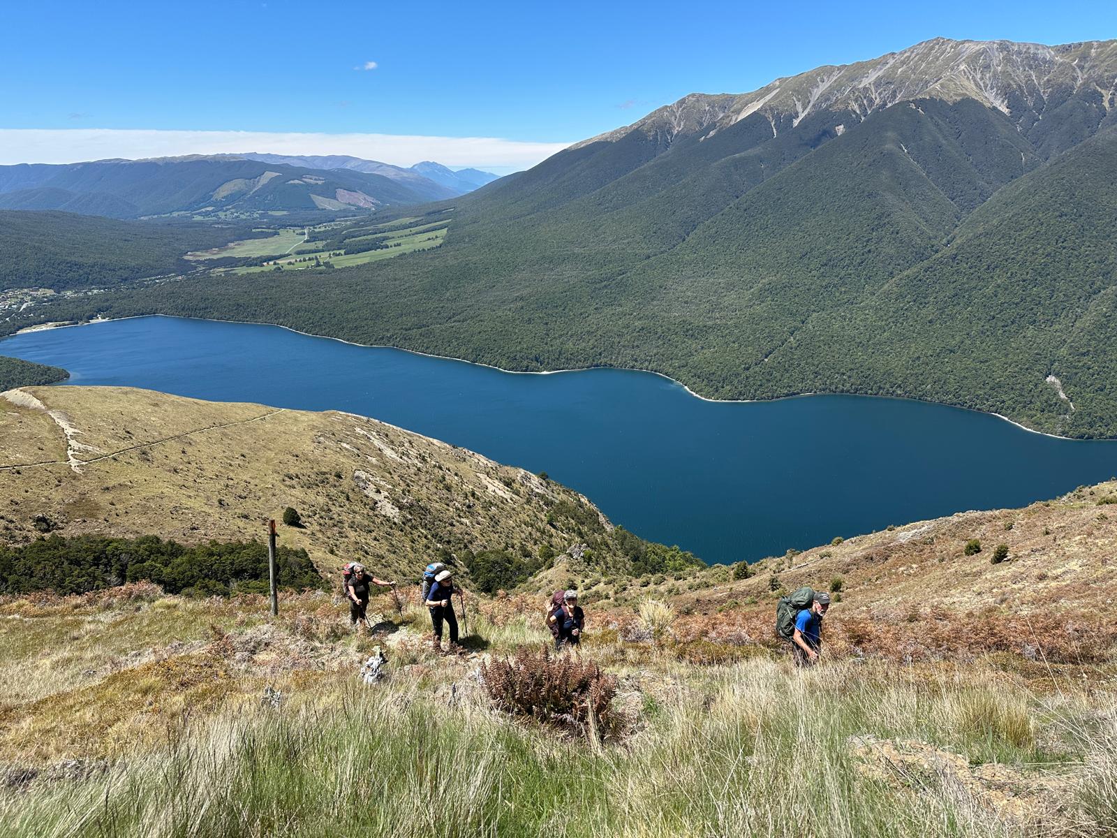
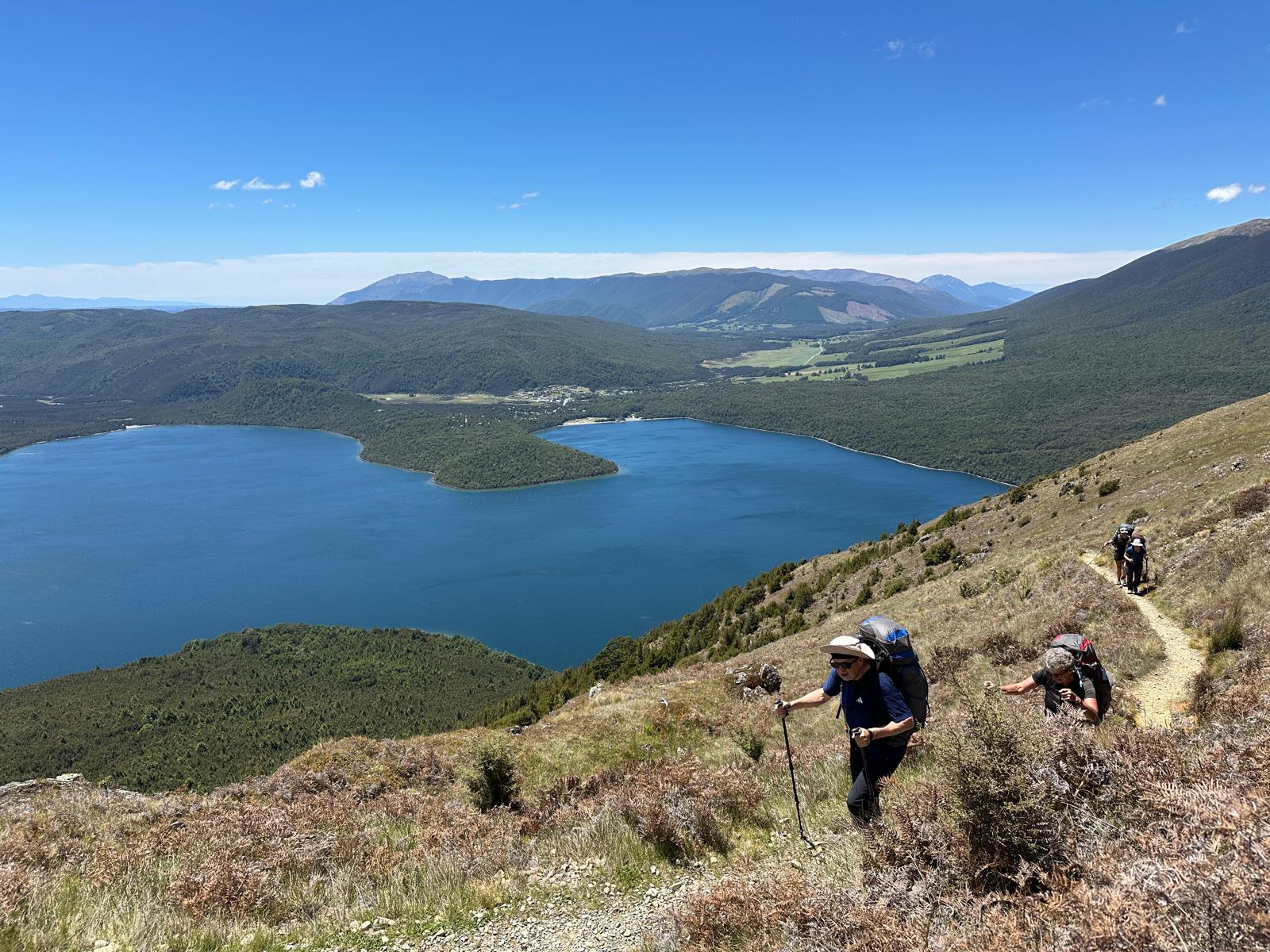
Back to the hike – this was a perfect climb. Nothing was too steep. The views over the blue lake were stunning. As we climbed, the lake got smaller but the views over the mountains got greater, then we were rewarded with views over to distant mountain ranges.
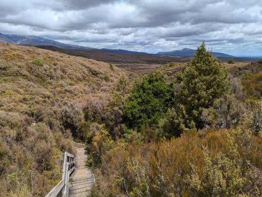
The setting of the hut was stunning – as the name suggests it was right on the bushline (or tree line as we would call it).
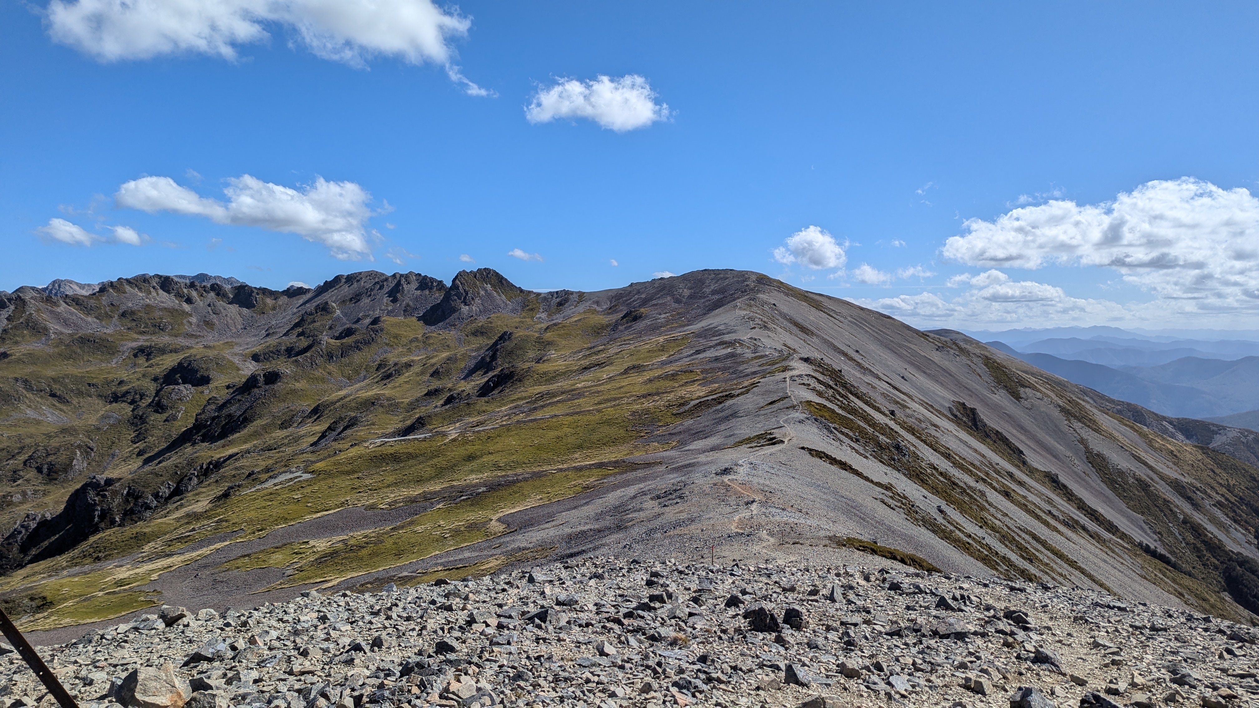
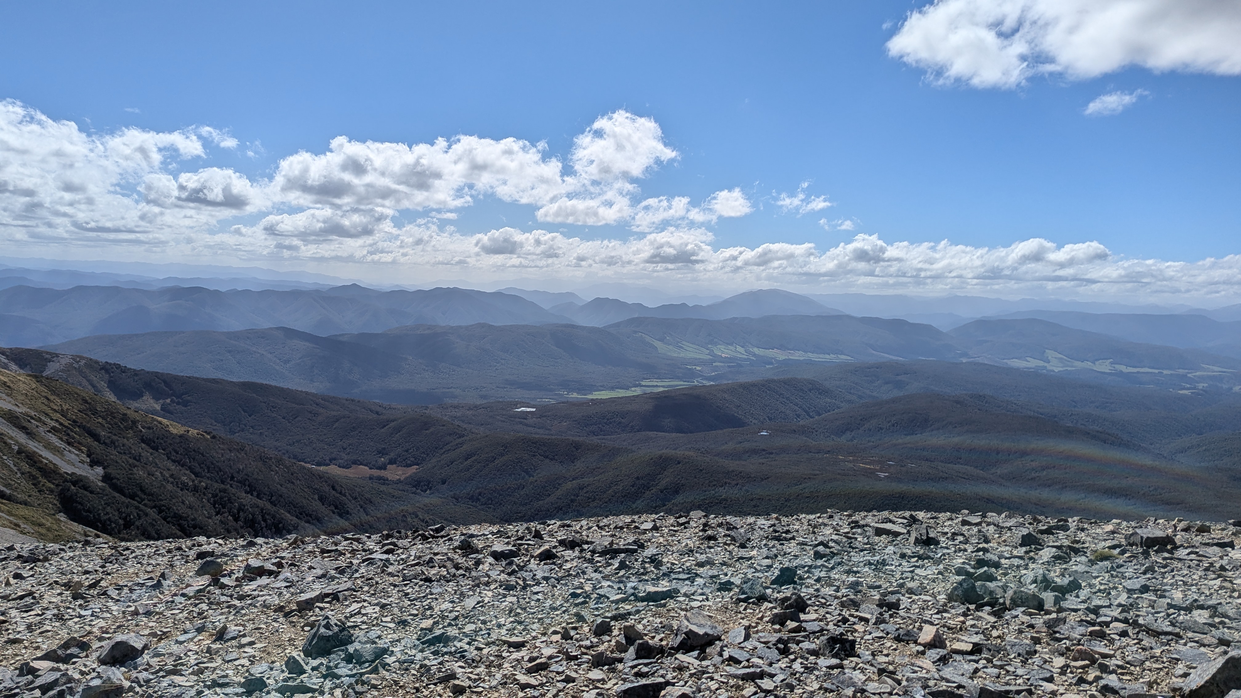
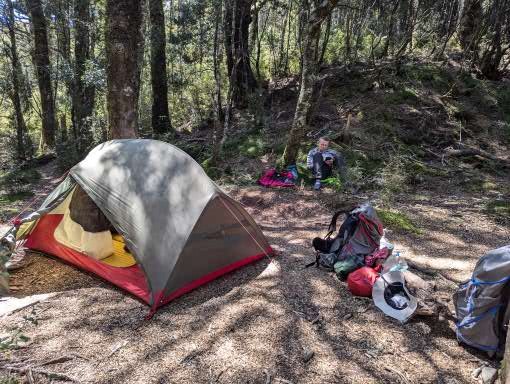
We set up our tent in the trees behind the hut where we would be relatively sheltered as the mountain was famed for its strong winds. We then emptied the rest of our packs apart from a few layers and some water to prepare for the next part of the day. The more energetic in the group (including us) decided to hike up to the main ridge and then along the ridge for a while. This route would eventually lead to the Angelus hut though that was not for us today; it was four and a half hours further on from our hit. Six of us set off, reaching the edge of the ridge about half an hour later. We then walked along the ridge, gradually climbing as the vista opened up even more views. It was windy but fortunately the forecast winds of 55-70km an hour did not materialise.
After about an hour we got to a lookout spot and the rest of the group decided to turn back. David and I were keen to carry on a bit longer so we agreed we would do another half an hour max, and then turn around so as to ensure we were back in time for dinner. The sun was getting lower and we were walking in the lovely golden light of late afternoon. We could see a high point ahead and now there were only the two of we could move faster. We set ourselves a brisk pace and managed to get to ‘Flagpost’ summit, one of the highest points on the ridge, about half an hour later. Our stay at the top was necessarily brief as we were hit by the famed strong winds. So we about-turned and walked equally briskly down. Our legs were beginning to tire following our exertions but, having checked the time, we got to the last turn off down to the hut as predicted. We then allowed ourselves to slow down a bit and got to the hut bang on time – to find cheese and wine ready and waiting for us, followed by a delicious meals cooked by our guides. Tired but elated we were tucked into out sleeping bags by 8.30pm and soon asleep.
(Bernie) Unlike our neighbour (a professional travel writer) we managed a good sleep in spite of the howling gale rattling the tent all night (not smug at all of course). However we did not see the dawn as I had no intention of opening the tent flap in the gale! By 6am though the call of nature dragged me out of the sleeping bag and into the morning. In the hut everyone was up and about and you could not hear or feel the wind! Luckily the Department of Conservation instruction that campers should NOT be permitted to use the hut facilities was no applied in practice (at least not here, at this time of the season. Others tell that it is strictly enforced elsewhere). We could therefore brew our coffee and our porridge, and eat our breakfast in relative comfort.
Taking down the tent involved a complicated dance with the 2 of us unpegging and clutching and folding down the tent before it was ripped from our hands. We managed to avoid any part of the tent blowing over the ridge and down the valley (chasing a tent sheet in the strong wind would have been a real challenge) and hurriedly brought everything down from the ridge to the hut where our belongings were strewn out ready for repacking. The only thing missing was the bag to our platypus water filter. David went back up the ridge and unbeleivably the very small and lightweight bag was caught in a bush and he brought it back triumphant. We were complete!
We only had a short day today so we took out time and we ambled off relatively late at around 9am. By this point the wind had decided to die down somewhat. We were on the dry side of the mountain, walking across arid desert-like conditions, with multi-coloured rocks that showed their volcanic past. Now we were walking round the opposite (i.e. southeast) side of the volcano – a looming presence above us still and almost totally free of cloud in the blue sky. Although the forecast was for rain by lunchtime the skies remained bright and sunny. Our legs were tired from the previous long day and all the climbing but we were moving well and made good progress.
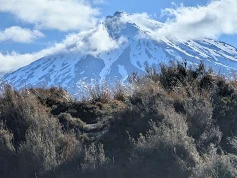
For reasons unbeknown to us, but presumably because it had missed previous lava flows, the scrubland which was devoid of vegetation ended and we reached a pretty wooded area. Crossing a fairly large river (on a bridge, not wading!) there was a sharp but extended climb through the trees. When we emerged out of the trees onto the ridge, we were greeted with dramatic new views of a snowy Mount Ruapehu. It was then a gentle amble down to the hut, our destination for the day, just a 3 hour walk.
Arriving at lunchtime and setting up tent was peaceful and slow. We camped in a clearing in the bush, just beside a river. It was quite cool in the shade but hot in the sun – a huge difference.
We then walked out to a set of mountain springs that emerge from the hillside, with water that has taken hundreds of years to percolate through the rock and then make its way back up to be extruded. It was a special place – and supposedly a place that two blue ducks had made their home. That may well have been true but the ducks were off somewhere else for the day when we visited. However it was peaceful and beautiful.
Back to the hut for more chat, food and chat. One of the features of these walks is that one picks up a group of people who all follow the same trail at the same place – so we caught up with Mary and Polly and Cat and Brandon, as we had the previous evening. Another talk from a warden – not totally inspiring and mostly about her life as a warden which was sort of interesting, but honestly not that interesting. A guide to the volcanic history or the local wildlife would have been gripping – but we got what we were given.
Then back to our books and sleeping bags. After just 3 days on the trail the enjoyable rhythm was settling in – just as when we are cycling. It was strange to think that tomorrow we would be back in civilisation (of sorts that is).
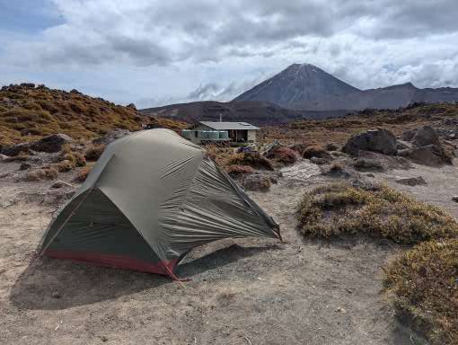
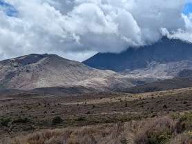
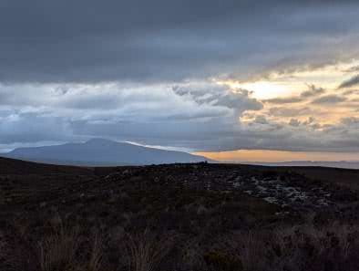
(Bernie) Most of yesterday the mountain tops had been wreathed in cloud but during the evening the clouds cleared revealing our first view of the conical mountain Ngaruhoe and the snowy peak of Ruapehu. Clear skies meant a chilly night but we were snug in our sleeping bags and slept well. We woke at 6am to beautiful clear skies, made coffee, cooked up our porridge and were set to go by 7.15.
The first part of the day overlaps with the famous Tongariro Alpine Crossing – a day walk rightly billed as one of the best day walks in the world. It is an end to end walk so shuttle buses collect walkers from the end and deliver them to a car park just below the Mangetepopo hut. We were told the first shuttle buses drop walkers off at the start carpark, which is half an or so down from the campsite; so if you want to avoid the crowds you needed to leave at either 6am or 10am. We didn’t want to do either of those so decided just to go with the flow. Although there were plenty of people on the track it did not feel oppressive and the landscape was so awesome (taking the literal meaning of the word) nothing could detract from the day. It was one of the best day’s walking I have ever done.
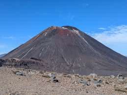
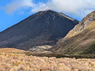
The first part of the day took us up a gentle valley with the steep climb out of the valley ahead of us. We had our first good views of the amazing Ngaruhoe volcano as we crossed the old, and not so old, lava fields. Signs warned us that we were entering an active volcanic area. The volcanos in Tongariro erupt with reasonable regularity – luckily mostly small eruptions are limited to steam or ash, although these can still do a good deal of damage. The last eruption experienced on the track was in the 1970’s and described as a very near miss for a walking group – so not so very long ago. Huge boulders told of the massive eruptions of times past.
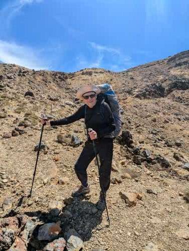
At the base of the climb further signs gave warnings that people should turn back if the weather looked bad or they were feeling unfit. We learned that about two people a week are airlifted off the track during the summer season. However, today the skies were clear blue, the air was still and we were feeling invigorated; so we started the combination of steps and steeper path up to the first crater. We got into a steady pace and although not as fast as the youngsters overtaking us, we were not as slow as others and felt rather smug that we were making our way up with our heavy packs while others had day packs (small pleasures, ridiculous of course!). The ever expanding, stunning views begged for frequent stops to gape in any case and to capture in photos.
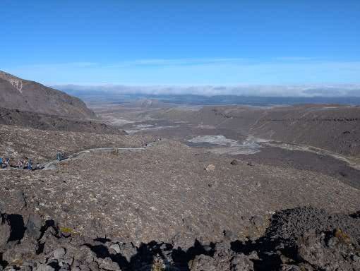
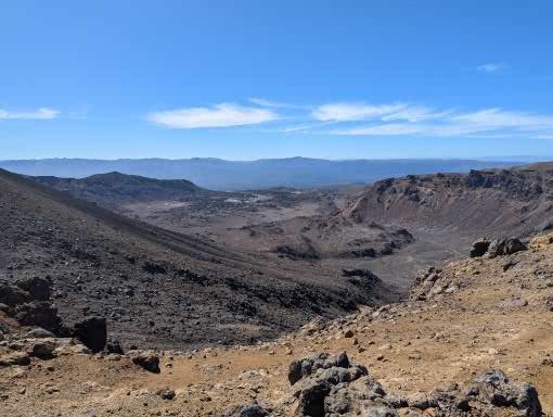
Suddenly we were stepping into the South Crater with a pancake flat base. We stopped for a break overlooking a smaller side crater with views up the red and black side of the volcano. A climb out of the far side of the crater to the Mangatepopo saddle opened up the views on the other side to the Oturere valley.
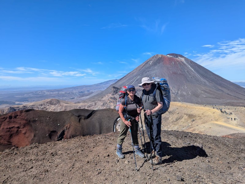
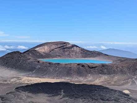
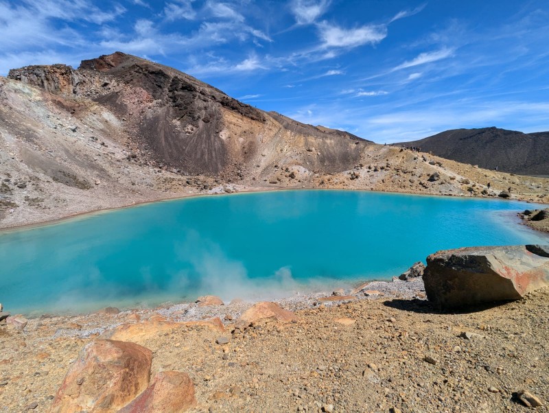
A last fairly steep climb took us to the highest point of the walk (1867m) with breathtaking views over the Red Crater, Tongariro mountain, the Blue Lake and Emerald lakes with their steaming fumeroles. I hope the photos do it justice.
We realised how lucky we were when we met the guide we were chatting to at the campsite the previous evening. He guides teenagers on their Duke of Edinburgh hikes (yes, DofE is in NZ) and had done the trail numerous times. He said he had never seen it so good – usually the top is on cloud. A ranger later described the weather as “one in a hundred day weather”. The summits of the mountains are sacred to the Maori (you are therefore not allowed to climb to the summits); for some reason the Maori gods were smiling on us today.
(David) I get the easier bit to write about – going down! But the first stretch was quite tricky, as we descended a steep shoulder with drops on either side. Underfoot it was moving sand and small rocks, and a bit like descending a scree with very small stones. Bernie took it easy and at one point stopped to allow a woman behind her to pass – but was told “No – I am following you – you are doing this descent so elegantly!”. Wholly unsurprisingly, no one complimented me on my descending technique as I staggered down trying not too lose my footing – when many did. No one tumbled off the sides – at least as far as we could see.
We stopped at the bottom by the fumeroles (wispy volcanic smoke coming from ground indicating activity just below the surface) in a small gap which was not overwhelmed by the stench of rotting eggs for our lunch – Ryvita, peanut butter and cheese! Whilst I accept this combination is not offered in the best restaurants, it was high calorie and delicious after 4 hours walking. Mary (one half of the Tasmanian couple joined us) whilst her partner, Polly, mooched around the volcanoes. They have a daughter who teaches geography in a tough school in Tassie, and were under strict instructions to take photos to bring life to her classes.
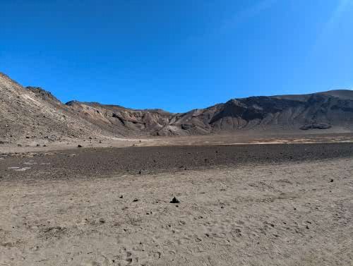
The paths split at this point – with the day packers on the TAC heading north to the end of their walk at Ketetahi car park and the TNC multi-day walkers heading towards Oturere hut. Suddenly the valley was deserted as we climbed down a section called the dragon’s tail. The Oturere Valley is high altitude desert with stunning rock formations. For those who have seen the Lords of the Rings films, this is the set for Mordor. By this point we were a tad tired, but met a jolly face coming the other way with a spade, clearing the track. This was Sally the Oturere hut ranger who told us we only had an hour to go, and all would be well! She was roughly right – it was about an hour but it stretched out as tiredness set in. But soon we went over a small ridge and there was the hut, nestling just below a ridge.
Sally had advised us to camp up on the ridge as she said the dawn was lovely from there. 90% of the time this is good advice; we were in the 10% when wiser heads would have pitched below the ridge line. But, in the calm of the afternoon, there seemed no reason not to take her advice.
Once the tent was pitched and a brew revived us, we ambled over to a stream for a wash and paddle. Mary had said she had “wallowed” in the water but she is clearly made of sterner stuff than me as I managed it up to my knees before screaming from the cold. But it did leave us cleaner than we had been for 48 hours.
A windy night!
Supper, reading, chat, brew, reading, more chat, funny stories, and early bed. That is the way of life on a trek and it is super enjoyable. I was stuck into a crappy book, loved the scenery and wished it could go on for ever. However, as the evening drew on, the wind got up and the lack of wisdom of our chosen campsite became clear. It was dry but blew a gale all night, with the sound of the wind trying to keep us awake – mainly unsuccessfully I can report. However the only reason the tent did not blow away down the valley was that it was weighed down our bodies! At one stage I got up to see if the guy ropes were holding – they were – and then went back to sleep. The woman in the next tent was on her own and claimed not to have slept a wink all night!
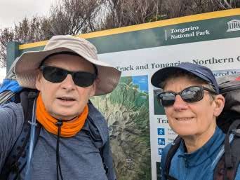
(David) Now I know that this is a cycling blog – but this next few entries have no wheels and only describe a walk – or a “tramp” to give our activity its local name here in NZ. For those who are only interested in cycling, I suggest you “look away now”. For the rest, this is a description of one of the NZ “Great Walks”, the Tongariro Northern Circuit, also known as the “TNC”.
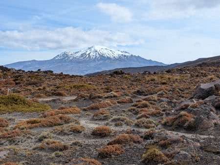
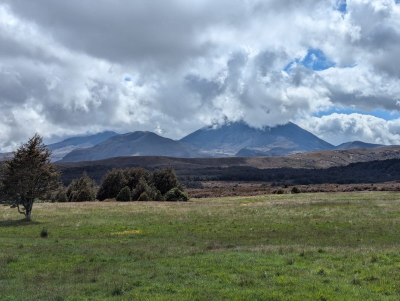
The TNC is a walk in the Tongariro National Park. It takes up to 4 days and goes around the conical Mount Nguruhoe (2287m), a classic volcano which looks like a mountain that a child would draw – straight sides and a snow covered top. The smaller mountain, Mount Tongariro (1967m) is north of Mount Nguruhoe, and the walk crosses the saddle between the two mountains. On the other side of the valley is the much higher Mount Ruapehu (2797m) which is longer and has an extensive snow covering at this time of year.
We drove from our accommodation in Turangi (having failed to find time to go fishing in a world fly fishing mecca) to the strangely named “Whakapapa” village to start the walk. We later learned that it was pronounced “Fu-whack-a-pappa”. The road took us gradually up to the village which is at about 1150m. The landscape was high altitude moorland, dominated by the two volcanos to the north, Nguruhoe and Tongariro and the Mount Ruapehue (2797m) range to the south, where there is extensive skiing in the winter.
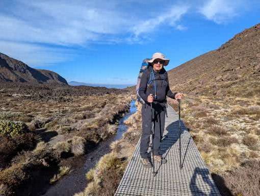
There are huts along this walk but they were all fully booked before we got our act together and so camping was the only option. Overall, this was better for us as it meant we got a good night’s sleep most nights, as opposed to the hit and miss of a night in a shared hut. Having sorted out renting a locator beacon (being either intent on being as safe as possible or as pessimistic as it goes) we put on our packs and started walking. A word about our packs – and thanks to our great friends Gill and Peter who provided advice and encouragement from their many years of trekking. We got lightweight rucksacks before the trip, good poles and a few other items such as a gas burner, but most of the kit was the same as we have used for cycle touring. The difference was we also packed freeze dried meals and other food for 5 days – 4 days plus a spare. The packs were heavy but not ridiculously so; probably about 14g for David and a bit less for Bernie.
We started our trek in the dry, but with cloud over the top of Mount Nguruhoe. The terrain was marsh/mud which went up and down across numerous streams that flowed down from the mountains to our right. Heather was introduced to this area to provide cover for grouse in the early C20th, but was a disaster as it wiped out the native species. Grouse never survived and so the original plan of turning the slopes into Scottish style grouse shooting never occurred. But heather spread at pace, with local fauna declining. The invasive heather is now a pest which the NZ Department of Conservation is attempting to remove – but it is a massive job as it has spread over vast areas.
The walk was steady rather than dramatic. There were a few others on the track – some overtook us and others came the other way. We could tell instantly if someone was a day walker – small pack – or a multi-day walker – big pack. The day walkers were faster (of course) and most of the multi-day walkers were faster than us (again of course). Lots of jolly greetings along the way. As we walked, the shape of the mountains changed – but far more slowly than on a bike. Gradually the top of Mount Nguruhoe cleared of cloud, revealing its classic shape, and we got to see the saddle we would have to climb tomorrow.
After 3 hours of sliding along muddy tracks we reached the Mangetepopo Hut at about 3pm, and found a place to set up our tent. The huts are hugely sociable places and we chatted to other walkers, all of whom had come to the hut under their own steam. There was no warden, no electricity and no hassle – everyone just getting on with things. We chatted to a couple from Tasmania who were about our age, a young couple from Boston, USA who were on a delayed honeymoon having negotiated 4 weeks holiday (amazing in a US context) and lots of New Zealanders.
Our first experiment with freeze dried meals was about 75% successful – we will get better with them – but it was tasty. By 8pm we were in our sleeping bags as the temperature began to fall and the light faded. This was both remote and not remote. It was remote in the sense that there were no roads, we were in a tent and felt tired from a decent walk; but it was also not remote in the sense that another tent was pitched very close to ours and we were on a fixed and very popular walking route. That seemed about the right balance to start getting used to the experience of tramping. If it goes well, we could explore more remote settings at a later date. For now, this was as good as it gets.