Tag Archives: hiking

Paparoa National Park, Pancake Rocks and kayaking on Lake Mapourika.

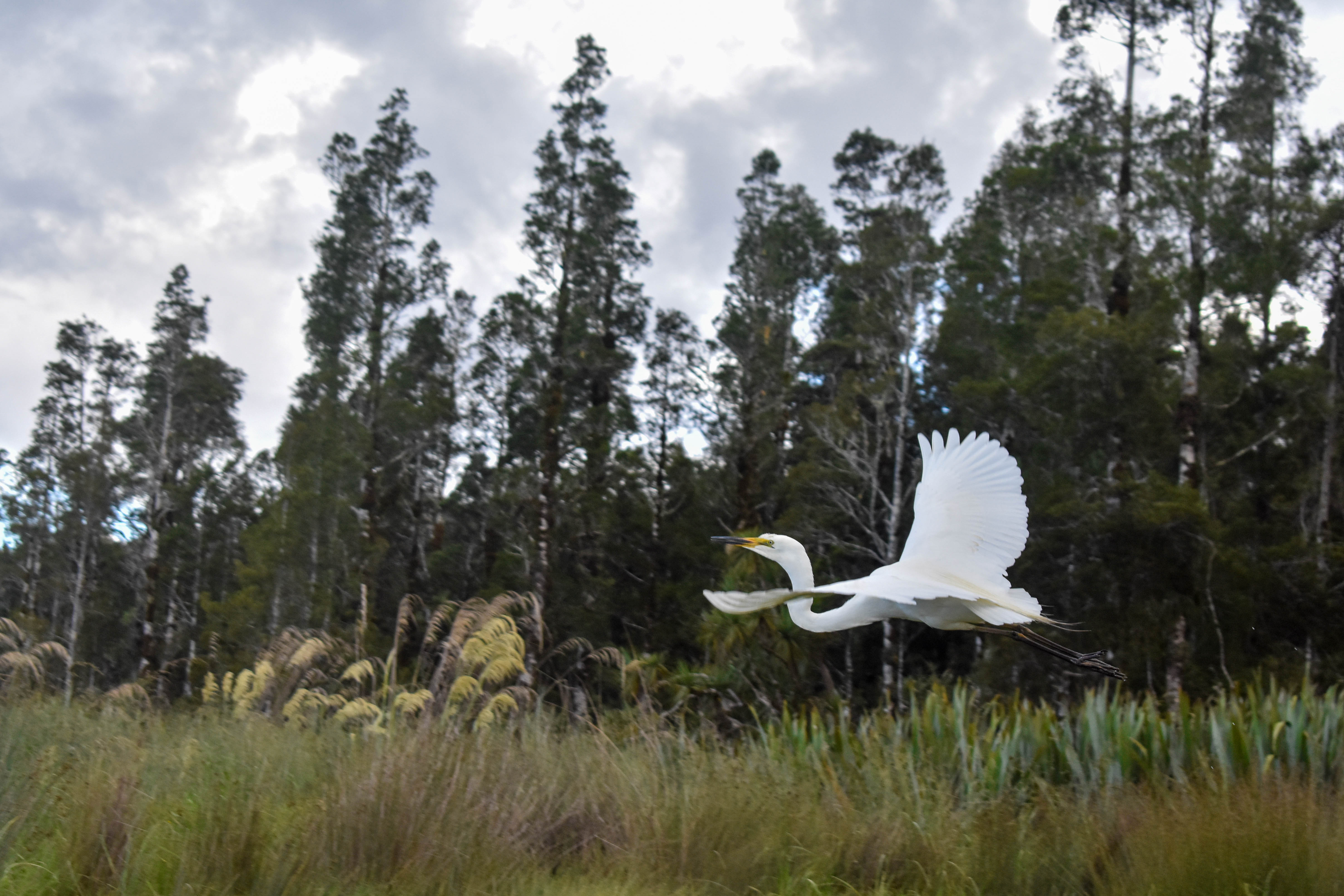
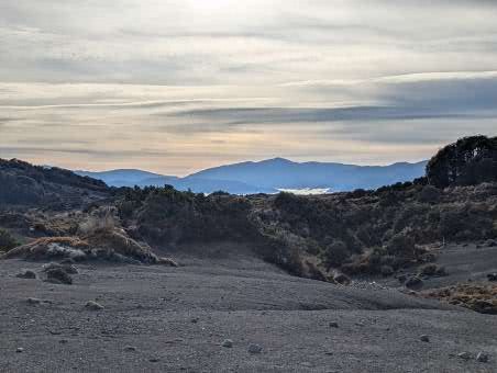
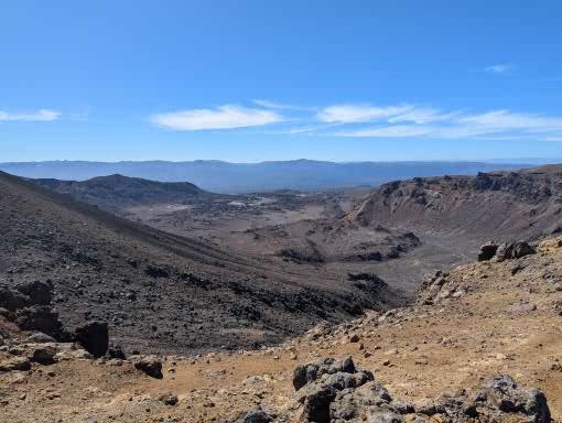
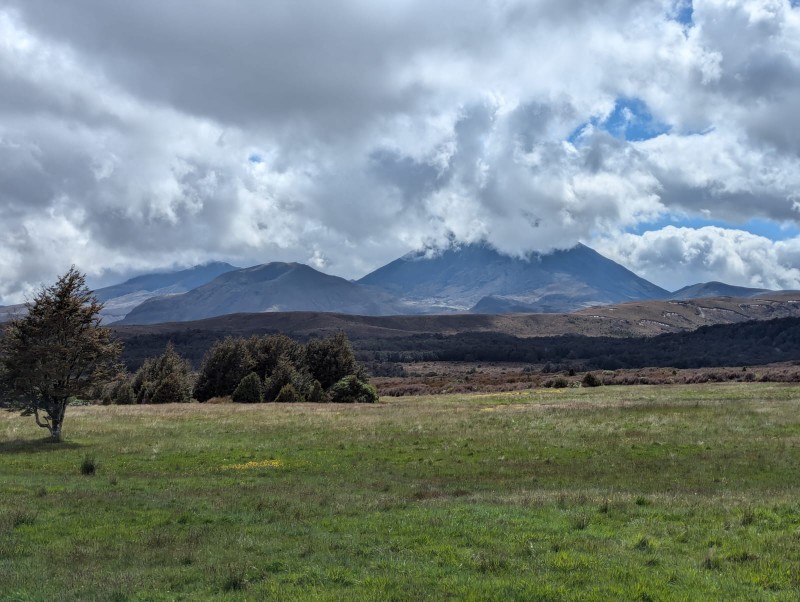
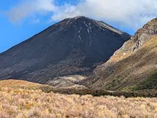
Although we had been warned that the West Coast of the South Island is extremely wet, we woke to another sunny day. A short drive took us to Paparoa National Park along the coast road (actually the only road) with dramatic coastline on our right and towering mountains, covered in green on our left.

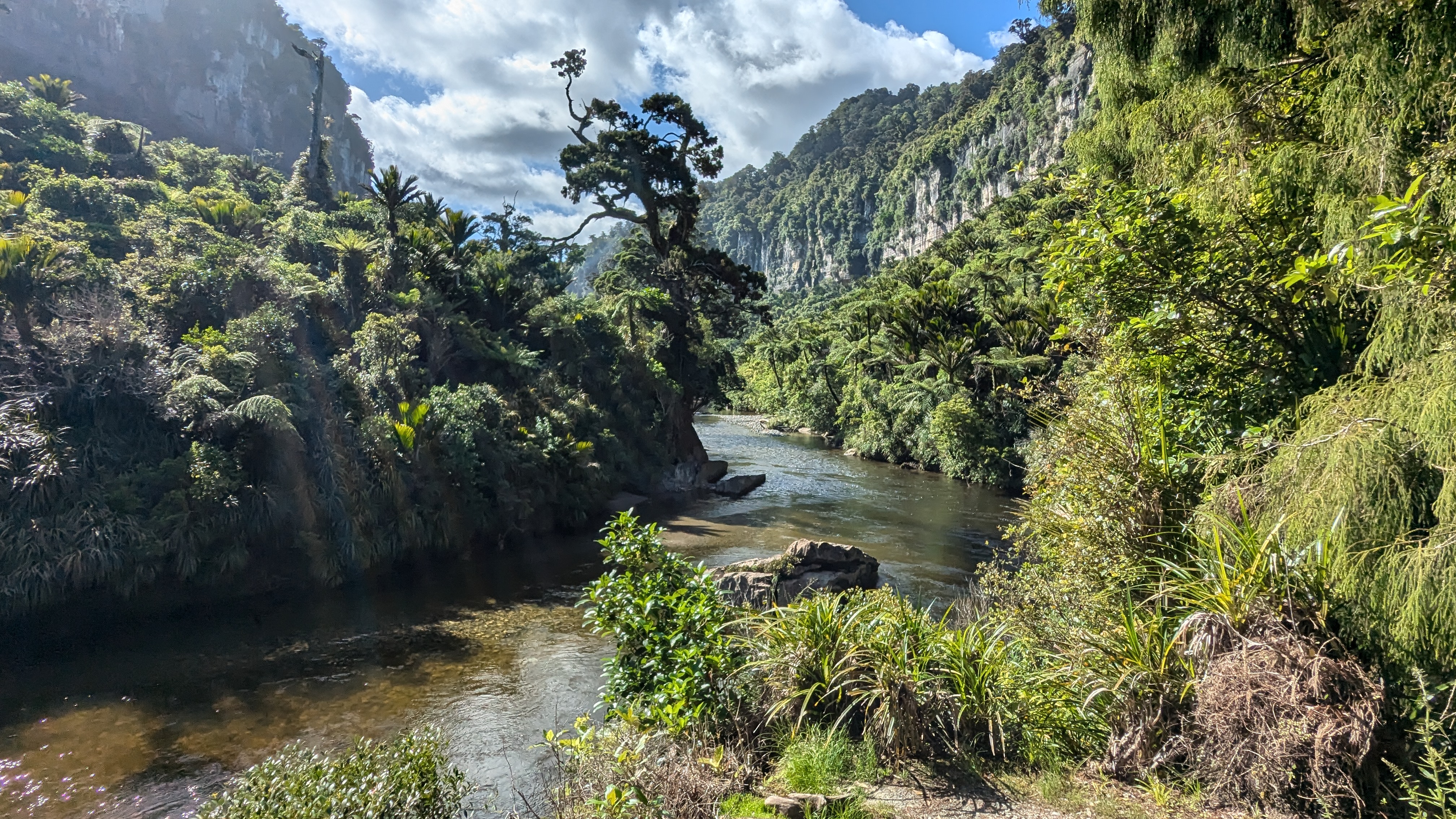
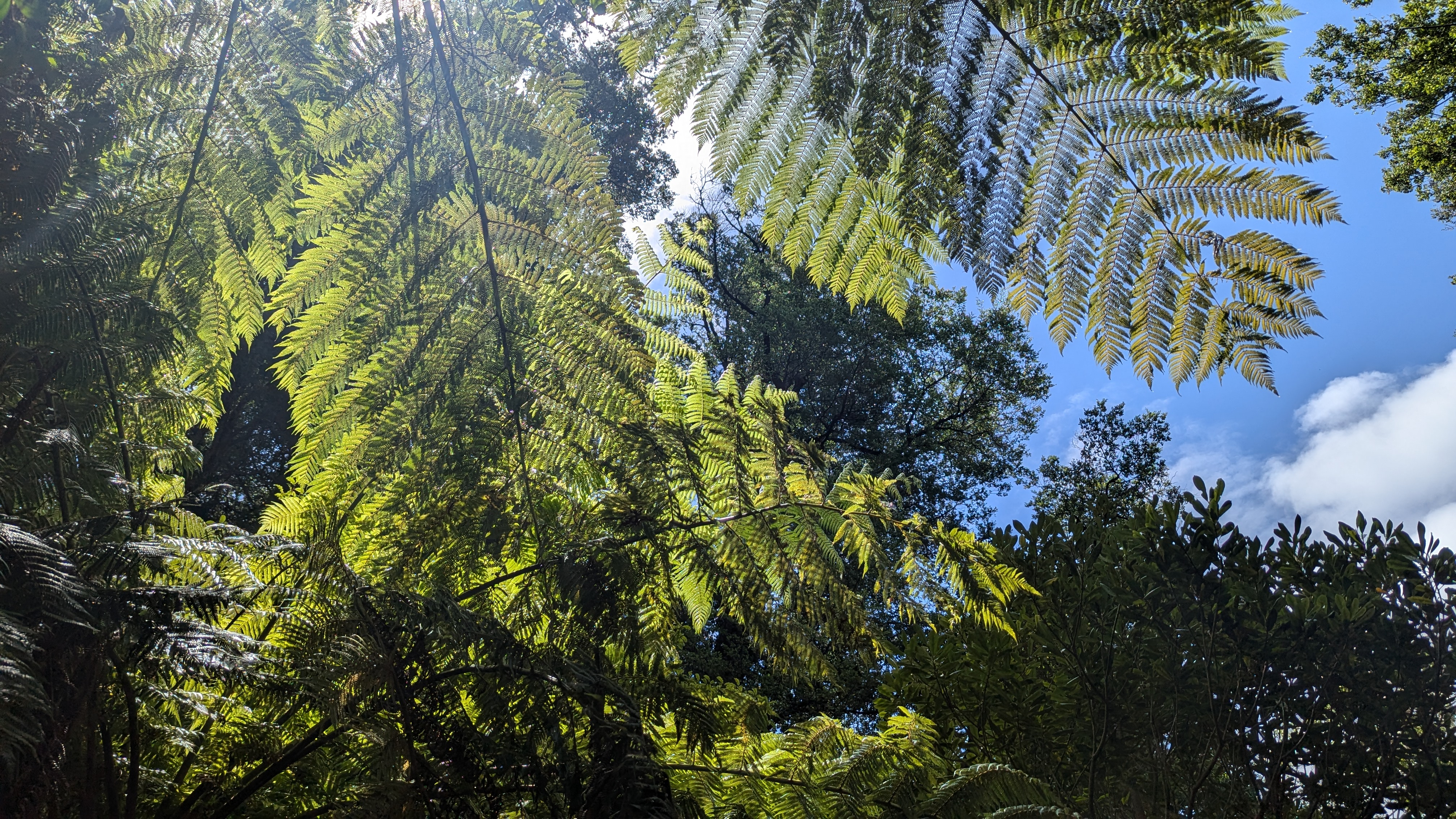
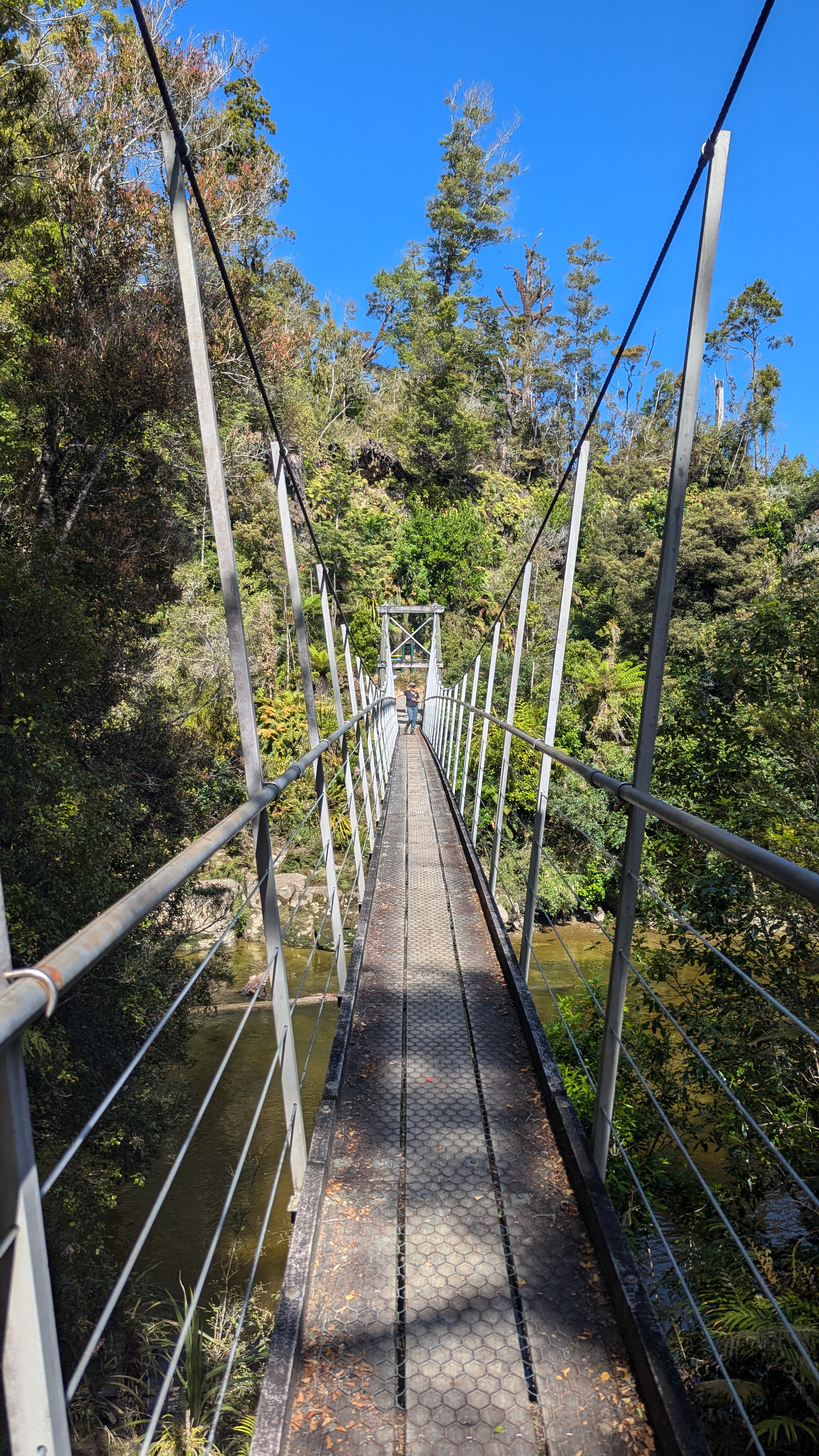
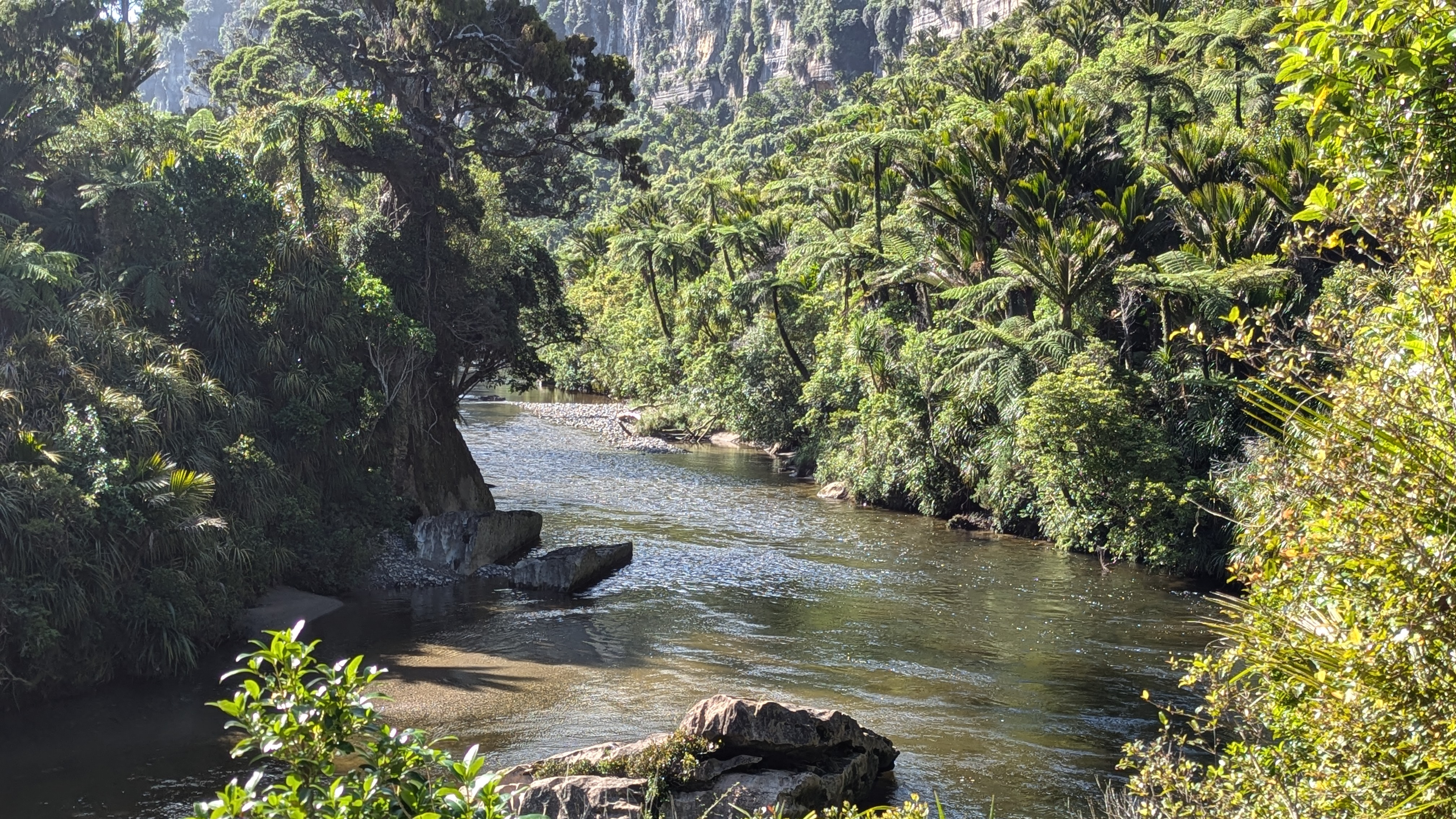
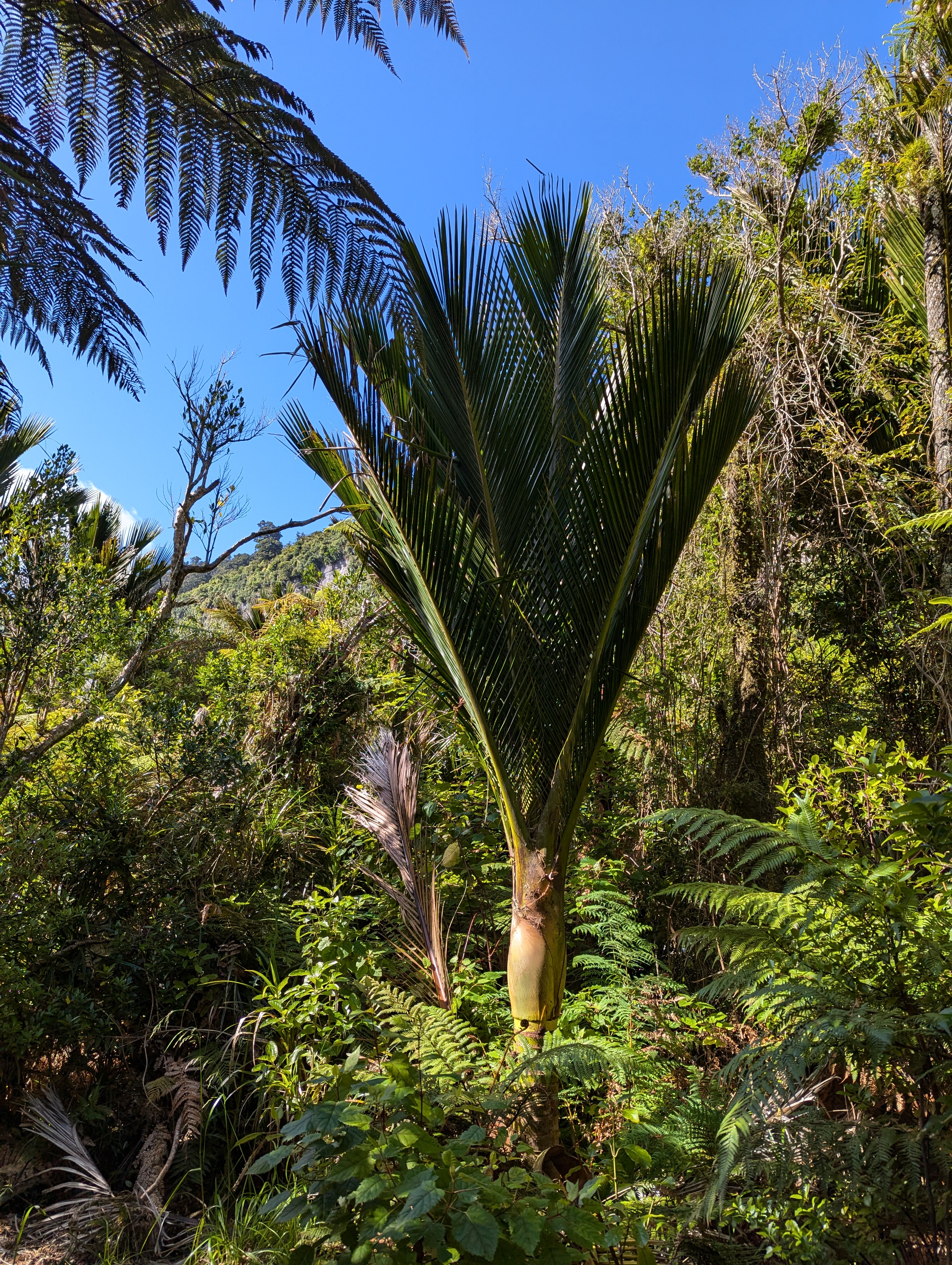
At Paparoa we had a gorgeous walk along the Paparoa river track. The bubbling river was clear but stained brown with the tanins leaching into the water from the surrounding forest, and edged with towering limestone cliffs and luxurious vegetation.   

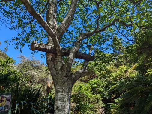
On the way back to the start we spied a wild goat in the vegetation just up from the river.  There are numerous goats in this area and they are a threat to native species – so are hunted with the aim of eliminating them.  However, they have proven elusive and difficult to catch and so, at this point, the ecological threat remains.

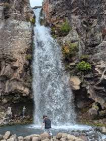
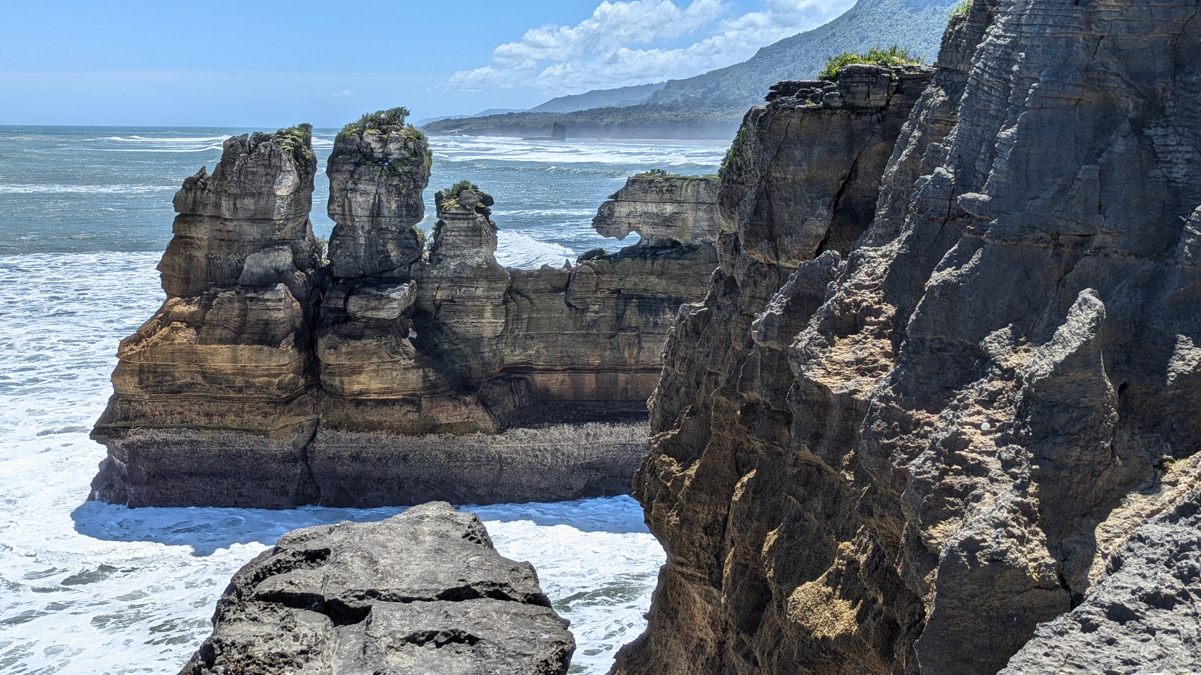
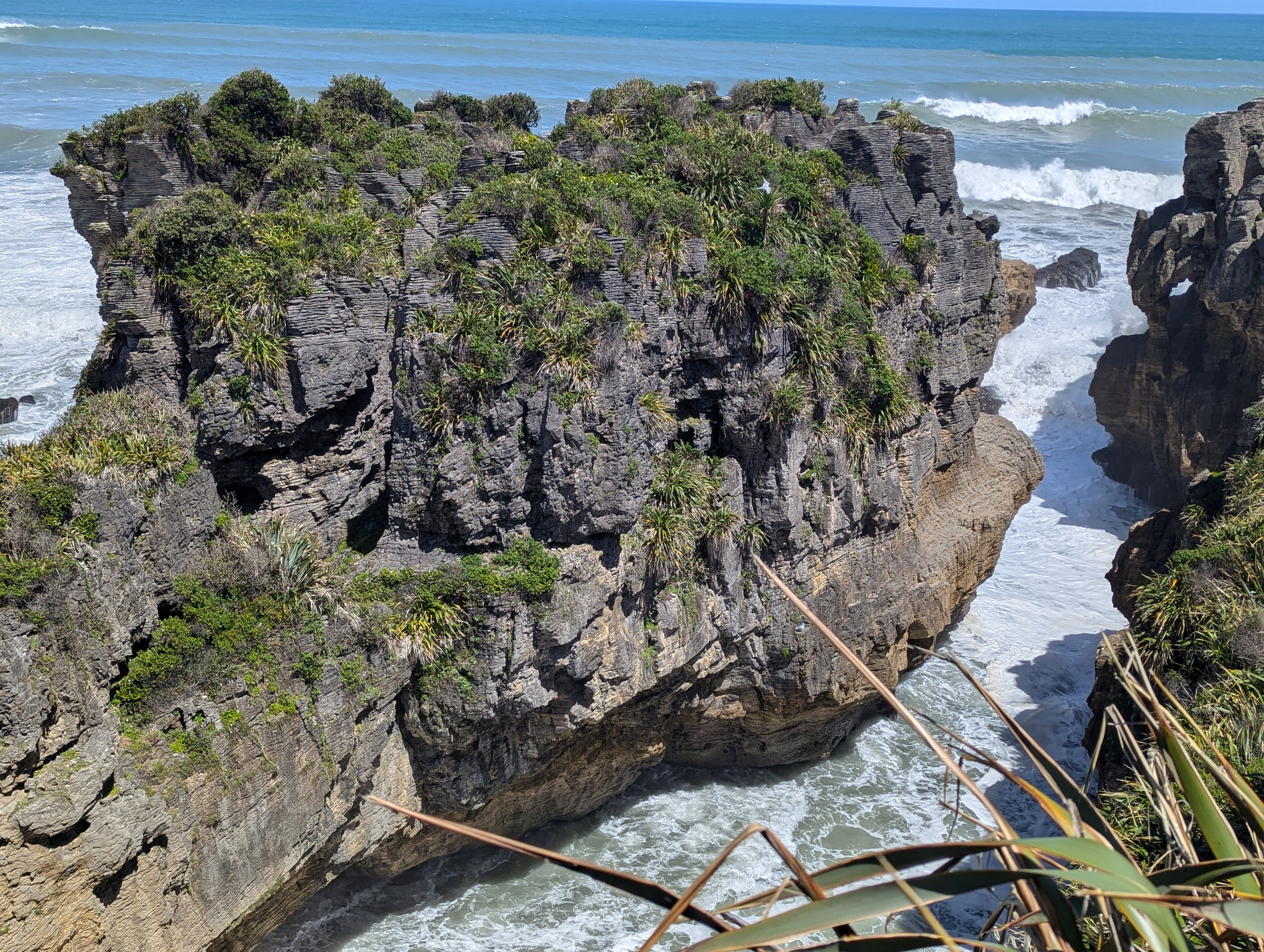
A little further along the coast we reached Pancake Rocks – a promontory of eroded cliffs made up of layers of limestone and compressed mud so that they looked like stacks of pancakes. Large holes, bridges and caves had been made from the waves crashing in from the Tasman Sea. We’ve seen lots of cliffs but none that looked like this.

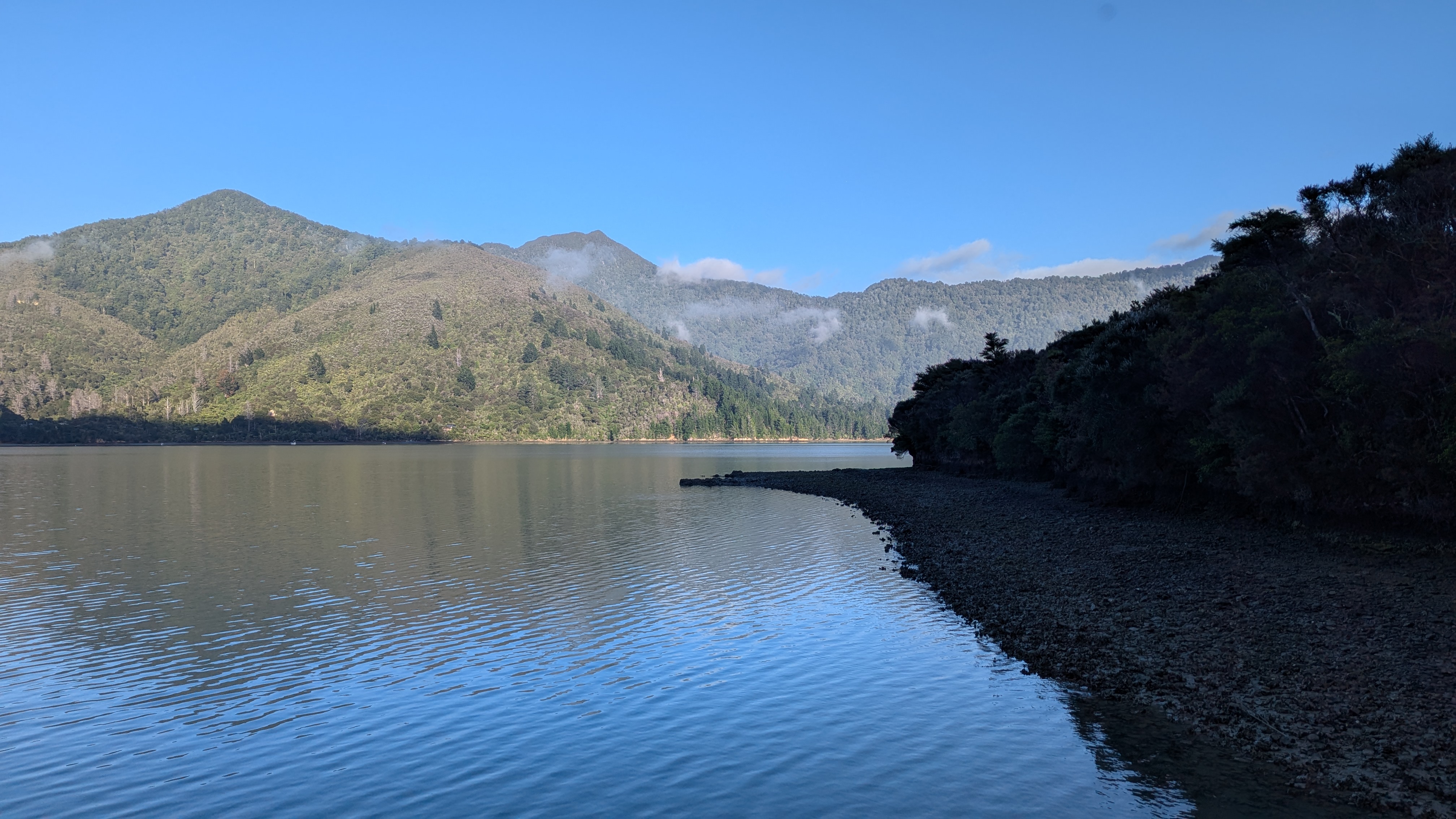
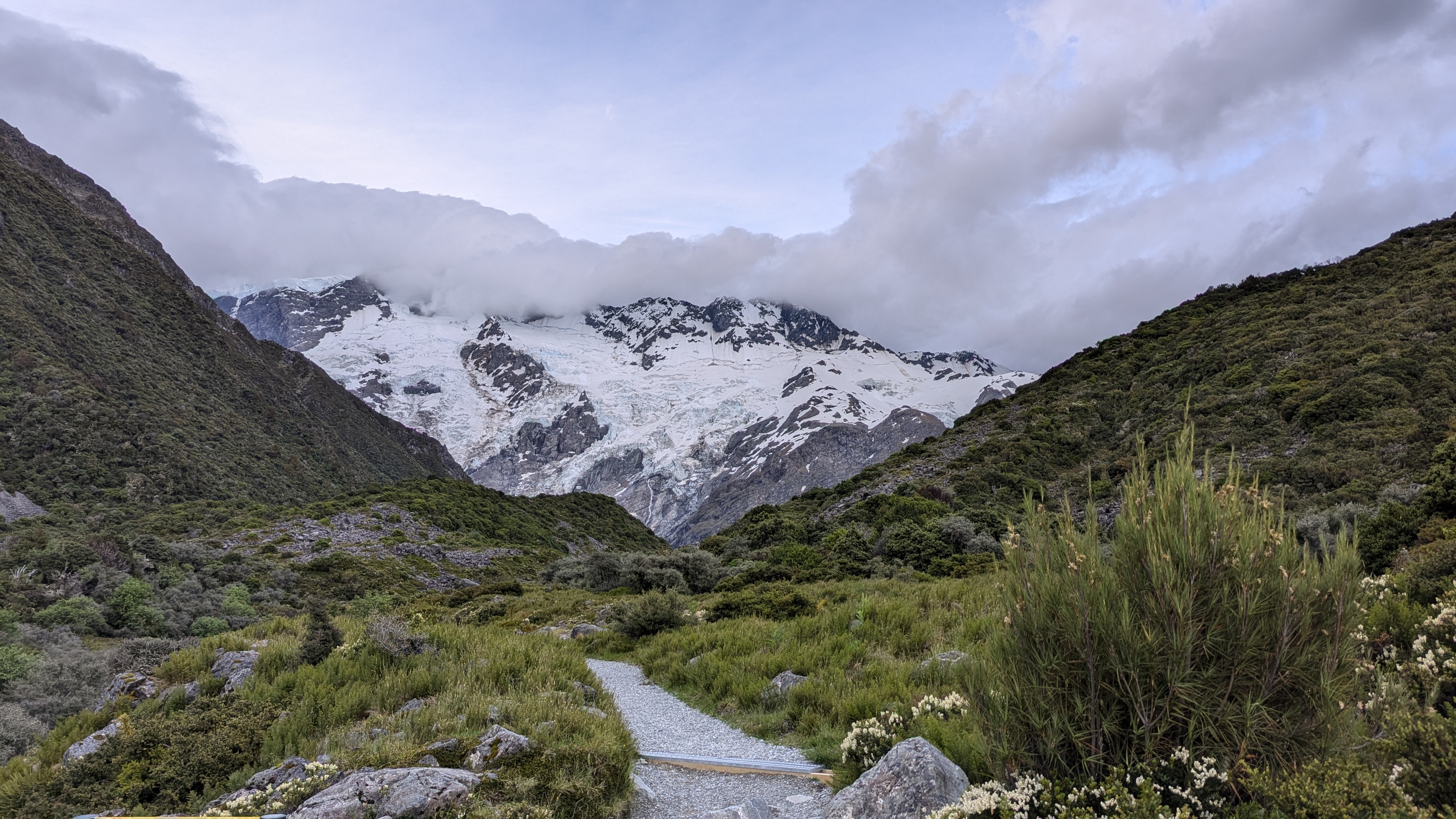
We then had a longer drive to Lake Mapourika and the village of Franz Joseph Glacier.  The famed rain swept through from time to time, clouds wreathing the green mountains, but it had largely cleared by the time we arrived. There had been a hasty change of schedule as the guides had received notification that the coast road (which is the only road) was going to be closed completely the following afternoon for a few hours.  Thus, if we wanted to make our way south, we would need to drive through the following morning. The planned kayaking trip on the lake for the morning had therefore been transferred to this evening.

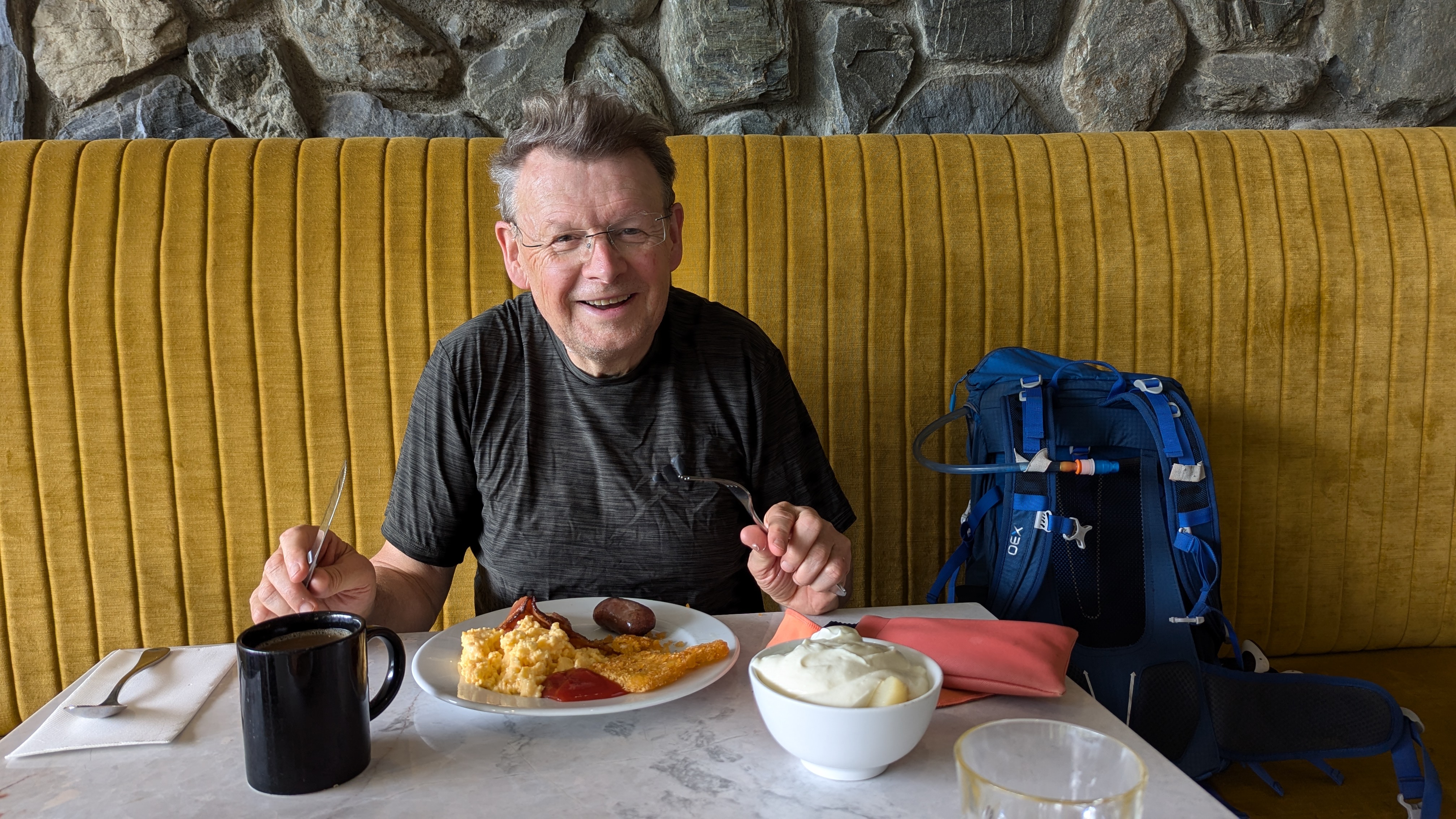
Kitted up with double kayaks, aprons and life jackets, and dosed up with sandfly repellent,  we had a serene and instructive guided kayak on the lake. After almost 40 years of marriage David and I managed to paddle our double canoe in (almost) perfect unison; at one stage we were told we had to slow down!!

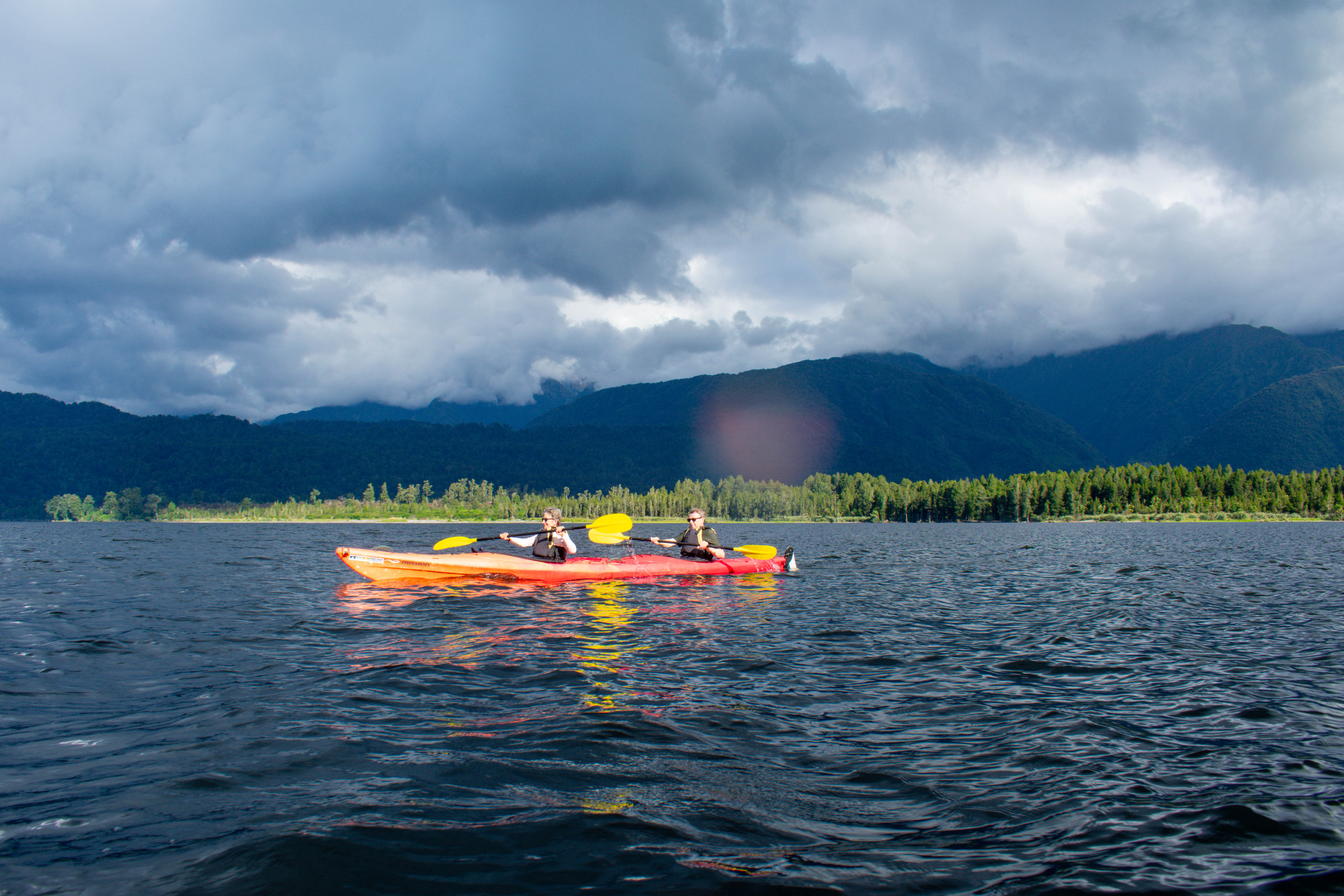
The lake was surrounded by untouched verdant forest. The soil layer was extremely thin so the trees grew very slowly.  The average age of the tree canopy was 800 years, with the largest trees being 1400 years old. The dense forestation was incredible to observe close up. There were 5 species of kiwi in the forest and a very active programme of kiwi conservation that was successfully increasing numbers after a period of decline. There was also a very active programme of eradication of mammals, which were introduced species to New Zealand by the colonisers over the last 100+ years (including goats – see above). The area was hoping to become mammal free by 2025 (just a few weeks away) by trapping and poisoning the invaders.  Some of the techniques were a bit hit and miss, and were controversial but overall the programme was working- albeit millions of dollars was invested to achieve that outcome. The last amazing fact was that although the lake was just below the mountain glaciers but was entirely fed by rainwater, and the water temperature was 18-20 degrees.  This is because it is a kettle lake – formed by a huge lump of glacier ice that had become separated from the main glacier and gradually melted.  The lake was therefore not fed by a glacier river but by the massive rainfall (up to 5 meters a year). The lake was almost black in colour from the tanins and therefore absorbed heat from the sun.  It could have provided fantastic swimming except for the very pesky swarms of biting sandflies (every inch of showing skin was smothered in bug repellent). The late hour and hunger also deterred us from swimming and so we all left the water more or less unbitten.

Nelson Lakes National Park. Overnight hike to Bushline Hut.

Our day off in Nelson was cloudy and rainy – so much for being the sunniest place on the South Island. It gave us the excuse to do very little for the day; so we were raring to go the next morning, which did dawn bright and sunny.

After a tasty breakfast (best coffee so far), a shortish drive took us to the beautiful setting of Lake Rotoiti in Nelson Lakes National Park. We did a short walk through the forest, learning about the key part played in the local ecology of the honeydew from the scale insect that lives in the bark of the beech trees. Unfortunately, invasive wasps were gobbling up the honeydew, so as in most parts of NZ, there was a programme to get rid of the invasive species to restore endemic species.

Lake Rotoiti
Eels below the jetty – they live for up to 100 years!

After an early lunch by the lake we set off on the hike proper for the day – a two hour tramp with packs up to Bushline Hut on Mount Robert, where we were staying overnight. We had elected to camp, rather than squash into the rows of mattresses in the hut, so were back to carrying full packs.  This paled into insignificance when we saw what out guides carried up –  their kit and all the food for 11 people for the evening meal and breakfast.  Their loads included 2 bottles of wine – I fear we set a precedent.

Back to the hike – this was a perfect climb. Nothing was too steep. The views over the blue lake were stunning.  As we climbed, the lake got smaller but the views over the mountains got greater, then we were rewarded with views over to distant mountain ranges. 

The setting of the hut was stunning – as the name suggests it was right on the bushline (or tree line as we would call it).

We set up our tent in the trees behind the hut where we would be relatively sheltered as the mountain was famed for its strong winds.  We then emptied the rest of our packs apart from a few layers and some water to prepare for the next part of the day.  The more energetic in the group (including us) decided to hike up to the main ridge and then along the ridge for a while.  This route would eventually lead to the Angelus hut though that was not for us today; it was four and a half hours further on from our hit. Six of us set off, reaching the edge of the ridge about half an hour later.  We then walked along the ridge, gradually climbing as the vista opened up even more views.  It was windy but fortunately the forecast winds of 55-70km an hour did not materialise.

After about an hour we got to a lookout spot and the rest of the group decided to turn back.  David and I were keen to carry on a bit longer so we agreed we would do another half an hour max, and then turn around so as to ensure we were back in time for dinner. The sun was getting lower and we were walking in the lovely golden light of late afternoon. We could see a high point ahead and now there were only the two of we could move faster.  We set ourselves a brisk pace and managed to get to ‘Flagpost’ summit, one of the highest points on the ridge, about half an hour later. Our stay at the top was necessarily brief as we were hit by the famed strong winds. So we about-turned and walked equally briskly down. Our legs were beginning to tire following our exertions but, having checked the time, we got to the last turn off down to the hut as predicted.  We then allowed ourselves to slow down a bit and got to the hut bang on time – to find cheese and wine ready and waiting for us, followed by a delicious meals cooked by our guides. Tired but elated we were tucked into out sleeping bags by 8.30pm and soon asleep.

The Nydia Trail – A delightful forest tramp

(David) This day started with a fantastic breakfast.  Now I know we go on and on about breakfasts in this blog – usually the best meal of the day which is “second breakfast” – but this was great.  We left our anonymous hotel to go a few hundred yards along the beach road to The Beach House Café, Kaikoura – squashed between the Little Laundromat and the Lazy Shag (which claimed to be “serviced” accommodation – although what services were provided was a little unclear).  Anyway, the eggs benedict and bacon, with excellent coffee, at the Beach House Café are worth travelling hundreds of miles for! 

Then it was back into the minibus to go north to the Marlborough Bay area.  This area of New Zealand is wine country, with mile after mile of vines across the hills, and even on flat fields.  The wines are well known in England and taste just as good here (more of that later).  We stopped for ice creams at the town of Havelock, which had a “frontier” feel to it.  The town sits beside Pelorus Sound, one of many sea water inlets that lead out into the Cook Strait.  Whilst there and spurred on by all the wineries we had passed, Bernie had the genius idea of buying some local wine which we smuggled into our backpacks for later.

Then it was a 45 minute drive along a gravel road on the northern side of the sound to get to Kaiuma Bay, where the trail began.  The trail was about 12 km, including two fairly substantial climbs and descents, to reach Nydia Bay where there is a “hut” complete with running water, electricity, a fridge (when the generator works) and hot showers – but still a hut.

The walk was almost entirely through native forest for the first 10km and then a final 2 km along the sound.  It is hard to describe how lovely it was to tramp through this hugely variable vegetation. 

We saw palms of all descriptions, rotting trees with fascinating bark shapes, beach trees which were nothing like the beach trees we have in England and enjoyed the steady hum of cicadas, which has been the signature sound of summer abroad for so long.  I hope the pictures do credit to the beauty of the forest. At the narrow shoulder we looked down to the idyllic Nydia Bay, surrounded by the forested hills, where the only access is to walk in (or rarely get to by water taxi, although the hut ranger said he had only ever seen people walk or mountain bike in).

Once we arrived, we all went swimming in the sea to cool down after a fairly arduous tramp.  It was so, so refreshing.  There was a jetty – so for the younger elements, the inevitable jumping off, diving and trying to do “loop the loop” in mid-air, trying to turn full circle to avoid a sensitive anatomical part hitting the water at speed.  Some were more successful than others. We went for the more genteel glide in off the jetty steps!

After a swim we repaired to the lodge to have freeze dried meals, to find our guides had carried up a whole cheese board including dips and crackers.  We brought out the wine for everyone that we had smuggled into our rucksacks as a surprise.  This was another unexpected treat which let to Bernie being awarded the “toy kiwi” prize for the day.  This was luxury tramping in a five star setting.

Aoraki/Mount Cook – Seely Tarns and Mount John, Lake Tekapo.

We set the alarm for 5.15am so that we could leave at first light. The rest of the group had elected to do a shorter walk up to the Red Tarns but we felt we wanted to give ourselves something a bit more stretching.  We knew it was a tough walk and we also knew we needed to be back down the mountain to coincide with the end of their walk, so as not to hold everyone up!

The forced early start gave us one of those truly magical moments. The sky was turning pink as we left, turning the glacier ahead of us a pale rose colour. As we started to walk the sky to the east was infused with a brilliant orange, the clouds shining and shimmering. It only lasted a few minutes but it was glorious and set us on our path in good spirits.

It was about a half hour walk up the valley to the base of the path up to Seeley Tarns. We were the only people about apart from one lone runner. As the path turned off it began to rise, seemingly almost up a cliff, and then it was steps, steps, steps and more steps. 

The path is reputably called a “the stairway to heaven” and involves climbing about 2,200 steps – and going up the 600m of height gain it felt like it!  However, as with so many mountain walks, the ever-evolving view kept us climbing and climbing.

We were going well – in fact so well that we almost missed the tarns. We thought it would be about 2 hours to get to the tarns (half way to the ridge) up but in fact we got there in just over an hour.  The sign was tiny and we nearly missed it by continuing on up the path to Mueller ridge. After a couple of minutes, we realised we could see the tarns and went back to the side path. There were only 2 tiny tarns but there was a lookout point with amazing views.

About 10 minutes after us, while we were eating out breakfast of bananas, the next person arrived and by the time we were going down there were a steady stream of people coming up, so it was special to have the place to ourselves for a short time.

We climbed a little higher up the path so we could look down on the tarns and take some pictures, and then it was down, down, down the stairs – killing on the knees. Half an hour back along the valley to the hotel where we even managed to scrape into the breakfast we had missed, arriving at 8 minutes to 10 with the restaurant closing at 10.  It rounded off the perfect walk.

We then rejoined the group and were taken in the minibus to the base of Mount John, at the edge of Lake Tekapo.  This vast lake starts here and goes north, with Mount John at its side.  The lake is an incredible blue colour, similar to lake Pukaki running up to  to Mount Cook. The colour is caused by glacial flour – tiny particles of rock that are rubbed away by the glacier and remain suspended in the water. This fine silt absorbs the darker blue and purples of the light spectrum while to water absorbs the longer red, orange and yellow wavelengths, leaving an amazing turquoise colour.

 The climb up the mountain was only about an hour long but we were feeling our earlier walk and took it slowly.  We went through some woods and came out onto an open area and then the wind hit us – and boy did it hit us.  The top of Mount John gives a 360 degrees view around the surrounding hills, all the way to the Mount Cook range.  It is the site of the world’s largest International Dark Sky Reserve; but all we really experienced was the very strong winds.   It was a shame that we did not return 12 hours later to see the southern skies as they are supposed to be truly astonishing.

Then back in the min-bus and the long journey to Christchurch which is still recovering after the 2009 earthquake. 

Aoraki/Mount Cook – a wet and windy reception to these amazing mountains

We are now on journey around the South Island of Aotearoa New Zealand – as the country is now known (the addition of Aotearoa reflecting its Maori heritage).  We joined a New Zealand trails group on a fixed itinerary, which started in Queenstown and today took us to from Wanaka to Aoraki/Mount Cook, a village at the foot of the extensive Aoraki/Mount Cook range of mountains, the highest part of the Southern Alps.  Aoraki is the Maori name for Mount Cook, the highest mountain in Aotearoa New Zealand.  As we were driven up Lake Pukaki (which is the lake of the Tasmin River), the weather started got progressively worse.  High winds and driving rain greeted us as we came into the mountain village that serves as a base for walkers, climbers and sightseers in these amazing mountains. 

We dashed out of the rain to visit the DOC (Department of Conservation) visitors centre.  It contained a vast amount of fascinating material about the formation of the mountains, the flora and fauna and a history of first and subsequent ascents.  These are seriously challenging alpine mountains and Mount Cook was only conquered in 1894.  The first attempt to climb Aoraki/Mount Cook was made in 1882 by an Irishman, Rev W.S. Green, and two Swiss guides. Although his party climbed to within 20 metres of the top, it was not until Christmas Day in 1894 that the summit was reached, by three New Zealanders: Tom Fyfe, Jack Clarke and George Graham.   They had been spurred into action by news that the American climber Edward Fitzgerald and the famous Swiss/Italian guide Matthias Zurbriggen were on their way to New Zealand. The foreigners arrived in the country in late December and were less than pleased to discover that they had come all that way only to be thwarted in their aim of climbing Mount Cook for the first time. 

We were not intending to do anything that stretching and were only due to climb up to the Muller Ridge via Sealy Tarns but no one in their right mind would attempt the walk voluntarily in such weather.  So we settled for a half hour walk up to Kea Point, where we were blown away by the view which was supposed to be expansive views of the Footstool, the Hooker Valley, the Mueller Glacier Lake and Moraine, Mount Sefton, and Aoraki/Mount Cook.  In fact we saw the lake and a bit of the glacier but the rest was in cloud.  But we were blown away by the wind and horizontal rain.

Then back to the hotel for an hour to play cards whilst we waited for our room to be ready, and watched the rain on the windows.  It cleared up later in the afternoon and we went out for a walk for about an hour and a half – up the side of a valley overlooking the Murchuison valley.  By this point it had cleared and the forecast for the following day was not too bad, so we agreed with our tour leaders to strike out early and walk up to Sealy Tarns – so at least doing some of the day we had missed although we would not get all the way to Muller Ridge.

Day 4.  Tongariro Northern Circuit.

We had a much quieter night in our lovely campsite under the trees and woke to another sun filled day.  We packed up camp, had our usual porridge and coffee, and were on our way by 7.15.

The morning walk was a gradual climb up to Tama saddle through low brush. On our right the mighty Mount Ngarahoe, walking around the southern aspect this time, still black and brooding even in the sunshine.  On our left the snowy Mount Ruapehu, gleaming white.  Awesome, beautiful, stunning – we have used all these adjectives many times already and need some new ones. As we set off we saw a lone walker ahead of us (going faster than us and so not for long) but then we saw no one else for the entire morning.  It felt wild and tame at the same time in this weather; much of the time I guess it feels wild and wilder as walkers are immersed in cloud.

We were walking really well and we seemed to reach the saddle in no time.  We almost wanted to walk slower to make the walk last longer.  There was a small side route which took just 10 minutes to the overlook Lower Tama lake;  a glistening blue backed by jagged rocking cliffs.

We decided not to add on extra hour there and back to the Upper Lake as we knew we had a way to go to reach Whakapapa village (Wh is pronounced Ph/Fh we later found out). We thought, after reaching the summit, it would be a gradual down hill all the way, similar to the way up.  But it undulated up and down with short but steep gradients.  Suddenly we began to feel the tiredness in our legs; largely psychological when you have to go uphill when you were expecting to go down. However over the last brow we could see the village ahead and a steady path down. We also suddenly started to see lots of people. 

The walk up the Tama lakes is a relatively easy day walk from the village, and more so at the Taranaki falls which is a 2 hour circular walk. We felt somewhat dishevelled, and probably a bit smelly, as we lumbered down the hill tortoise like with our worldly belongings on our back, as other skipped up fresh with gleaming white trainers.  Everyone had a cheery smile and some even an admiring (or possibly pitying) look.  No one quite said that we should not have left the old folks home but it was perhaps well hidden on their faces!

The Taranaki Falls was our last ‘feature’ stop. An impressive gush of water over a cliff, dropping about 30m to a pool before running off down the hill. David of course could not resist walking round the back of the falls and dipping his head into the water.  He came out looking rather damp but gained the admiration of a group of lads who proceeded to follow him – and got a lot wetter than he did!

The last hour of any walk, whether 4 hours or 4 days, always seems a drag, and so did this one as we reluctantly reached the village and could not extend the walk any further as we handed in our emergency beacon (unused!) at the Visitor Centre.  Then we had an excellent coffee and pie at the coffee-cart as we looked back up at the mountain and the route we had walked. Let’s be honest – we felt a tiny bit proud of our achievement.  It was not just walking around the TNC with full packs, carrying our own food, camping and tramping all the way.  It was that we had enjoyed ourselves so much.  We were left to wonder what the experience would have been like in fog, wind and rain, with endless climbing and nothing to see at the top apart from more cloud.  We were stunningly lucky and will have days ahead when the weather gods are not blessing us, but for now we were basking in the sunlight as we took a final look back at these wonderful mountains.

Day 3.  Tongariro Northern Circuit.

(Bernie) Unlike our neighbour (a professional travel writer) we managed a good sleep in spite of the howling gale rattling the tent all night (not smug at all of course). However we did not see the dawn as I had no intention of opening the tent flap in the gale! By 6am though the call of nature dragged me out of the sleeping bag and into the morning. In the hut everyone was up and about and you could not hear or feel the wind! Luckily the Department of Conservation instruction that campers should NOT be permitted to use the hut facilities  was no applied in practice (at least not here, at this time of the season. Others tell that it is strictly enforced elsewhere).  We could therefore brew our coffee and our porridge, and eat our breakfast in relative comfort.

Taking down the tent involved a complicated dance with the 2 of us unpegging and clutching and folding down the tent before it was ripped from our hands.  We managed to avoid any part of the tent blowing over the ridge and down the valley (chasing a tent sheet in the strong wind would have been a real challenge) and hurriedly brought everything down from the ridge to the hut where our belongings were strewn out ready for repacking.  The only thing missing was the bag to our platypus water filter.  David went back up the ridge and unbeleivably the very small and lightweight bag was caught in a bush and he brought it back triumphant.  We were complete!

We only had a short day today so we took out time and we ambled off relatively late at around 9am.  By this point the wind had decided to die down somewhat. We were on the dry side of the mountain, walking across arid desert-like conditions, with multi-coloured rocks that showed their volcanic past.  Now we were walking round the opposite (i.e. southeast) side of the volcano – a looming presence above us still and almost totally free of cloud in the blue sky. Although the forecast was for rain by lunchtime the skies remained bright and sunny.  Our legs were tired from the previous long day and all the climbing but we were moving well and made good progress.

For reasons unbeknown to us, but presumably because it had missed previous lava flows, the scrubland which was devoid of vegetation ended and we reached a pretty wooded area.  Crossing a fairly large river (on a bridge, not wading!) there was a sharp but extended climb through the trees.  When we emerged out of the trees onto the ridge, we were greeted with dramatic new views of a snowy Mount Ruapehu.  It was then a gentle amble down to the hut, our destination for the day, just a 3 hour walk.

Arriving at lunchtime and setting up tent was peaceful and slow.  We camped in a clearing in the bush, just beside a river.  It was quite cool in the shade but hot in the sun – a huge difference. 

We then walked out to a set of mountain springs that emerge from the hillside, with water that has taken hundreds of years to percolate through the rock and then make its way back up to be extruded.  It was a special place – and supposedly a place that two blue ducks had made their home.  That may well have been true but the ducks were off somewhere else for the day when we visited.  However it was peaceful and beautiful. 

Back to the hut for more chat, food and chat.  One of the features of these walks is that one picks up a group of people who all follow the same trail at the same place – so we caught up with Mary and Polly and Cat and Brandon, as we had the previous evening.  Another talk from a warden – not totally inspiring and mostly about her life as a warden which was sort of interesting, but honestly not that interesting.  A guide to the volcanic history or the local wildlife would have been gripping – but we got what we were given.

Then back to our books and sleeping bags.  After just 3 days on the trail the enjoyable rhythm was settling in – just as when we are cycling.  It was strange to think that tomorrow we would be back in civilisation (of sorts that is).

Day 2. Tongariro Northern Circuit.

(Bernie) Most of yesterday the mountain tops had been wreathed in cloud but during the evening the clouds cleared revealing our first view of the conical mountain Ngaruhoe and the snowy peak of Ruapehu. Clear skies meant a chilly night but we were snug in our sleeping bags and slept well.  We woke at 6am to beautiful clear skies, made coffee, cooked up our porridge and were set to go by 7.15.

The first part of the day overlaps with the famous Tongariro Alpine Crossing – a day walk rightly billed as one of the best day walks in the world. It is an end to end walk so shuttle buses collect walkers from the end and deliver them to a car park just below the Mangetepopo hut.  We were told the first shuttle buses drop walkers off at the start carpark, which is half an or so down from the campsite; so if you want to avoid the crowds you needed to leave at either 6am or 10am.  We didn’t want to do either of those so decided just to go with the flow. Although there were plenty of people on the track it did not feel oppressive and the landscape was so awesome (taking the literal meaning of the word) nothing could detract from the day. It was one of the best day’s walking I have ever done.

The first part of the day took us up a gentle valley with the steep climb out of the valley ahead of us.  We had our first good views of the amazing Ngaruhoe volcano as we crossed the old, and not so old, lava fields.  Signs warned us that we were entering an active volcanic area.  The volcanos in Tongariro erupt with reasonable regularity – luckily mostly small eruptions are limited to steam or ash, although these can still do a good deal of damage.  The last eruption experienced on the track was in the 1970’s and described as a very near miss for a walking group – so not so very long ago. Huge boulders told of the massive eruptions of times past.

At the base of the climb further signs gave warnings that people should turn back if the weather looked bad or they were feeling unfit.  We learned that about two people a week are airlifted off the track during the summer season. However, today the skies were clear blue, the air was still and we were feeling invigorated; so we started the combination of steps and steeper path up to the first crater. We got into a steady pace and although not as fast as the youngsters overtaking us, we were not as slow as others and felt rather smug that we were making our way up with our heavy packs while others had day packs (small pleasures, ridiculous of course!).  The ever expanding, stunning views begged for frequent stops to gape in any case and to capture in photos.

Suddenly we were stepping into the South Crater with a pancake flat base.  We stopped for a break overlooking a smaller side crater with views up the red and black side of the volcano.  A climb out of the far side of the crater to the Mangatepopo saddle opened up the views on the other side to the Oturere valley.

  A last fairly steep climb took us to the highest point of the walk (1867m) with breathtaking views over the Red Crater, Tongariro mountain, the Blue Lake and Emerald lakes with their steaming fumeroles.  I hope the photos do it justice.

 We realised how lucky we were when we met the guide we were chatting to at the campsite the previous evening.  He guides teenagers on their  Duke of Edinburgh hikes (yes, DofE is in NZ) and had done the trail numerous times.  He said he had never seen it so good – usually the top is on cloud. A ranger later described the weather as “one in a hundred day weather”. The summits of the mountains are sacred to the Maori (you are therefore not allowed to climb to the summits); for some reason the Maori gods were smiling on us today.

(David) I get the easier bit to write about – going down!  But the first stretch was quite tricky, as we descended a steep shoulder with drops on either side.  Underfoot it was moving sand and small rocks, and a bit like descending a scree with very small stones.  Bernie took it easy and at one point stopped to allow a woman behind her to pass – but was told “No – I am following you – you are doing this descent so elegantly!”.   Wholly unsurprisingly, no one complimented me on my descending technique as I staggered down trying not too lose my footing – when many did.  No one tumbled off the sides – at least as far as we could see. 

We stopped at the bottom by the fumeroles (wispy volcanic smoke coming from ground indicating activity just below the surface) in a small gap which was not overwhelmed by the stench of rotting eggs for our lunch – Ryvita, peanut butter and cheese!  Whilst I accept this combination is not offered in the best restaurants, it was high calorie and delicious after 4 hours walking.  Mary (one half of the Tasmanian couple joined us) whilst her partner, Polly, mooched around the volcanoes.  They have a daughter who teaches geography in a tough school in Tassie, and were under strict instructions to take photos to bring life to her classes.

The paths split at this point – with the day packers on the TAC heading north to the end of their walk at Ketetahi car park and the TNC multi-day walkers heading towards Oturere hut.  Suddenly the valley was deserted as we climbed down a section called the dragon’s tail.  The Oturere Valley is high altitude desert with stunning rock formations.  For those who have seen the Lords of the Rings films, this is the set for Mordor.  By this point we were a tad tired, but met a jolly face coming the other way with a spade, clearing the track.  This was Sally the Oturere hut ranger who told us we only had an hour to go, and all would be well!  She was roughly right – it was about an hour but it stretched out as tiredness set in.  But soon we went over a small ridge and there was the hut, nestling just below a ridge.

Sally had advised us to camp up on the ridge as she said the dawn was lovely from there.  90% of the time this is good advice; we were in the 10% when wiser heads would have pitched below the ridge line.  But, in the calm of the afternoon, there seemed no reason not to take her advice.

Once the tent was pitched and a brew revived us, we ambled over to a stream for a wash and paddle.  Mary had said she had “wallowed” in the water but she is clearly made of sterner stuff than me as I managed it up to my knees before screaming from the cold.  But it did leave us cleaner than we had been for 48 hours.

A windy night!

Supper, reading, chat, brew, reading, more chat, funny stories, and early bed.  That is the way of life on a trek and it is super enjoyable.  I was stuck into a crappy book, loved the scenery and wished it could go on for ever. However, as the evening drew on, the wind got up and the lack of wisdom of our chosen campsite became clear.  It was dry but blew a gale all night, with the sound of the wind trying to keep us awake – mainly unsuccessfully I can report.  However the only reason the tent did not blow away down the valley was that it was weighed down our bodies!  At one stage I got up to see if the guy ropes were holding – they were – and then went back to sleep.  The woman in the next tent was on her own and claimed not to have slept a wink all night!

Day 1:  Tongariro Northern Circuit

(David) Now I know that this is a cycling blog – but this next few entries have no wheels and only describe a walk – or a “tramp” to give our activity its local name here in NZ.  For those who are only interested in cycling, I suggest you “look away now”.  For the rest, this is a description of one of the NZ “Great Walks”, the Tongariro Northern Circuit, also known as the “TNC”. 

The TNC is a walk in the Tongariro National Park.  It takes up to 4 days and goes around the conical Mount Nguruhoe (2287m), a classic volcano which looks like a mountain that a child would draw – straight sides and a snow covered top.  The smaller mountain, Mount Tongariro (1967m) is north of Mount Nguruhoe, and the walk crosses the saddle between the two mountains. On the other side of the valley is the much higher Mount Ruapehu (2797m) which is longer and has an extensive snow covering at this time of year.

We drove from our accommodation in Turangi (having failed to find time to go fishing in a world fly fishing mecca) to the strangely named “Whakapapa” village to start the walk.  We later learned that it was pronounced “Fu-whack-a-pappa”. The road took us gradually up to the village which is at about 1150m.  The landscape was high altitude moorland, dominated by the two volcanos to the north, Nguruhoe and Tongariro and the Mount Ruapehue (2797m) range to the south, where there is extensive skiing in the winter.

There are huts along this walk but they were all fully booked before we got our act together and so camping was the only option.  Overall, this was better for us as it meant we got a good night’s sleep most nights, as opposed to the hit and miss of a night in a shared hut.  Having sorted out renting a locator beacon (being either intent on being as safe as possible or as pessimistic as it goes) we put on our packs and started walking.  A word about our packs – and thanks to our great friends Gill and Peter who provided advice and encouragement from their many years of trekking.  We got lightweight rucksacks before the trip, good poles and a few other items such as a gas burner, but most of the kit was the same as we have used for cycle touring.  The difference was we also packed freeze dried meals and other food for 5 days – 4 days plus a spare.  The packs were heavy but not ridiculously so; probably about 14g for David and a bit less for Bernie.  

We started our trek in the dry, but with cloud over the top of Mount Nguruhoe.  The terrain was marsh/mud which went up and down across numerous streams that flowed down from the mountains to our right.  Heather was introduced to this area to provide cover for grouse in the early C20th, but was a disaster as it wiped out the native species.  Grouse never survived and so the original plan of turning the slopes into Scottish style grouse shooting never occurred.  But heather spread at pace, with local fauna declining.  The invasive heather is now a pest which the NZ Department of Conservation is attempting to remove – but it is a massive job as it has spread over vast areas. 

The walk was steady rather than dramatic.  There were a few others on the track – some overtook us and others came the other way.  We could tell instantly if someone was a day walker – small pack – or a multi-day walker – big pack.  The day walkers were faster (of course) and most of the multi-day walkers were faster than us (again of course).  Lots of jolly greetings along the way.  As we walked, the shape of the mountains changed – but far more slowly than on a bike.  Gradually the top of Mount Nguruhoe cleared of cloud, revealing its classic shape, and we got to see the saddle we would have to climb tomorrow.

After 3 hours of sliding along muddy tracks we reached the Mangetepopo Hut at about 3pm, and found a place to set up our tent.  The huts are hugely sociable places and we chatted to other walkers, all of whom had come to the hut under their own steam.  There was no warden, no electricity and no hassle – everyone just getting on with things.  We chatted to a couple from Tasmania who were about our age, a young couple from Boston, USA who were on a delayed honeymoon having negotiated 4 weeks holiday (amazing in a US context) and lots of New Zealanders.

Our first experiment with freeze dried meals was about 75% successful – we will get better with them – but it was tasty.  By 8pm we were in our sleeping bags as the temperature began to fall and the light faded.  This was both remote and not remote.  It was remote in the sense that there were no roads, we were in a tent and felt tired from a decent walk; but it was also not remote in the sense that another tent was pitched very close to ours and we were on a fixed and very popular walking route. That seemed about the right balance to start getting used to the experience of tramping.  If it goes well, we could explore more remote settings at a later date.  For now, this was as good as it gets.