We said our goodbyes after a delicious breakfast prepared by Julie. Such a warm and generous host.
Today was a slightly odd and in parts frustrating day, but which ended with us camping at an amazing location in a desert gorge.
The greater Phoenix metropolitan area is “extensive”. The first 38 miles today were flat, suburban cycling; partly along canal paths but mainly along fairly busy roads with houses on either side. Some neighbourhoods were smarter than others, but overall it was our exposure to middle America. Very little grass here as front yards were mostly stones and cacti but there was green in the occasional park or sports field. It was low rise, low density often fairly attractive housing that went on for mile after mile. This area must have been desert a few years ago but the city has expanded to meet demand, although whether there is the water to support such a vast urban area as our climate changes remains to be seen.


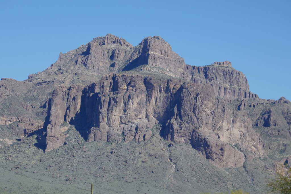
Eventually we approached the foot of the Superstition mountains which marked the end of the plain. The stones above us were as red as any mountain I have ever seen. The road then swung left uphill past some “Disney themed” attractions celebrating the time when this was frontier country. We passed up the chance to visit a ghost town and gold mine; it looked antiseptically clean and far too organised to have any real ghouls. By now the road was narrow and the gadient was getting steeper, but the traffic was thinning as we headed up to Canyon Lake.
We were on the 88 state road towards Roosevelt Lake, the Apache Trail, as it was the trail used by Apache native americans in days gone by. Sections of this road beyond Canyon Lake were washed away in 2019 when there were monsoon rains, and it has not reopened to traffic as a through road. It was always a road that had a 20 mile unpaved section but now part of that is impassable for cars but is used to access Canyon Lake which is a well known beauty spot.

The Arizona State Traffic organisation confirms that, whilst the road is closed to vehicles, it remains open to pedestrians and cyclists. No one seemed to know if it was actually passable for cyclists but we have decided to give it a try.
We wound our way up the road to Canyon Lake, passing a group of locals who were packing their horses back into a trailer after an 8 miles ride into the bush.That looked a great way to explore the terrain – if you had skills on a horse (which we don’t really have). Can it be that different to a bike?
Then up and over as we swooped down to Canyon Lake. Our first attempt to find a campsite was met with a US “jobsworth” who unhelpfully insisted there was a minimum 2 day stay requirement at his campside and that would be $120 if we wanted a pitch. We demurred and he said we could go 2 miles “along” to Tortilla Flat where there was another campsite where you can stay for a single night – all said as if we should be equated to some form of species of low life for not staying more than one night. And – he added – there was no water there.
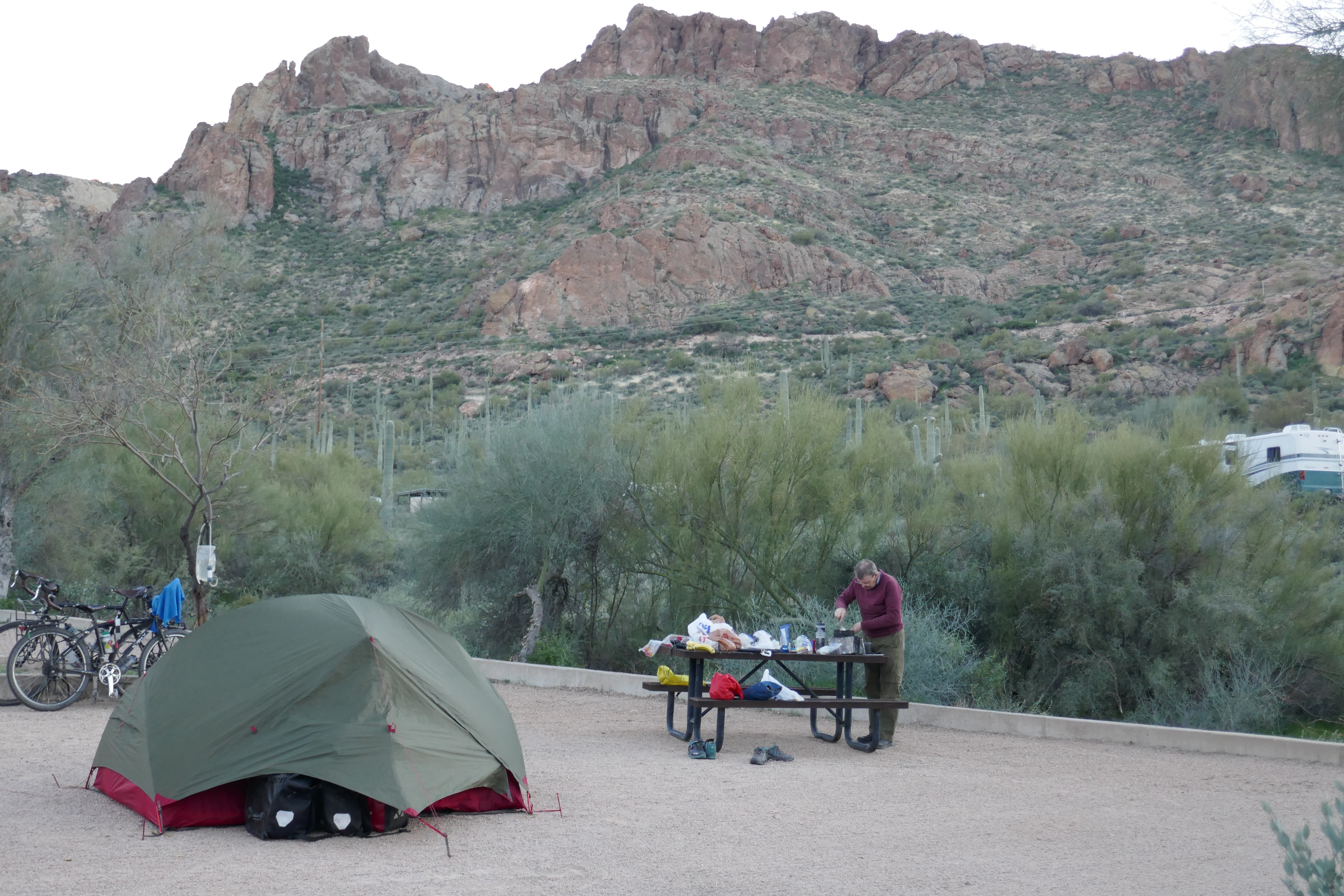
So we filtered water from the lake and cycled off fully laiden – by now it was nearly 5pm. Mr “jobsworth” was wrong on just about every point. First, it was not 2 miles but 4. Secondly, it was not “along” but a 400 feet climb up and then a 200 feet descent. Thirdly, it had water when we arrived – plenty of it. But most of all, Tortilla Flat was in a fantastic valley with spectacular views on all sides.

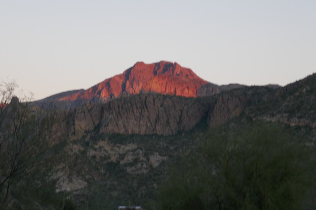
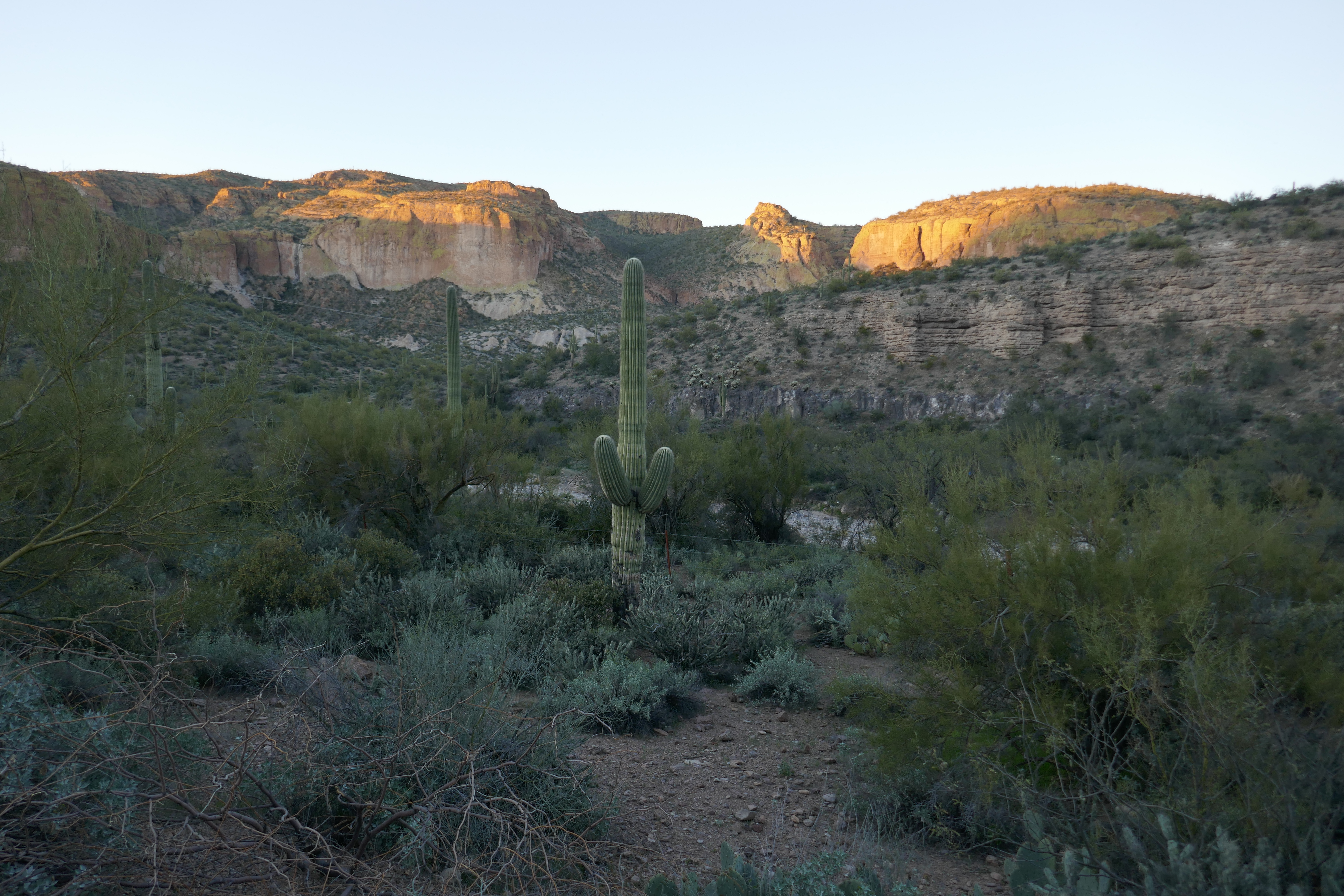
We paid our $20 for the night and felt it was better than a 5 star hotel any day as the setting sun lit up the mountain tops. We spent part of the evening chatting to Terry and Cindy, the hugely welcoming campground hosts and felt really pleased to be here. But we were the first cyclists to stay at the campground and they could not tell us if any anyone had made it through. So tomorrow will be a challenge and it remains to be seen if we will make it the Roosevelt Dam along the washed out section of the road. By the time I am able to post this blog, we’ll know the answer.

amazing scenery. Hope you’ve made it through!