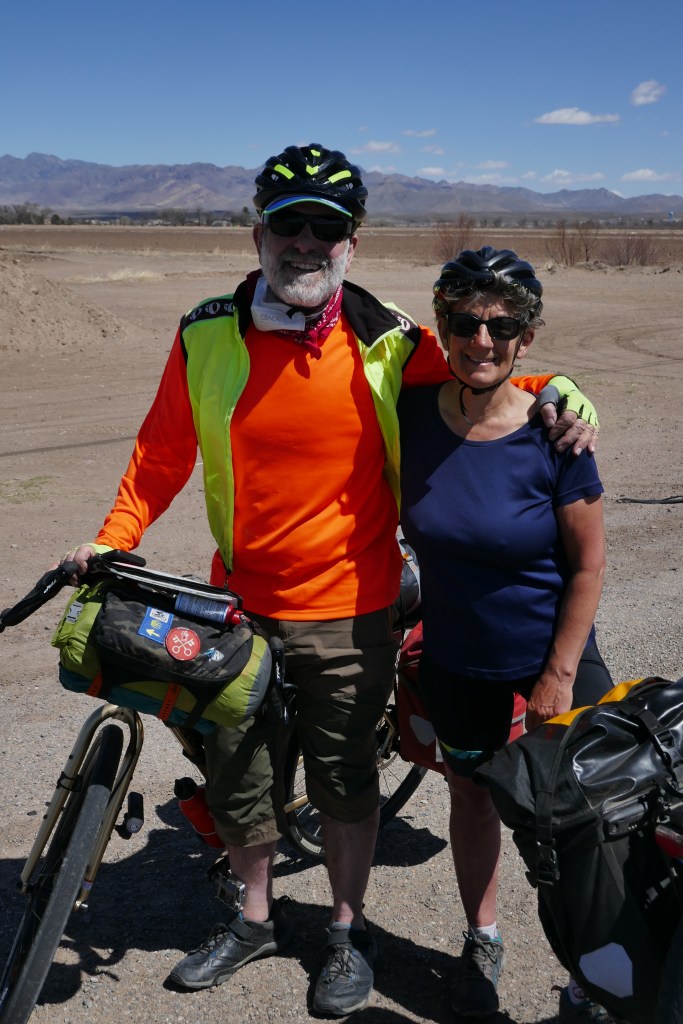
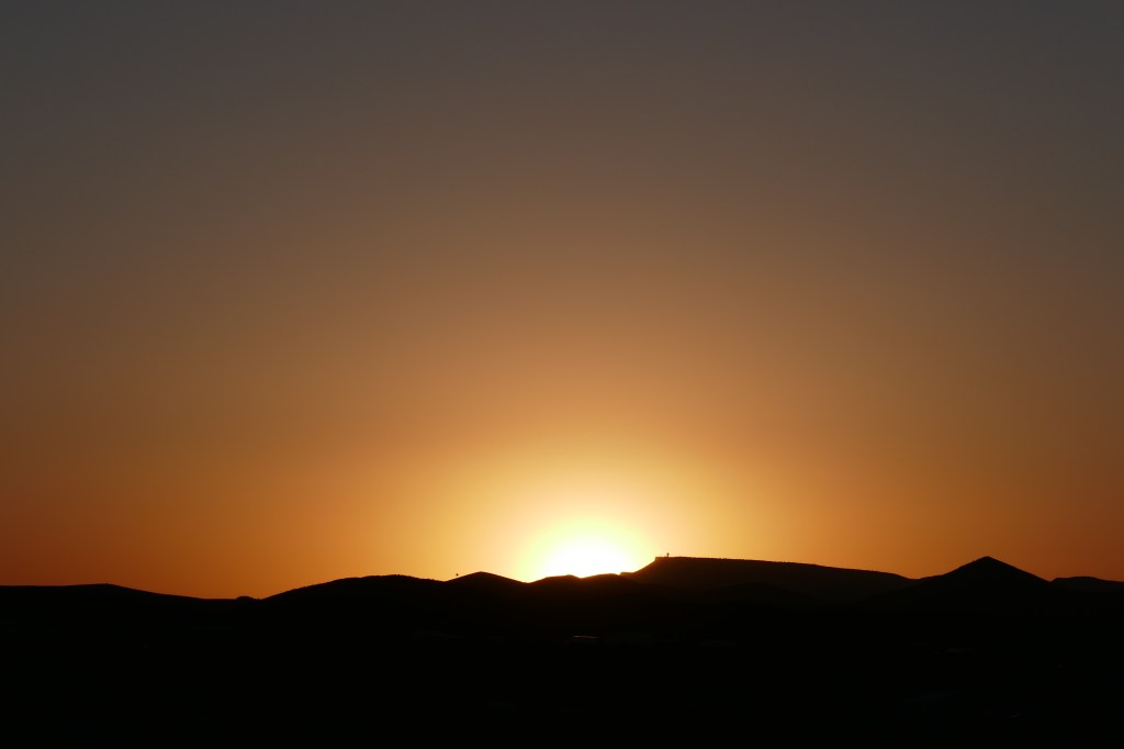
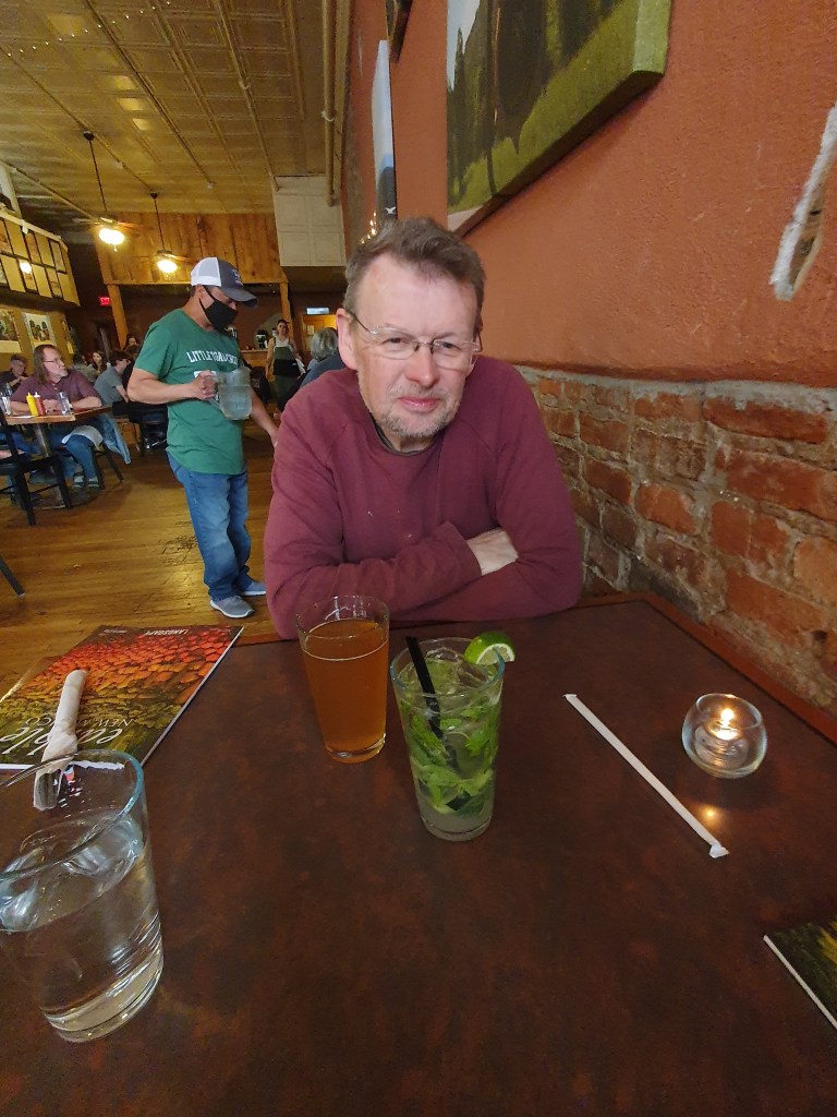
This is just a brief update to reassure everyone that I am on the mend. We are now in Austin, sitting out the time before we can fly home.
I was diagnosed with a broken collar bone, 7 broken ribs, a punctured lung and very extensive scarring and bruising. Certainly my worst injuries in over 50 years of cycling. They kept me in hospital for 6 days – mainly to drain the lung and make sure the puncture was mended. More complex than applying a sticky patch which is what we do for inner tubes.
The draining procedure involved giving me ketamine – so I had a multi-coloured psychedelic experience as part of the treatment. It was a pretty bad trip and I will not be seeking to repeat it in a nightclub. Many thanks to the wonderful staff at the Del Sol Medical Centre, Mission Valley. They could not have been more professional and were endlessly encouraging. I sought to keep my natural role as the curmudgeon under wraps.
The16 hour train journey to Austin on Amtrak was a Challenge but it is good to be here. IATA guidance says no flying within 14 days of a pneumothorax, so we will probably not get back to the UK until about 9 April. Meanwhile the pain is under control (most of the time) and the healing process has started.
I am sorry to report that the observation at the end of the lost posting that nothing is certain on a bike trip has proved sadly prescient. About 10 miles into our ride back to E Paso a group of large, probably wild dogs appeared from nowhere and started to attack us. We were riding side by side and both speeded up to avoid the jaws that were trying to bite our legs, and somehow our bikes came together and I fell to the ground and slid along the road. Strangely the dogs were so shocked by this that they backed off. We later learned that another cyclist who came to the same hospital this weekend was not so lucky and suffered serious dog bites after being attacked.
The pain from my left shoulder and arms was instantly excruciating and I knew straightaway that this was serious. A farmer who was ploughing his field and saw everything stopped and caused a truck to stop. This heroic guy, called John, took us 30 miles to the nearest Emergency Hospital and helped with all the gear – a really nice guy going way out of his way.
I was treated by the lovely medical team and diagnosed with a broken collar bone (clavicle), 7 broken ribs and extensive bruising and scarring. This is frankly not a great place to be but the pain has eased over the last 36 hours with copious amounts of morphine.
I was transferred to a larger hospital and after X-Rays and CT scans, hope to be discharged tomorrow. We have not yet inspected the bike but it will need repairing – a job for Mark Young when we get home.
But that is the end of this trip. We both feel pretty gutted but hope you have enjoyed the blog so far.
When the London Underground (which is mode of transport in London and not revolutionary sect – best joke in a “A Fish called Wanda”)) reaches Kennington tube station, the message comes over the tannoy “All change, all change …”. That is how we felt after today. Today started like any other cycling day.
We cycled 10 miles south to central El Paso. As we went along fairly main road a young man looked across at us from the sidewalk and said “You must not do that – it is SO unsafe”. Well meant but what was the response? There was minimal traffic and a bike lane on the road – so we respectfully disagreed. But it voiced a common perception here that cycling was really, really unsafe. For me, sitting in front of the TV consuming junkfood was far more unsafe – but that is just a perspective too.
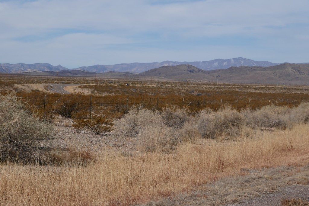
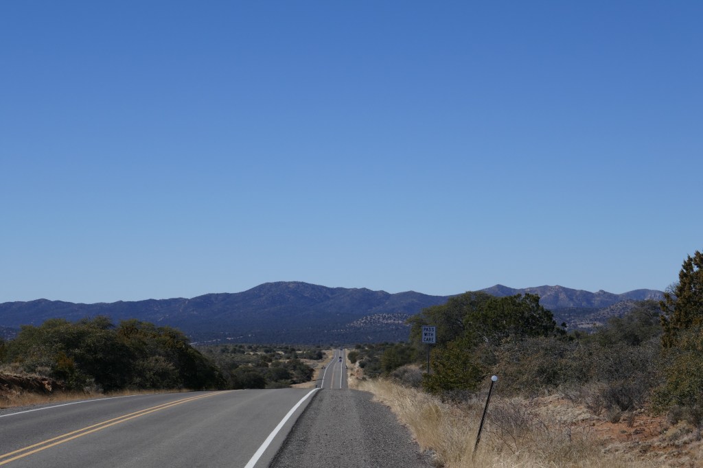
At the centre of El Paso we joined the third section of the Southern Tier Route going South East out of El Paso along Mission Valley, following the Rio Grande and with the Mexican border a few miles to our West.
We stopped for a totally superb breakfast at a Mexican Restaurant and, as soon as we entered, it made us want to speak Spanish. The Mexican Spanish character is so loud, in your face and fun loving. As reserved English people, we wanted a part of it.
Then we pressed on through flat irrigated fields and shopped at a Mexican food store in Fabens – friendly, much lower prices and able to buy small quantities. Much better for cyclists than the larger supermarkets.
The wind was light, the road was flat and it was not too busy. Occasionally we saw a border patrol vehicle but it was pretty low key. That is in comparison to something we saw yesterday when we were on the major dual carriageway out of El Paso. All of a sudden we saw three young men running across the carriageway – vaulting the central reservation in an impressive way and dodging the traffic. They made it across unharmed, I am pleased to report and then we saw a Border Force Patrol car pull up to the side of the motorway and a patrol officer got out. There was just a moment when we could see indecision in his mind – do I risk my life by following them or is this “one that got away” or, more accurately, three that slipped through. The prospect of running across a motorway having abandoned his vehicle was too much and the young men were not pursued – at least at this point. Goodness knows what will happen to them next because the streets are not paved with gold in El Paso, but it may be years before anyone official catches up with them. All that was yesterday – today we saw parts of the wall and other sections where there is no wall but there is electronic surveillance – including a truck with a collapsable viewing tower. All very technological but, so it seems, no match for young men who can vault central reservations.
After 65 miles we got to Fort Hancock and checked into the only motel – just off the I10. The woman at the desk was Indian and spoke English with a strong Indian accent – the first time we have come across this in the US. She asked where we were from and we said “England” – and she responded “Leicester?”. Not London but Leicester – demonstrating the fame of that East Midlands city for the Indian diaspora throughout the world. I sadly said no but remarked that my late father was from Leicester, which was something at least.
Once we got to our room, we started to think about the next few days and the problems facing us loomed large. A major weather system is coming in and the winds on our route will make it impossible to cycle for the next 5 days or so. Although it is quiet now, 60-70mph winds are predicted. That will cause sandstorms in the desert and there is a severe weather warning. The winds are all over the place but that is pretty irrelevant – since we cannot cycle against winds of that strength and it’s too dangerous to cycle when they are cross winds or in our favour.
We are idiots to be honest. This weather was predicted a few days ago (albeit not the severe weather warnings) and we had not thought through the implications. We are on a route and we just thought – “we’ll get through” – but of course we will not.
So what to do? We vexed for an hour or so and realised we had a few options, none of which seemed great. The best option by far seemed to take a train across the area of rubbish weather and replan our trip. For all the downsides of splitting the journey, in fact this has some attractions because (a) most people describe the Texas desert as a “challenge” and some of the most boring riding imaginable (with 89 miles between water points in one place), (b) the next part is the Texas Hill Country which is fine but it is reported to us that it seems to go on for ever, and c) if we take a train across part of Texas, we could start again in Austin and make it all the way to Florida rather than finish in New Orleans as planned.
So – on balance – it’s the Kennington tannoy call. Tomorrow we will ride back to El Paso and then get the train on Monday to Austin, Texas. That means tomorrow’s blog might be very boring (if we write it at all) because it will be the same route we followed today in reverse. Sunday night will be back in El Paso and then Monday we will load the bikes onto Amtrack and have a 15 hour/overnight train journey.
The one thing we can say for certain is that nothing is certain on a bike trip.
We had a good relaxing start to the day as Mike had generously let us have the use of the house while he was at work. The first job was to mend the puncture on David’s airbed – one leak was duly found and patched. We then planned the next few days on the bikes and wondered about the level of remote desert that we were heading into. Still, it has to be done if we are to get to the Texas Hill Country. We then had an enjoyable time catching up with home – talking to the children, David’s mum and and with friends via the wonders of WhatsApp.
About 11.30 we wrenched ourselves off to do something with the day and cycled to downtown El Paso – about 10 miles away. We stopped at an outdoor shop and stocked up with more water bottles as preparation before heading into the more remote desert areas. The route wiggled through the hills then down into the downtown area.
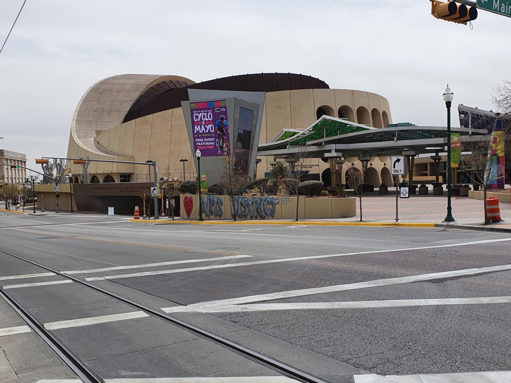
We visited two free museums – the History Museum and the Museum of Art. We learnt something about the history of the area and the complex interactions between indigenous tribes, the Spanish and Americans. The art museum had a beautiful exhibition of modern ceramics and some interesting pictures by Texan artists. We skipped through the latin-american rooms that were dripping with religious artworks – beautiful in their own way but not what we were in the mood for.
The Theatre at El Paso
Opposite the museum was the El Paso theatre – a lovely modern building. After our dose of culture we got something to eat and found a delicious ‘healthy eats’ place that showed that the US can do lovely healthy meals.
As we came out of the cafe we were unlocking our bikes when a person passing by asked us where we were travelling to. Mark Lynch is an Irishman who is cycling the Southern Tier in the other direction to us – starting in Florida and heading to San Diego. Like us, he had hardly seen another touring cyclist and he too was having a day off in El Paso (also visiting hte same 2 museums). What a coincidence that our paths should cross when neither of us was cycling with loaded panniers. We had a good chat and exchange of information. It would have been great to spend the evening with him but we were committed to having dinner with our hosts. Culture and then multiple invitations for the evening!!
We had an ‘interesting’ cycle back, I was sure we could take a more direct route back and google maps showed us what looked like a reasonably straightforward route. It started well enough but then we turned onto a road that was like the M25, flanked by the M6, the M1 and the railway line. Once we were on there, there was no turning back as a multiple array of spaghetti junctions weaved down and up and over. There was a very wide shoulder and no signs saying ‘no bicycles’ but we were definitely the only cyclists on it! Come to that we did not see any other cyclists all day, it’s really not a mode of transport in the US. We put our heads down and pedalled hard and eventually we managed to get ourselves onto a saner road….but by then my phone was running out of battery and finally died. Luckily we were near enough to work out how to get back! I’ll never complain about the Komoot routes again, even if they seem to be ridiculously long winded – it was for good reason!
We arrived back with our host family just in time for the evening meal. Mike’s daughter-in-law is from Honduras and produced a delicious Honduran meal. The family are Mormons and we were joined by 3 ‘Sisters’, young women who were doing their 18 months missionary work in the El Paso area. We regaled them all with our travelling tails and they sweetly prayed for us.
After the Sisters left another friend arrived and a Ping Pong competition commenced! David was beaten but not humiliated. I ducked out pleading complete ignorance of the rules!
A nice family end to the day before hitting the road again.
Today was flat, with the wind mostly behind us and was only 57 miles – so a pretty gentle day overall given the challenges of recent days.
The road wound its way down the Rio Grande valley and occasionally crossed the dry river bed.
The dry river
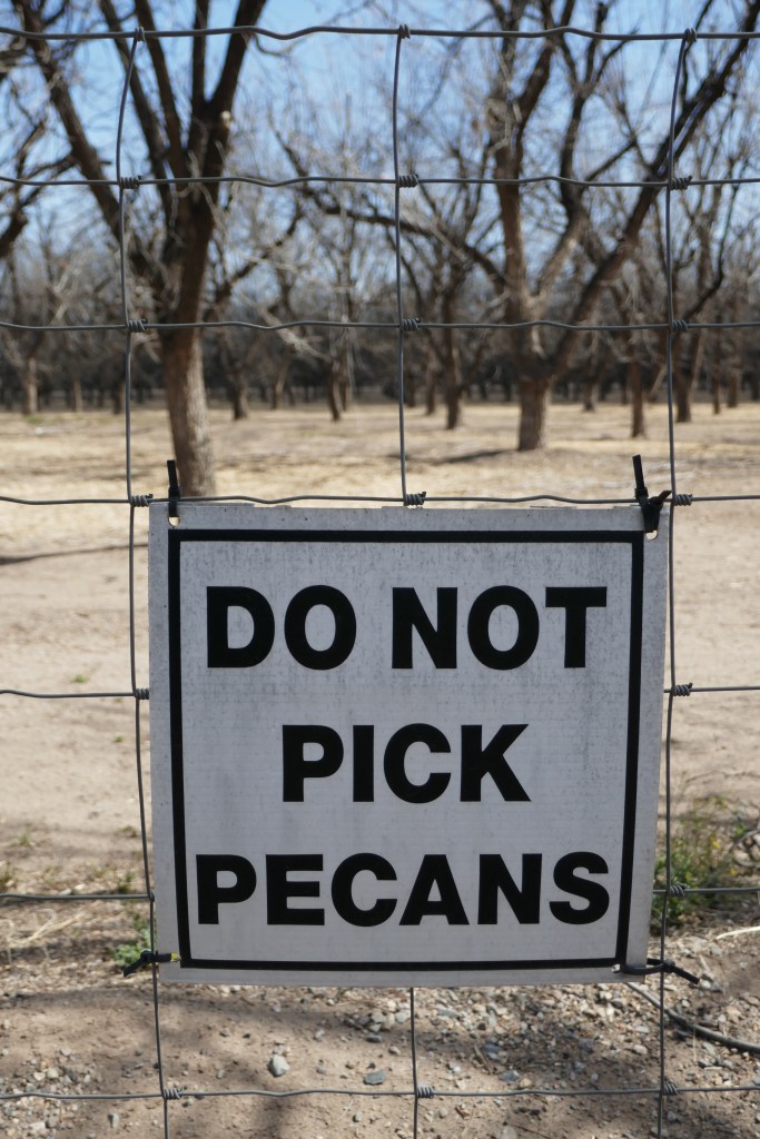
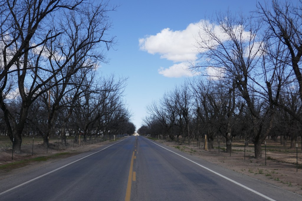
Most of the traffic used the interstate and so traffic on our road was pretty light. We passed numerous Pecan trees with signs which left us in no doubt that the absence of a fence did NOT mean help yourself. The trees were bare and so we were not tempted to be violators but pecan theft is clearly perceived to be a problem.
Bare Pecan trees – must be marvellous when in leaf.
The signs saying that this was the chilli capital of the world continued on both number plates and outside farms. This was therefore the “Chilan” valley or the “Pecli” valley depending on how one wishes to see it. One interesting feature was the increasing evidence that this is a bi-lingual area where a large part of the workforce are of Mexican heritage. Signs were in Spanish everywhere and there were lots of Catholic Churches. Also, as we moved from rural areas to the suburbs, the affluence levels notably increased. Yards were tidier, there were fewer abandoned vehicles on show and more houses and less trailers.
We also met John Sumo, our first “Southern Tierer” going in the opposite direction. John is a teacher from Maine and did the Southern Tier route as far as El Paso in 2020 when Covid forced him to abandon the trip. He had driven down to El Paso, parked his truck and was starting again to complete the remainder of the route to San Diego. As the wind was mostly in our favour, it was inevitably mostly (totally) against John. He was on his own and breaking himself in on day 2 of a trip – a feeling we know so well. It is always tough at the start before the body adapts to the unusual amount of effort needed to cycle 50+ miles a day! We exchanged notes, gained valuable information about the route South of El Paso and wished him well. We also reflected on how fortunate we were to be traveling together. We are together 24 hours a day and really enjoying each other’s company. Doing this trip together is infinitely more enjoyable than doing it on one’s own.
As we came towards El Paso the wind got up and was against us in parts, but still mostly in our favour. We followed a bike path along the river bed, and then joined a main road. By this stage we were nearly at our warmshowers host’s residence but he was not back from work until later. So we had an hour’s stop at a lovely coffee shop, and did “stuff” like renew my Bar Practising Certificate (dull admin needed even on holiday) and more enjoyably spoke to Ant about his possible new job and the process of leaving his present employers on the best possible terms.
Then we ambled across to a lovely house where Mike, our WarmShowers host welcomed us and fed us a lovely meal. Mike is a radiologist with the US military and is posted to El Paso – the military’s choice not his. He was warm, interesting and a keen cyclist.
So not a spectacular day or one with any major challenges – just ambling along gently and experiencing dry, rural America. The desert south of El Paso will bring larger challenges but that is fine for now.
We dawdled up in the morning because 1) we wanted to wait until the sun was right up and it was a bit warmer before starting with a descent 2) the first 15 miles were downhill and then it was flat so although we had over 60 miles to do we thought it would be easy. It didn’t quite work out that way; but not knowing the future at that point we enjoyed our first cup of coffee in our sleeping bags and packed up gradually and were off at about 9.
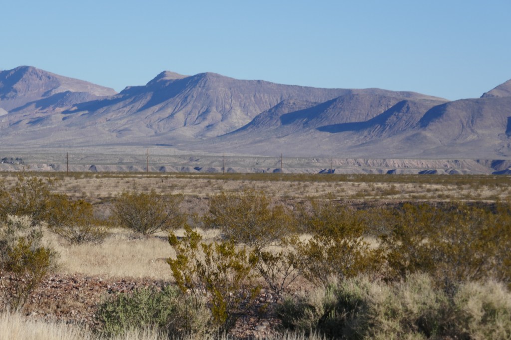
After a small climb we probably had the easiest start to a day so far as the first 15 miles were indeed downhill – fairly steep at first then a gradual downhill across a wide plain to Caballo Reservoir – a reservoir on the Rio Grande.
The lake was not particularly picturesque; the water was some way away from the road and we wondered if the water level was particularly low (as it turned out, we were correct). We made our way south on a quiet road (the main traffic being on a parallel interstate). There were lots of RV parks and boat parks, but it all looked a bit scruffy and untidy – as if this was a dying area for tourism and permanent trailer residents were taking over. One of the things that has repeatedly struck us since starting this trip is just how many people in the USA end up living full time in trailers. We knew that this was the bottom end of the American housing market but, until this trip, had not realised quite how massive that section of market is occupied by trailer-dwellers.
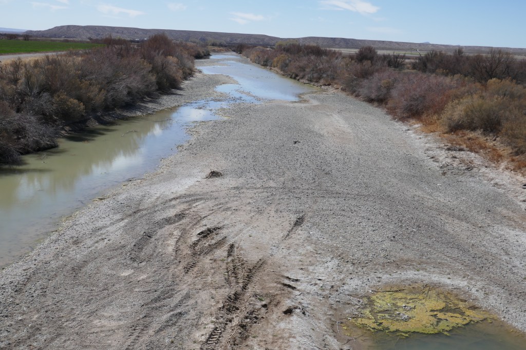
Passing numerous parks, all was still going well when we stopped at a nice Mexican cafe in Array and had burritos and apple pie. Every sign we passed was for a chilli farm and the burrito made our lips tingle with local chillies. Soon after we set off again the road crossed the Rio Grande – and we were astonished that it was virtually dry – just a small trickle. There is water further up but it all seems to have been diverted for irrigation – growing more chillies!
Things had now suddenly changed – a brisk wind against us had sprung up while we were eating. The next 20 miles to the town of Hatch was therefore a battle against the wind. It felt far worse than the climb from yesterday as the gusts pummeled us relentlessly. In fact the gusts seemed to last longer than the brief lulls between. By the time we reached Hatch, we were pretty exhausted and sat inside a supermarket cafe to recover and then stock up on provisions.
When we set off again the wind direction had changed a bit and was mostly a side wind and at times even slightly in our favour. We felt better but now we were dealing with heat, sun and lack of shade. This was the first hot day we have had so we are not acclimatised to cycling in 30 degree heat yet. The road started to twist and turn alongside the Rio Grande – now completely dry. The wind got even stronger. As the road turned sometimes it was slightly in our favour, at other times against us. The side gusts were also tricky to deal with, knocking us about on our bikes.
At last we reached the rather worryingly named town of “Radium Springs”. It wasn’t obviously glowing as we approached and it was home to Leasburg Dam State park. We gratefully turned into the state park, where camping is usually not an issue. We found the campground host to ask where we could pitch our tent and he told us all the pitches were full. We must have looked extremely crestfallen as he said he would take us to the group site, as long as we paid our 14 dollar campground fee, which of course we did.
The site was ideal with a covered eating area, a pit toilet and a water tap and a flat sandy spot for our tent. It overlooked the river and the dam – unfortunately completely dry. The campground host told us that there would usually be water at this time of year but there had been little snow in Colorado so little was coming down to fill the river and what little water there was being held further upstream in the reservoirs (as we had seen in Caballo). If there wasn’t significant snow fall in the next month or lots of rain in June/July they would be in trouble. It was a sad, sad sight and one likely to continue with climate change. Although one place and one year is not evidence this is one example among many. Who on earth could argue against the need for action with this in front of our eyes.
We revived ourselves with a ‘bucket shower’ under the tap and a brew and rested our legs while the sun got lower. Next to our camping area was a large RV and the occupant arrived just after our dinner so we went over to explain why we were in the group area. Sorry can’t remember his name but he kindly invited us in for coffee. It was interesting to be in one of these huge RV’s – a real home from home – but more importantly it was great to meet someone and have an interesting conversation. He was an Army Veteran and had spent a long time in Europe, and had interesting and thoughtful observations about the differences between life here and in Italy. After retiring from the military he was in the final stages of training to be a police officer with the Department responsible for Fish and Game Regulation. However, as a law enforcement officer, he also got summoned to cover anything else from vehicle accidents to domestic violence.
He was a generous, interesting and interested man who we warmed to despite very clear differences of perspective. Indeed, coming across well thought out differences of perspective is one of the things that makes this trip so fascinating.
We bid goodnight to a new friend and went back to our tent. The most notable feature of the night was that David’s airbed developed a puncture (not that he told Bernie about this until the morning) and so he woke feeling like he had slept badly on a bed of concrete. Another thing to try to fix on our day off in El Paso.
We dawdled up in the morning because 1) we wanted to wait until the sun was right up and it was a bit warmer before starting with a descent 2) the first 15 miles were downhill and then it was flat so although we had over 60 miles to do we thought it would be easy. It didn’t quite work out that way; but not knowing the future at that point we enjoyed our first cup of coffee in our sleeping bags and packed up gradually and were off at about 9.
The emptiness ….
After a small climb we probably had the easiest start to a day so far as the first 15 miles were indeed downhill – fairly steep at first then a gradual downhill across a wide plain to Caballo Reservoir – a reservoir on the Rio Grande.
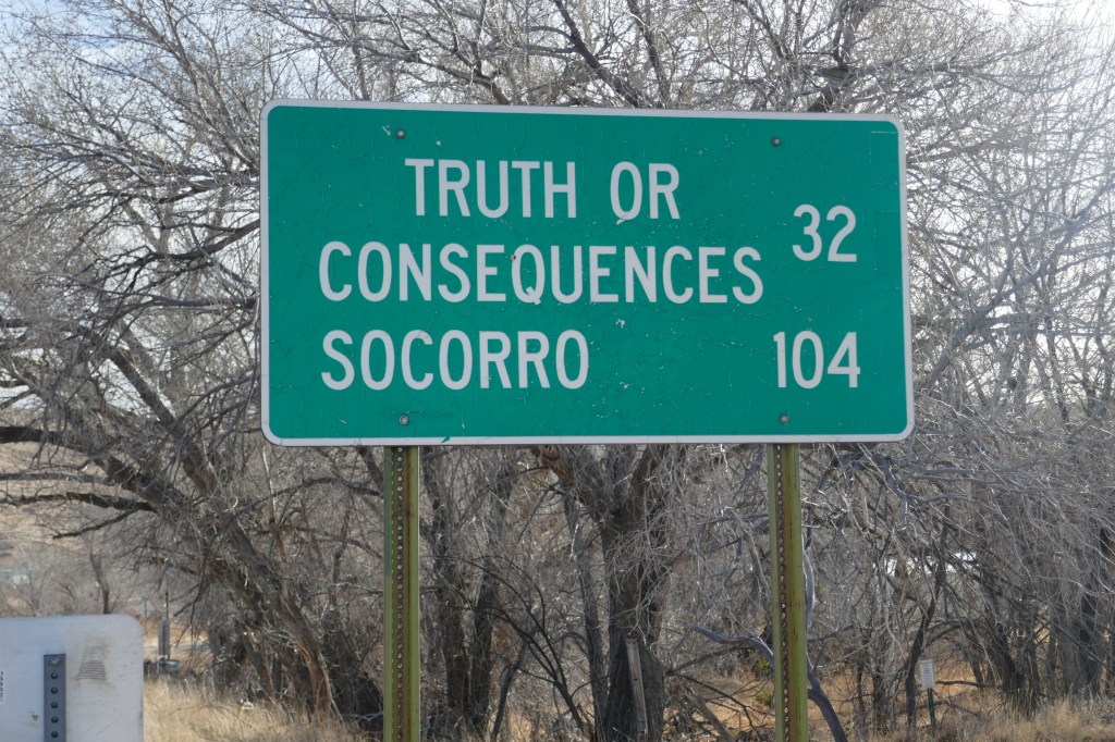
There is really a place called “Truth or Consequences” but it was not quite on our route
The lake was not particularly picturesque; the water was some way away from the road and we wondered if the water level was particularly low (as it turned out, we were correct). We made our way south on a quiet road (the main traffic being on a parallel interstate). There were lots of RV parks and boat parks, but it all looked a bit scruffy and untidy – as if this was a dying area for tourism and permanent trailer residents were taking over. One of the things that has repeatedly struck us since starting this trip is just how many people in the USA end up living full time in trailers. We knew that this was the bottom end of the American housing market but, until this trip, had not realised quite how massive that section of market is occupied by trailer-dwellers.
Passing numerous parks, all was still going well when we stopped at a nice Mexican cafe in Array and had burritos and apple pie. Every sign we passed was for a chilli farm and the burrito made our lips tingle with local chillies. Soon after we set off again the road crossed the Rio Grande – and we were astonished that it was virtually dry – just a small trickle. There is water further up but it all seems to have been diverted for irrigation – growing more chillies!
Things had now suddenly changed – a brisk wind against us had sprung up while we were eating. The next 20 miles to the town of Hatch was therefore a battle against the wind. It felt far worse than the climb from yesterday as the gusts pummeled us relentlessly. In fact the gusts seemed to last longer than the brief lulls between. By the time we reached Hatch, we were pretty exhausted and sat inside a supermarket cafe to recover and then stock up on provisions.
The not so grand Rio Grande!
When we set off again the wind direction had changed a bit and was mostly a side wind and at times even slightly in our favour. We felt better but now we were dealing with heat, sun and lack of shade. This was the first hot day we have had so we are not acclimatised to cycling in 30 degree heat yet. The road started to twist and turn alongside the Rio Grande – now completely dry. The wind got even stronger. As the road turned sometimes it was slightly in our favour, at other times against us. The side gusts were also tricky to deal with, knocking us about on our bikes.
At last we reached the rather worryingly named town of “Radium Springs”. It wasn’t obviously glowing as we approached and it was home to Leasburg Dam State park. We gratefully turned into the state park, where camping is usually not an issue. We found the campground host to ask where we could pitch our tent and he told us all the pitches were full. We must have looked extremely crestfallen as he said he would take us to the group site, as long as we paid our 14 dollar campground fee, which of course we did.
Sunset at Radium Springs
The site was ideal with a covered eating area, a pit toilet and a water tap and a flat sandy spot for our tent. It overlooked the river and the dam – unfortunately completely dry. The campground host told us that there would usually be water at this time of year but there had been little snow in Colorado so little was coming down to fill the river and what little water there was being held further upstream in the reservoirs (as we had seen in Caballo). If there wasn’t significant snow fall in the next month or lots of rain in June/July they would be in trouble. It was a sad, sad sight and one likely to continue with climate change. Although one place and one year is not evidence this is one example among many. Who on earth could argue against the need for action with this in front of our eyes.
We revived ourselves with a ‘bucket shower’ under the tap and a brew and rested our legs while the sun got lower. Next to our camping area was a large RV and the occupant arrived just after our dinner so we went over to explain why we were in the group area. Sorry can’t remember his name but he kindly invited us in for coffee. It was interesting to be in one of these huge RV’s – a real home from home – but more importantly it was great to meet someone and have an interesting conversation. He was an Army Veteran and had spent a long time in Europe, and had interesting and thoughtful observations about the differences between life here and in Italy. After retiring from the military he was in the final stages of training to be a police officer with the Department responsible for Fish and Game Regulation. However, as a law enforcement officer, he also got summoned to cover anything else from vehicle accidents to domestic violence.
He was a generous, interesting and interested man who we warmed to despite very clear differences of perspective. Indeed, coming across well thought out differences of perspective is one of the things that makes this trip so fascinating.
We bid goodnight to a new friend and went back to our tent. The most notable feature of the night was that David’s airbed developed a puncture (not that he told Bernie about this until the morning) and so he woke feeling like he had slept badly on a bed of concrete. Another thing to try to fix on our day off in El Paso.
We started today not knowing where it would end up but have stopped in a nice little campsite in Hillsboro, a small town on the other side of the mountain. Alls well that ends well – and a very happy birthday to my sister, Tricia.
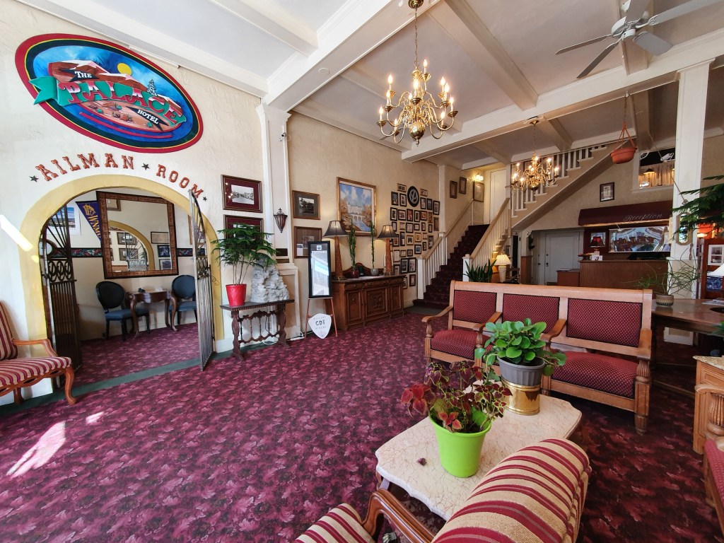
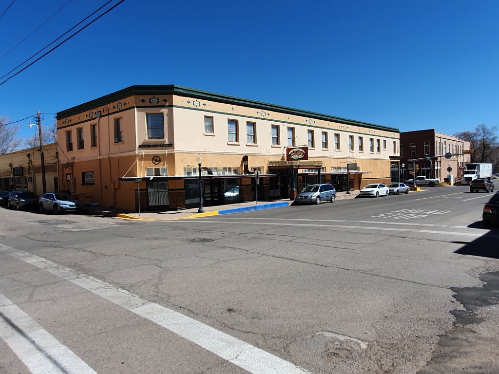
The day started with breakfast at the Palace Hotel – pretty mediocre to be honest but we cobbled together porridge and fruit – whilst the electric kept tripping because the system could not take the coffee machine, the kettle and the microwave all working at the same time. Memories of our house in France where the same thing happened if we put a heater on! The manager was relaxed about it – just resetting the trip switch from time to time, but not seemingly worried about the impression this dodgy electricity supply sent to his guests. We rather enjoyed the faded Victorian splendour of this place, with memories of pioneer days in the past. I am sure as bookings increase some improvements will be made, but we just hope that do not detract its unique character – that is both the hotel and the manager!
We met a retired chap from Santa Fe at breakfast who was less enamoured of the hotel and the town generally than us, but out contact point was tyhat he had previously raced bikes. He gave our bikes the once over in an informed and interested sort of way. He had cycled all over Europe – partly racing and partly supported touring. He had clearly had experienced a life in the saddle, albeit not carrying his own gear, even though he now had let age retire him from cycling. He was particularly taken with my gear arrangement – bar end shifters – and gave the impression that no one had that type of arrangement for decades. True, I conceded, but it works for me and I can mend it if it goes wrong, so there is something to be said for a simple approach.
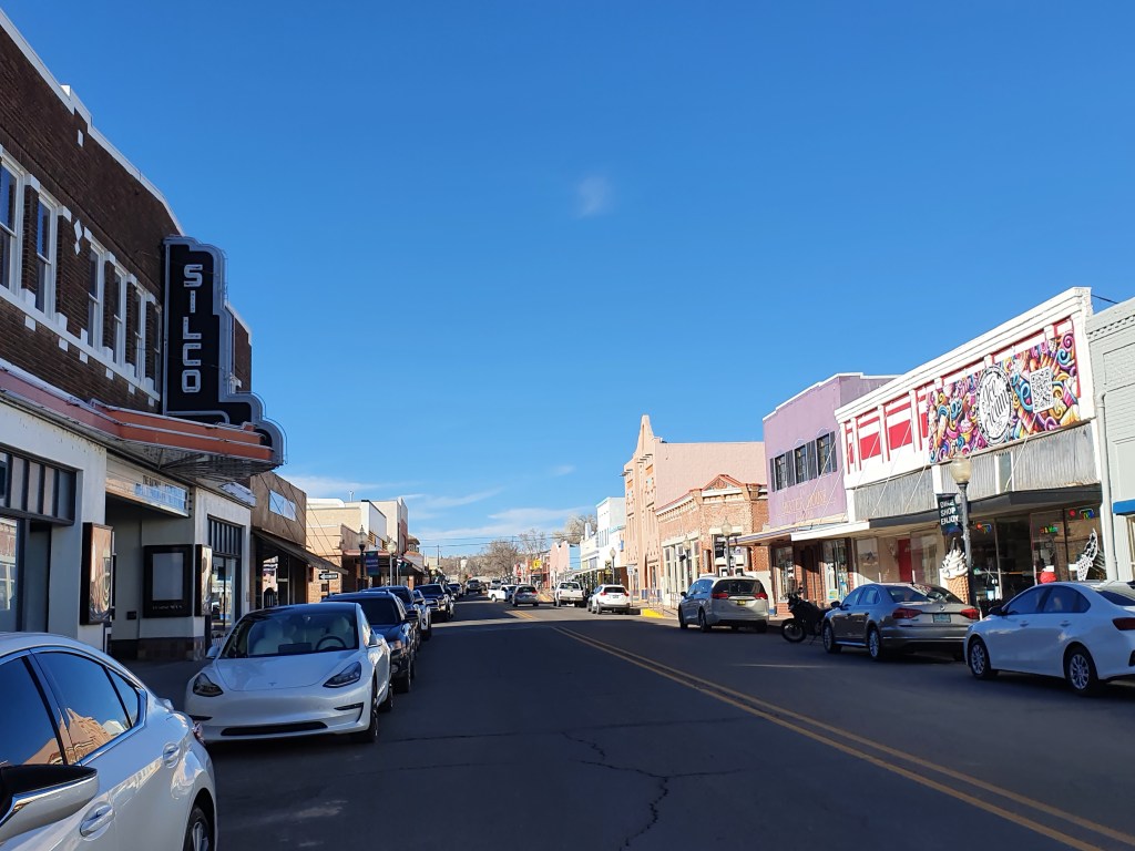
We got away about 7.30am, late for us, and cycled through the historic part of Silver City. The rest of the town sprawled to the North and looked like many other US towns – wide roads and low rise, modern developments indicative of land being a low cost and a lack of planning restrictions to constrain edge of town (or even out of town) development. But the population density is so different to the UK that planning is inevitably very different.
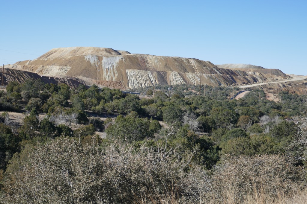
The road was a wide dual carriageway to Santa Clara, but we left the main road when we turned off onto the 152. We struck off into the mountains on a road that stayed wonderfully quiet all day. We climbed gently for a few miles then came across the Chino Copper Mine, which extends over about 5 miles in area. It was one of the largest open cast mines in the country and produced vast quantities of copper. The environment paid the price because the hillside was stripped away, with vast parts of the mountains being cut away in segments. The effect was both impressive and depressing at the same time. The copper mine has been working since about 1870 and continues on a vast scale today but it seems to be run with very few jobs being created. I am not an expert on the environmental degradation caused but doubt that it would meet EU standards! The claimed reclamation project just said the site would be reseeded – difficult when all the topsoil has been stripped.
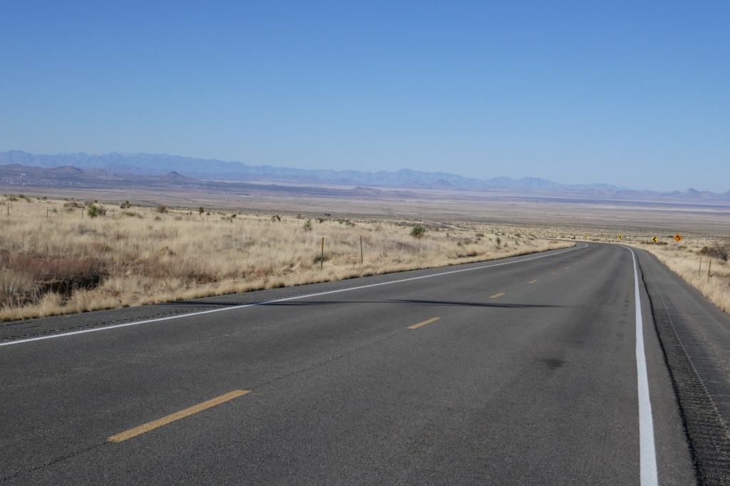
After the copper mine the road wound up and then descended to the San Lorenzo valley – down from 7450ft to below 5800ft. The valley was occupied but arid. This area is suffering historic low levels of rainfall as climate change plays havoc with traditional weather patterns.
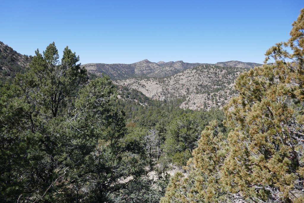
We took the 152 road towards Emory Pass, climbing up to 8,300 ft – the highest point in the whole route from San Diego to Florida. This was a long, slow climb through a beautiful gorge – known as the black ranges. We were not sure if we would have the energy to get to the top of would camp half way up. As it was, the Forest Service campsites were all closed (for no clear reason) and we were both climbing pretty well, our day off had no doubt helped. So we pressed on and reached the pass by about 3pm. The view looking East was spectacular. we could see wilderness for as far as we could see – and that seemed to be hundreds of miles. It was slightly hazy and so the photos may not do this amazing view justice but it was awesome.
We met a retired couple from Northern California at the top who were doing a National Park tour in their (sensibly sized and hence very modest by US standards) campervan. He was a cyclist and did 120 miles day when in training, but made it quite clear that riding fully loaded was something he had never done (and probably would never do). We have met lots of people in cars who say they are cyclists – strange thing is that they are never on cycles. We have also met virtually no touring cyclists even though we are following one of the classic cycle touring routes. It seems that Covid put people off and many have not regained their confidence yet. They will come back but maybe not until next year.
View from top of Emory Pass
The descent from Emory Pass will live long in our memories. A good descent has three things. First, it must not be too steep or we just spend the whole time on the brakes and end up with numb fingers. A descent is better if it has turns and curves, to swing the bike around and get a constantly changing view. And lastly a classic descent needs unforgettable views around every corner. This one had it all – not too steep, plenty of bends and great views.
We stopped at the depressed hamlet of Kingston – once the largest town in New Mexico but now an almost ghost town, but pressed on to the little hamlet of Hillsboro because it was 1000 feet lower and thus warmer. We found the owner of the RV park who asked us to camp in her garden, treated us like honored guests and would not take any payment! We have done nothing to deserve such largesse but are happy to accept it.
The sky has been cloudless for days and it is getting warmer. Next we have to tackle the flatter sections towards El Paso. But for today we feel pretty proud that our fitness has improved enough for us to enjoy a mega day over the mountain.
We were determined not to do much today – and probably nearly nothing at all would be best. Six days cycling from Phoenix without a break was sort of tough and we felt we had deserved time off for good behaviour.
So we woke late, read in bed and ambled down to breakfast at the hotel. It was informal but the coffee was good. The delightful owner was there – talking to guests and keeping the show on the road.
The Palace Hotel
We then ambled through the town to an outdoor store where we bought a few pieces of clothing – things wear out on a bike tour and need replacement. We met some folks who walked the mountains and got a degree of comfort that the creek at “Iron Creek Campground” had running water. We have passed innumerable dry creeks in the last few weeks and the campground is advertised as having no “potable water” which is fine for us as long as we can filter some creek water. But if the creeks are all dry, we will be in difficulties. We got the same message from the bike shop – people had been up there in recent days and the creek had water in it. Our aim tomorrow is to cross Emory Pass to reach Kingston (in New Mexico not “on-Thames”), but that is likely to be 5k+ ft of climbing and so we needed to know if there was an option of camping before the pass if we don’t feel we have the energy for the final climb. Then it will be downhill for a bit and 100 miles into El Paso – and the second part of the route will be done.
The town of Silver City was founded in pioneer days and has had its ups and downs since then, including being affected by a crash in the price of silver in 1893 which caused economic havoc throughout this area. The cause of the crash was the President’s decision in Washington to protect Eastern bankers by repealing an Act which forced the government to buy silver so that the country would move to the gold standard. Gold won; silver lost and the price of silver dropped; wages for miners were reduced and mines closed, leaving more out of work miners and so wages fell even more. The depression was worst in Denver but was pretty hard felt in Silver City, only saved by the fact that copper mining overtook silver mining. How strange it was that the interests of bankers took precedence over those of working people. That is something that would never be repeated – of course. I am not sure irony works too well in a blog!
Copper mining brought jobs but it left mountains ravaged as the surfaces are removed and not replaced – leaving permanent scars across a once beautiful land. As locals explained to us, these days copper mining comes and goes but no one has a guaranteed job for life in a copper mine; the politics change and the mines are subject to closure and then re-opening.
The architecture of the town shows periods of affluence with some fine buildings, as those who made it in business invested in houses to demonstrate their success. Some have been recently restored and are stunning – overlooking the town with Italianate balconies and other features.
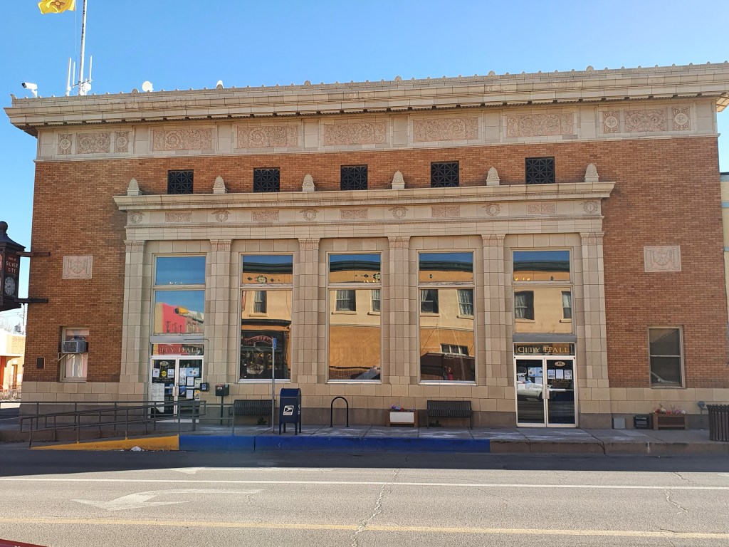
We visited the District Court House but the only Judge not on spring break had called in sick but were warmly welcomed as fellow toilers in the legal world; the friendly Sheriff’s officers explained that they are moving from remote hearings back to in-person hearings as we are at home.
The afternoon passed in a relaxed level of activity and inactivity – a total sort out of our gear, repacking, reading, shopping at the whole-food co-op (expensive but good food) and more reading. I am reading a great book by Alan Johnson (the former MP who had a room next door to me) about his childhood. It’s a great read and shows that he grew up in grinding poverty, mainly driven on and supported by his sister and mother. I knew Alan well at one stage but did not know his back-story before he became a postman. It is a remarkable story – beautifully written and is evocative of a now lost post-war London.
Then we went back to the Toad Brewery for a meal and I am about to get humiliated (again) at Scrabble. A good day’s relax and preparation for the days ahead.
After our 11 hour day yesterday we knew we had a shortish mileage day but a big climb day. We did not know how our legs would feel after the battling headwinds. The forecast was for increasing wind during the day with strong gusts – not against us but a strong side gust can be very tricky – so we knew if we were going to set off we needed to do it early. There was very little to keep us in Lordsburg, which was just an extended pit stop from the Interstate, so we had determined to get to Silver City somehow, even if we had to hitch a lift.
So it was that the alarm dragged us out of sleep at 6am. While I was brewing our morning coffee on our campstove outside our motel room I couldn’t work out why it was still pitch black. It should have been dawn. I checked my phone again – no, we had the right time. I checked that we hadn’t crossed another time zone – we hadn’t. However the clock had changed to summertime and gone forward an hour – 2 weeks before it does in the UK! We packed up but it meant we had time for a second brew while we waited for it to get light enough to leave!
I had also had a tumble yesterday. With the strong headwind David was brilliant at leading – I was only a few centimeters from his back wheel so he had to keep a very steady pace and I had to concentrate hard on matching my leg rhythm to his and spent hours looking at his back wheel. I got so excited when I saw the turn to Lordsburg ahead that my concentration wavered momentarily and I hit his back pannier and tumbled over. No harm done other than to pride, although I did feel very wobbly for the last few miles to the motel. When we got there it transpired it wasn’t me who was wobbly but my back pannier, as I had damaged one of the clips and it was hanging on by one clip rather than two. Luckily we have extra straps for just such an eventuality and David had my pannier firmly strapped to the rack before we set off.
Early morning in the low light
The other thing we have learnt it that the desert is very cold at night in March, even more so at 4000ft. We set off wrapped up in all our layers, thick gloves, overshoes, buffs under our helmets. As the bike computer temperature adjusted to the outside air the figures started to tumble, down to 21F or minus 6C! It felt sharp but as the air is so dry it didn’t feel too bad and as the sun appeared over the mountain it soon started to warm up. We also started climbing almost immediately which helped stop our hands freezing to the handlebars!
Lookingback to Lordsberg after some climbing
The yellow morning light was gorgeous as we started to gradually climb out of the flat plain we were on the day before. As we gained height the vegetation began to change – greener, more diverse, even some trees. Our legs felt surprisingly good after our previous long days – we must be getting a lot fitter.
As with most sports, how you feel is mostly in the head. We were pushing harder and going slower than when we were in the headwind yesterday but it felt so much easier. For a start your whole body was not being buffeted by the wind and the scenery was constantly changing. With a long climb you get a feel of making progress, which really helps you keep going.
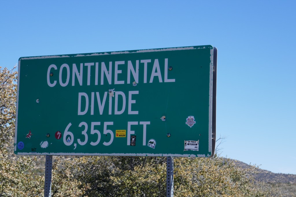
We topped out at about 6335 ft at the ‘continental divide’. After that the area was more populated with scattered dwellings – and was mostly down hill. That’s the other thing that keeps you going on a climb – the prospect of a glorious descent on the other side!
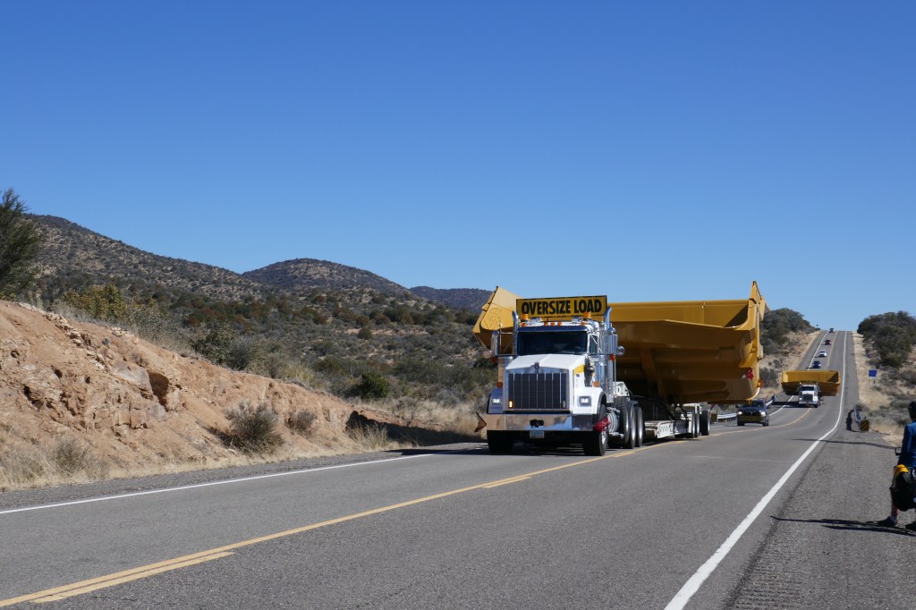
Being pushed off the carriageway by the widest of “wide loads”
A few more ups and downs, legs now definitely tiring. A stiff climb up past the Tyrone Mine (the 3rd largest open cast copper mine in the world) but we rolled into Silver City just after 1pm. Here we were going to have a rest day – and our early start extended this to a day and a half.
Silver City was badged as a quirky, cultural town and the downtown area was very quaint. Built on silver mining, this folded by the end of the 19th century and mining now is for copper, as it was at Gobe. We checked out the Palace Hotel – a building dating from about the 1880s so pretty old for the US. The garrulous owner showed us a number of rooms to choose from – we chose the one where the window did not need to be propped open with a block of wood! The whole place had some character, a change after our budget motels.
It was blissful to rest for the afternoon and then stroll round the town. Everything was shut (Sunday) but every second shop seemed to be an art gallery of some sort. We will check them out tomorrow but will have to resist buying!
This may not have been a great place to be a Judge!
We were hungry so we checked out the Little Toad Creek Brewery across the road from the hotel. At 5.30 it was heaving – we forget that they eat so early in the US. It was a good thing we did go then as soon after they were turning people away as they had been so busy they had run out of food in the kitchen! We had standard American fare but it was tasty and filled the hole in our stomachs. We reflected on how far we had come in the last 2 weeks cycling and concluded that we still enjoyed it and could still get fit enough without our bodies falling apart. A day off tomorrow will be part of that recuperation.
Today was the day when we should have been at Lucy and James’ wedding in England. Our children were there, many of our friends were there and we had them in our minds all day. The pictures sent to us by WhatsApp looked fabulous and it was clear a good time was had by all. So L & J – congratulations and apologies again to you (and to our great friends Alison and Steve) for missing your big day. We were there in spirit and wishing you well.
Instead of attending a wedding we really wanted to go to, we had by far our toughest day on this trip instead. Bad choices you may feel and you may be right. It rivals the day we had in the UK when we went from Macclesfield to Bradford in the UK – though this was probably a bit tougher.
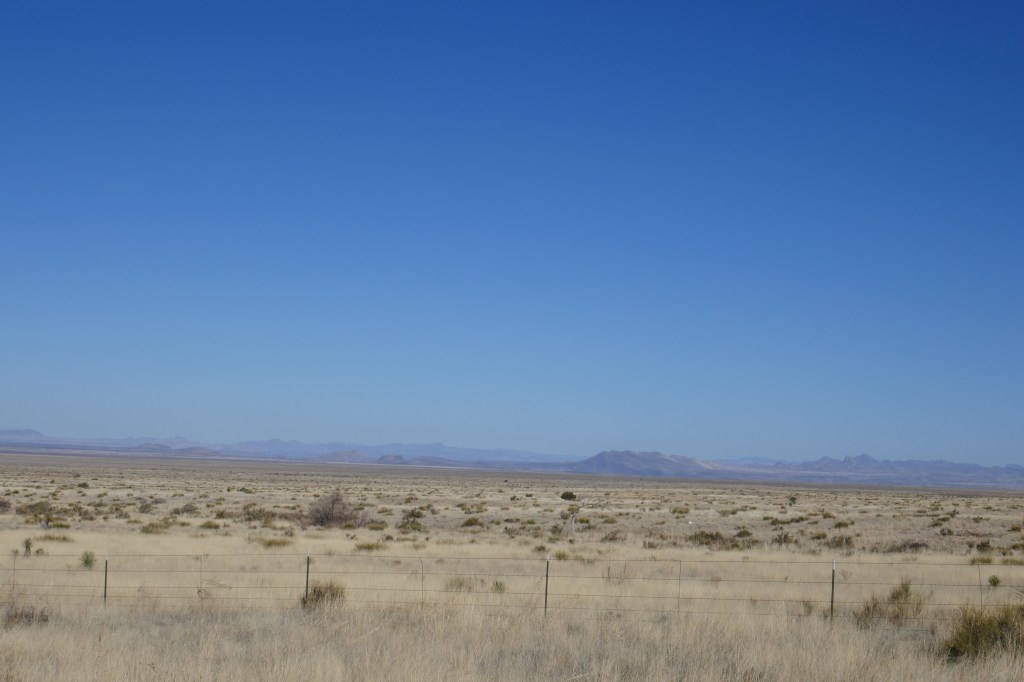
Places are far apart here and there is lots of wonderful nothingness in-between. The places we could stay (including camping with water) were separated by many miles – and we knew this was a second 70+ mile day – after 76 miles yesterday – as there was nowhere between Duncan (40 miles) and Lordsberg (75 miles)..
We had read the forecast the night before and knew that it would be very, very different to yesterday for 3 reasons. First, and mainly, the wind had inconveniently turned 180 degrees around and instead of pushing us along (as it had yesterday), it would be against us all day with a steady 10mph and gusts of 18mph. Secondly, yesterday we finished up 1500 feet below where we started. Today we had a major climb, a descent and then a gradual climb ending up 1500 feet above where we began. Thirdly, this was a second long day in a row – no recovery time and so some measure of creeping tiredness was inevitable.
The day started really nicely. We were on the road before 7 and it was calm. The road out of Safford was quiet, no wind and was flat. Were the cycling Gods in our favour and the forecast would be proved wrong. We doubted it but dared to hope – dashed of course.
The road soon left the irrigated fields and went out into the wilderness. This is not a rich area – not subsistence farming but our impression is that there are very few jobs in farming these days and not a lot of other economic activity to drive a local economy. Land seems cheap, plots are large and there is not much reason to keep things looking good. So most yards had abandoned cars, rusting agricultural machinery or a variety of other discarded objects. It all left the feeling that there were lots of people left behind – many flying “Trump 2020” flags. That may seem harsh and we did see one Biden flag – but only one all day.
The road started climbing (as predicted) and the wind got up and was against us (as predicted). It made for slow progress but we gradually gained amazing views of the valley were climbing out of. We started at about 2900ft and topped out this climb at 4,400ft – not steep but we climbed against the wind for 27 miles. Traffic was light and there was no farming except, strangely, at the very top where there was a cattle farm. Maybe there is a water source there.
On the way up we stopped to examine a historical monument – put up in 1936 to two settlers who were said to have lost their lives in the 1850s “bringing law, order and stability” to the area. They were killed by Indians when they pursued the Apache after 45 of their horses had been stolen. I have no doubt that, if the plaque were erected today, the message would be very different and might reflect that there was order in the valley before the settlers arived – and in fact it was their disruption of the established order that had held sway in the area under the control of indigenous peoples that led to the conflict. The plaque may just have told us more about attitudes in 1936 than what happened in the 1850s.
We slogged on to the top with the wind more of a challenge than the slope, and then descended to the little town of Duncan. Here we had “breakfast” at a very traditional diner – cheese omelette, bacon, hash browns and coffee. By now it was midday and we took our time as we knew the next section was equally tough because the wind was due to increase.
Eventually we had our fill of coffee (endless refills is a US tradition we strongly support) and went back on the bikes after chatting to a couple of locals who were bemused, impressed and worried for us in equal measures. Bizarrely, we ended up talking about Shakespeare plays at the RSC because the elder man had taught English in High School but had never been to England or seen English actors in a Shakespeare play who were steeped in the language. Makes us realise how lucky we are to have Stratford as an accessible evening out at home.
The afternoon passed in a blur. We crossed into New Mexico and battled the wind every turn of the pedals – with us in an alternative reality as we counted down the miles. The road was straight and largely flat as far the mountains on all sides, and so the landscape was almost unchanging. I took most of the lead and Bernie had to concentrate to stay in my wind shadow – a two person peleton across the high altitude plains. This was real cowboy country – and we even saw cattle – but we were just focused on getting there. Eventually we arrived – about 6pm and collapsed.
Today was Lucy and James’ day and we offer them love and support and hope they have a long and happy life together. For us, it all felt a long way away from them but for us getting there was a minor achievement; but there was no time to celebrate because we were too tired.
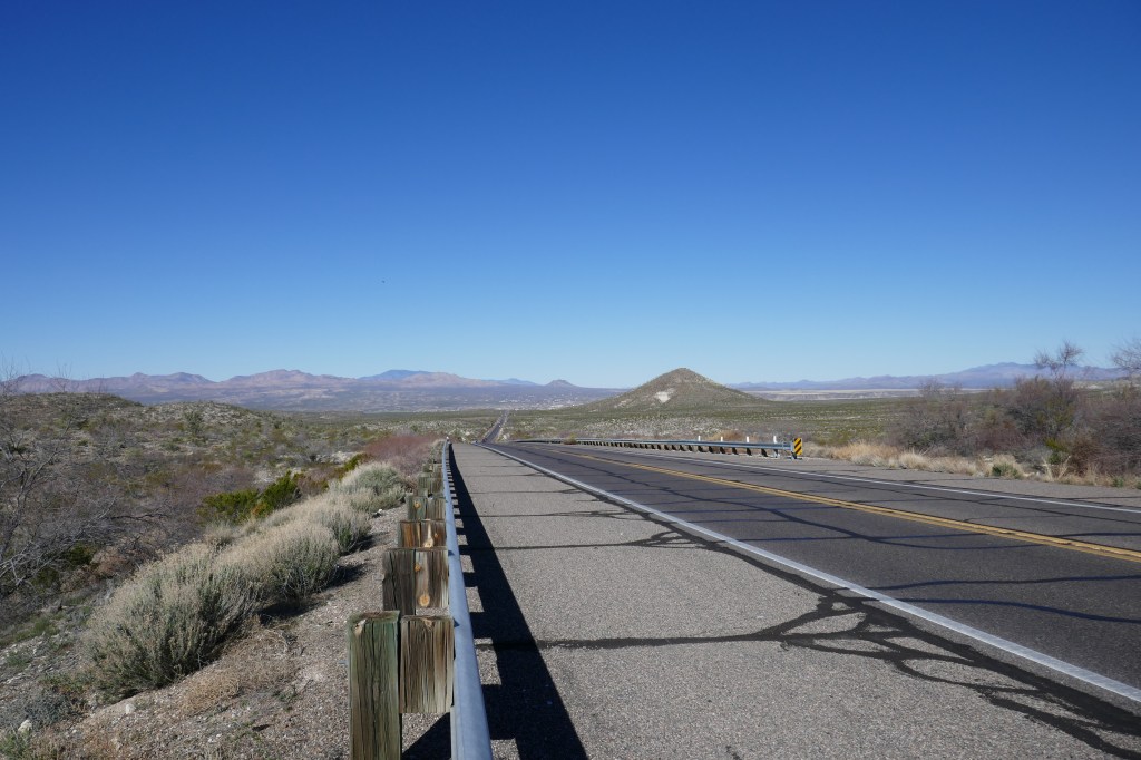
We knew we had a long day ahead of us so we were up with the larks and on the road at 7. We expected the roads to be quiet at that time of day but the US wakes up early and traffic was busy for the first few miles out of town, now on the a new road the 70 which we will be following for a couple of days, but it gradually eased off.
The first 30 miles or so bumped up and down through hills. None of it was too strenuous and we were going well – probably because we were doing more descending than climbing and we had a favorable wind.
We were now in the San Carlos Apache Indian reservation. About 10,000 Apache live on the reservation, which was established in 1872 as they were removed from their homelands and set against other Apache tribes by General George Cook as a deliberate strategy. The Apache had dominated much of northern Mexico, Arizona, New Mexico and Texas for hundreds of years and they were relatively successful in resisting white invasion compared to other tribes but eventually succumbed. The Apache leadership was passed on through female inheritance, so they were on to something (guess who is writing this!).
Cycling through the reservation, the land seemed very barren and unproductive, but perhaps there were better areas. Eventually we came out of the hills and into the valley to the town of Bylas ‘Home of the Apache’. We passed mostly simple wooden shacks but little else. There was a central gas station but no store that we could see. There was a herbal tea shop but nowhere for coffee! There was one fast food outlet that we were grateful to sit in and have some food after 45 miles. The town seemed bleak with little that could provide employment. I hope we got an unfair impression.
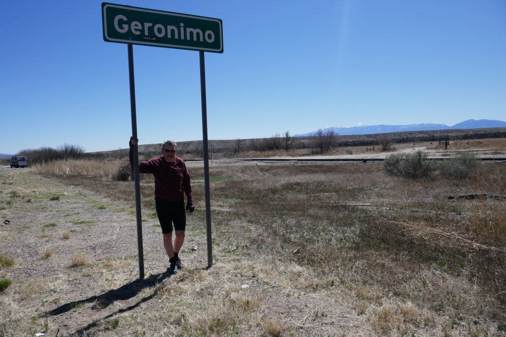
Geronimo consisted of a single, abandoned house but was the home of the Indian Chief of that name
On from Bylas we entered an area of some irrigated fields – cotton we had been told, although the fields were bare at this time of year and looked as if they were being prepared for planting.
At Fort Thomas we passed the Melvyn Jones International Memorial. Melvyn Jones was born there in 1879 and lived there for 8 years. He went on to found the Lions Club (when he was living in Chicago), with Lions Clubs now throughout the world. He died in 1961.
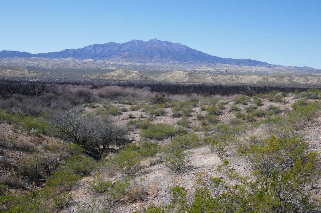
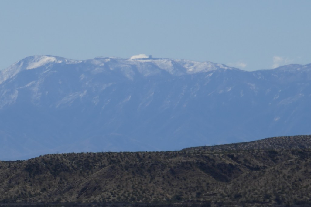
Most of the day we had been able to see Mount Graham, which reaches almost 11,000ft and was topped with snow. The road was flat and the wind behind us so we motored along the flat valley. After about 70 miles we reached an urban area of increasing traffic and at 77 miles we reached Safford. Most activity seemed to centre on the extremely busy main road. Moving one block away was like a different universe of quiet pleasant roads.
Mount Graham in the distance
We stopped a a bicycle shop to buy an inner tube after David’s exploded the day before. The guy running it was retiring so was running down the stock but we were able to get the tube. It’s sad but it seemed unlikely anyone else would take on the bicycle shop.
We found ourselves a motel – marginally more upmarket that the day before. However basic suits us as we can take in the bikes and cook outside on our little stove. I walked the less than half a mile to a supermarket and was again struck that no one walks in the US. We virtually never see people walking on the street, which makes a lot of places appear like ghost towns. An example was the night before – when we cycled through the town to reach the restaurant it seemed dead but the moment we opened the door to the restaurant it was heaving with life.
Although we had broken a distance record for this trip we did not feel too bad – helped by the fact that a lot was flat with the wind behind. I fear this won’t last.
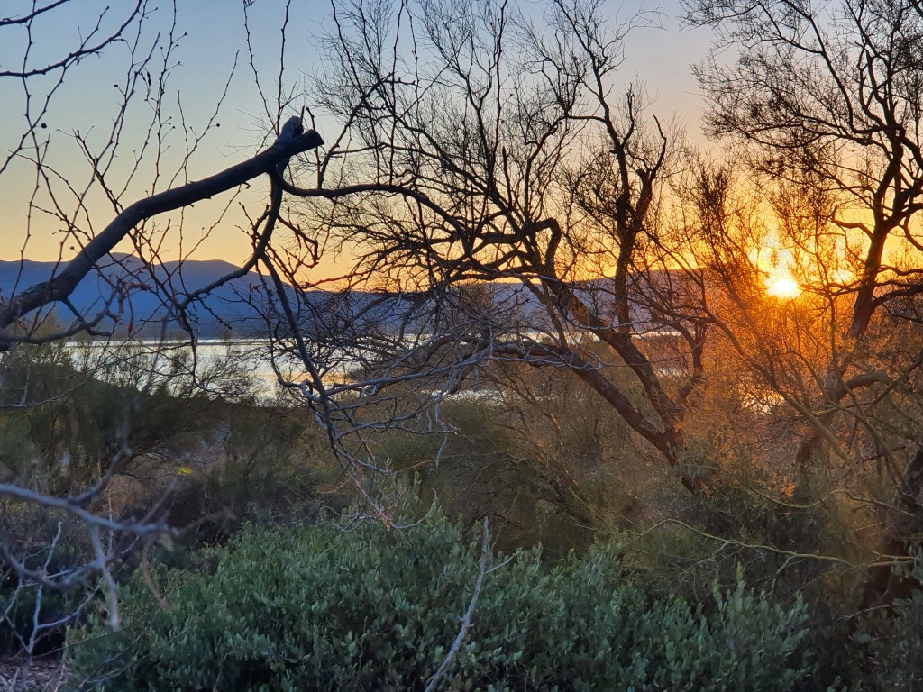
We woke in our tent at about 6.30 after both having had a very long and sound sleep. The tension and the effort of the day seemed a long way away. Morning coffee in our sleeping bags and then a relaxed, leisurely breakfast with Tom and Carolyn. They are such wonderful company – interested in everything and so knowledgeable. They showed us the cliff dwellings which are high above us. These were in use by the Apache Tribe who were at the centre of sophisticated trading networks well before they came into conflict with white settlers. They did not have a written tradition so piecing together history is a case of looking at fragments of pottery, glassware and other clues to work out what was going on. But it was a lot!
Dawn over the lake
By 10am we were all packed up and could not think of any more excuses and had drunk too much coffee. So we said our farewells set off. T & C were going north to see relatives in Las Vegas and then back up to Eastern Washington. We hope we will see them again soon.
We knew that today was a short day. We were going into areas with limited accommodation and service options and so today was 35 miles, followed by two 70+ mile days. But there was one major climb we needed to get over before we could get to the town of Globe. This was a climb of about 1800ft, and most of it was around 7%. So it was a slow plod up with great views as we got near the top.
Then it was a glorious descent – or it was until my rear inner tube decided to explode with a loud bang. About 7 inches of tube were severed and it was clearly not repairable. Goodness knows what had caused that!
After the descent, the country flattened out and we saw why Globe has a reputation as one of the largest sites of open cast mining in the USA. Mining started with silver in 1875 and then moved to copper which is still mined in the area. The town has a “frontier” feel and its history includes a wide selection of lawlessness including stage coach robberies, murders and lynchings. It felt pretty peaceful when we saw it – staying at the down at heel but cheap El Ray Motel.
The town was buzzing in the evening and we were recommended to try Blooms, a Chinese restaurant. It was excellent – great portions for cyclists and even a glass of rather good wine. The atmosphere was half the fun – with people dressed up for a Thursday night on the town and others just grabbing a take-out on their way home. This restaurant – like many in the USA – closes at 8pm as people have done with eating by then. We left just before it closed and floated effortlessly back to the motel after probably our best meal of the trip so far.
An advance warning: this will be quite a long blog post as it was one of those EPIC days which we get once in a while. Luckily this was epic and magical rather than epic and disastrous! 34 miles may look an easy day but it took us 8 hours. The photos will hopefully give some idea but could not capture the grandeur of the scenery we were privileged to experience this day.
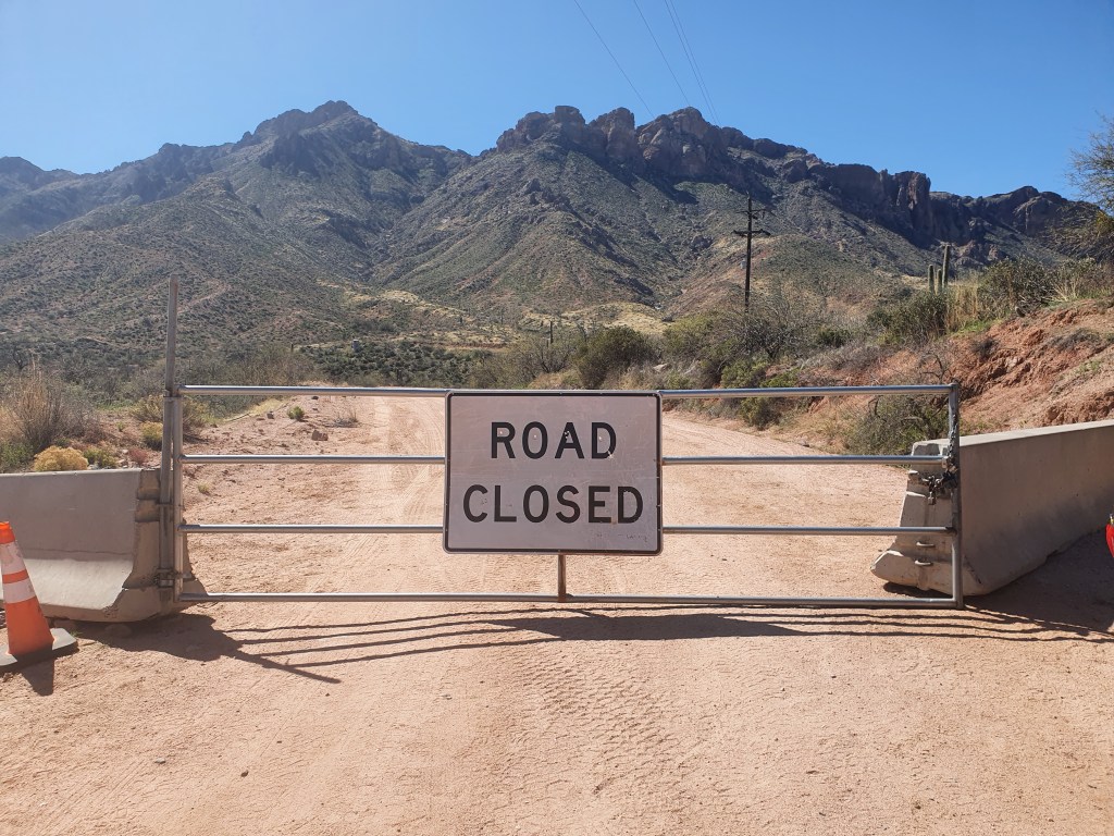
As David ended yesterday’s post – we started the day with some trepidation as to whether we could get through to Roosevelt Lake on Highway 88. The golden sun on the campground as we woke up made us feel that it was worthwhile waking up to this gem of a place, even if we ended up turning back and back at the same campsite in the evening. We were mildly encouraged when we met a Forest ranger volunteer just as we were leaving the campsite. We asked if we could get through and he was mildly encouraging. He had hiked down the closed road and thought we could probably get through so we set off with more confidence and all the information we could get.
The genuine cowboys we met on the path
The first five miles were up hill on good tarmac through a veritable cactus garden. It was greener with some flowering plants too displaying pinks and purple flowers. This is what we call a ‘European climb’ ie not a long long slow 1% climb but a steady 6-7% with views opening up at every turn.
Abandon hope all who enter here!
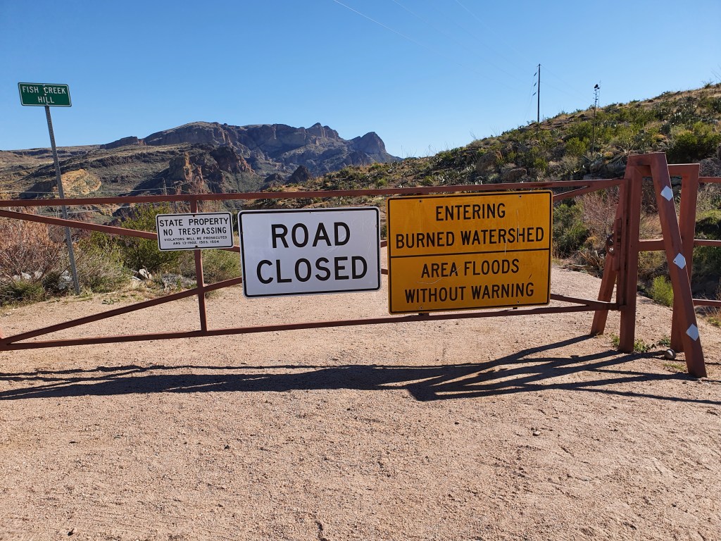
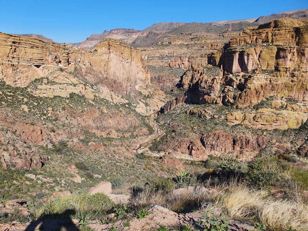
As it flattened out, we reached the end of the tarmac. There was a sign warning we faced 22 miles of unpaved road ahead. The start of the adventure. We rarely cycle on dirt roads as, with heavy panniers and road tyres, it is quite tricky but we bumped along learning to try and ride with the bumps rather than fight them. After 2 miles we reached Fish Creek Hill overlook with magnificent views into the canyon and surrounding mountains – and the ‘road closed sign’. It was deserted but there was a huge parking area – and a car parking space designated for disabled only parking. Great but maybe unnecessary!
Fish Creek Vista
There were signs explaining that this was an apache trail and that a crucial part for those driving with carriages and horses was dropping down Fish Creek Hill.
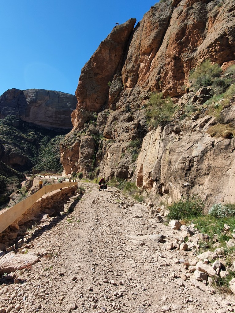
We had been told not to worry about the barrier. So we unpacked the bikes to get through the barrier and repacked the bikes to start the road down to Fish Creek Hill. I say ‘road’ but this was generous. We had to walk the majority of the 2 miles down as the road surface was full of sections of large stones or consisted of large ruts. The canyon walls were on our right and a steep drop on the left so we weren’t taking any chances! However we wanted to stop so many times to take photos that it really didn’t matter.
We have cycled on better roads but in few better places
Half way down we had one of our more unusual encounters. We met two guys on horseback – real cowboys who were looking for their 74 head of cattle (at that point they had only found 6). They seemed totally unperturbed to come across two mad heavily laden english cyclist picking their way down the road. ‘Do you have cowboys in England?’ they asked. We explained that our cows are fenced in, although sheep may roam up on the moors. They pointed out 2 sheep precariously balanced high up on the canyon wall – this looked precarious to us but they assured us they never fall off.
The cowboys also assured us that we would get through – in fact their trailer was parked 2 miles down so from there we knew the road was passable from there. A great relief as it would have been a hell of a push to get the bikes back up the track. There was a huge set of boulders across the road just below the cowboys but a narrow gap by the wall had been created – after all the horses had got through – so we were able to lift the bikes over. From there we could see the bridge and the creek and we were soon down and having a break under trees, eating the banana loaf that Julie had made for us.
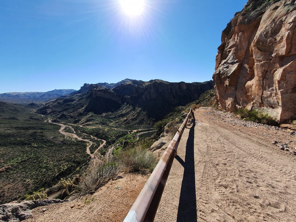
From here we plodded along the dirt road for the next 18 miles. At one stage I glanced at my Wahoo and saw we were averaging 5.4 miles an hour! So it was not fast but was rewarding. The road broadly followed the Fish Creek river but it had numerous climbs and drops, most of which were pretty steep. The ups were hard and the downs were harder. This was not complete remoteness because there were electricity cables throughout the valley – we assumed they were bringing the hydro-electric power from the Roosevelt Dam down to the Phoenix area. Various trucks of workers were working on the power lines and gave us a wave from their posts high up on the stanchions as we passed. There was also a helicopter delivering large blocks of something back and forth to a particular stanchion – we wondered at the pilot’s expertise as he or she delivered load after load.
Finally through the closed section.
The road snaked its way up and down along the valley and we ambled along trying to find the parts of hard sand and avoiding the soft bits where the types sank into the surface and it came to a complete stop. That was fine until a minibus came the other way and David was forced into soft sand, came off and grazed his leg. It looked worse than it was – or so he assured me – and was not too bad after we cleaned the sand out of the graze. Just a flesh wound!
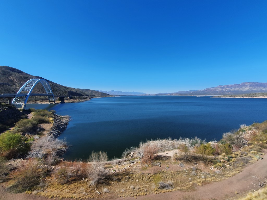
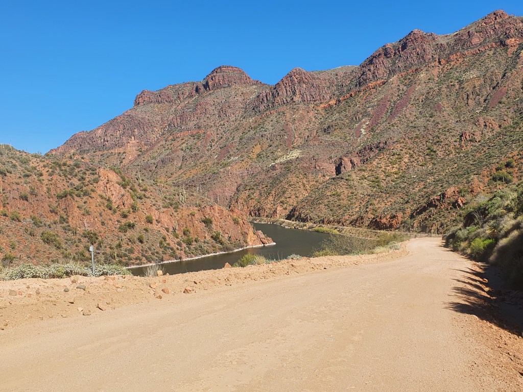
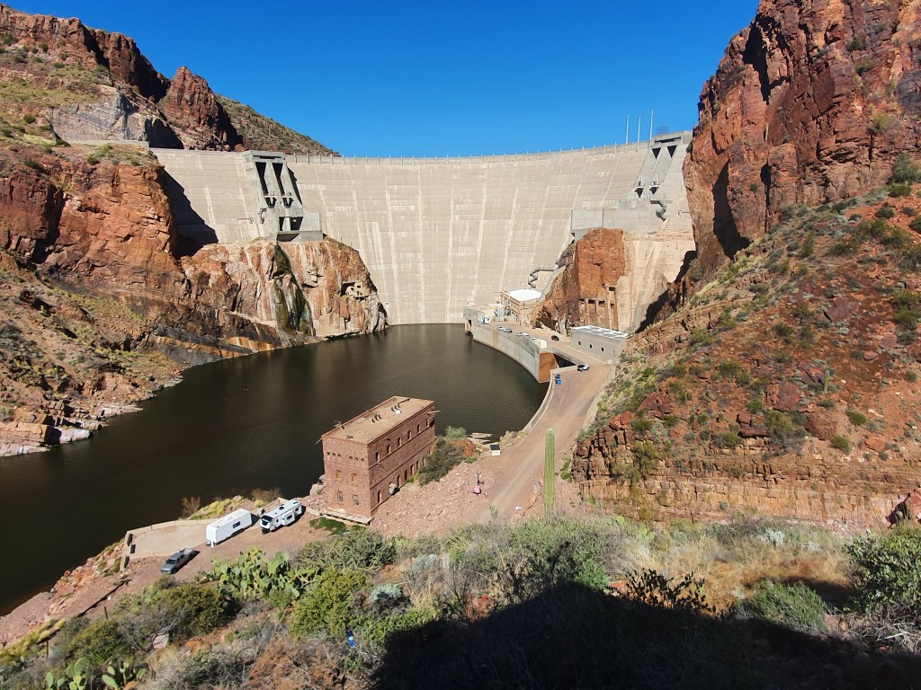
Eventually we saw the Roosevelt Dam and experienced the joy of tarmac again. The Dam was built between 1906 and 1911, and was the largest stone dam in the world at the time. It was rebuilt in the 1990s when they worked out that it might not be tall enough to withstand the highest likely flood – raising the level of 77ft and putting in hydro-electricity.
Roosevelt Dam over the Salt River
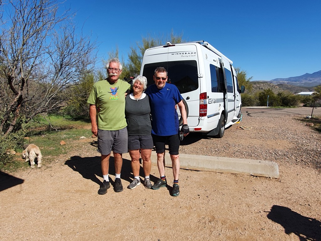
Then it was just 6 miles to the Windy Hill campsite (yes it was windy) to meet up with Tom and Carolyn Sullivan who were our first ever warmshowers hosts in Washington State in 2013. They were on the site with their camper and their welcome was as warm as ever. It was lovely to see them and we shared an evening of chat, laughter and observations on life, the universe and everything. They are now in their 70s and an example of living life to the full – getting the most from each year and contributing to the good of others.
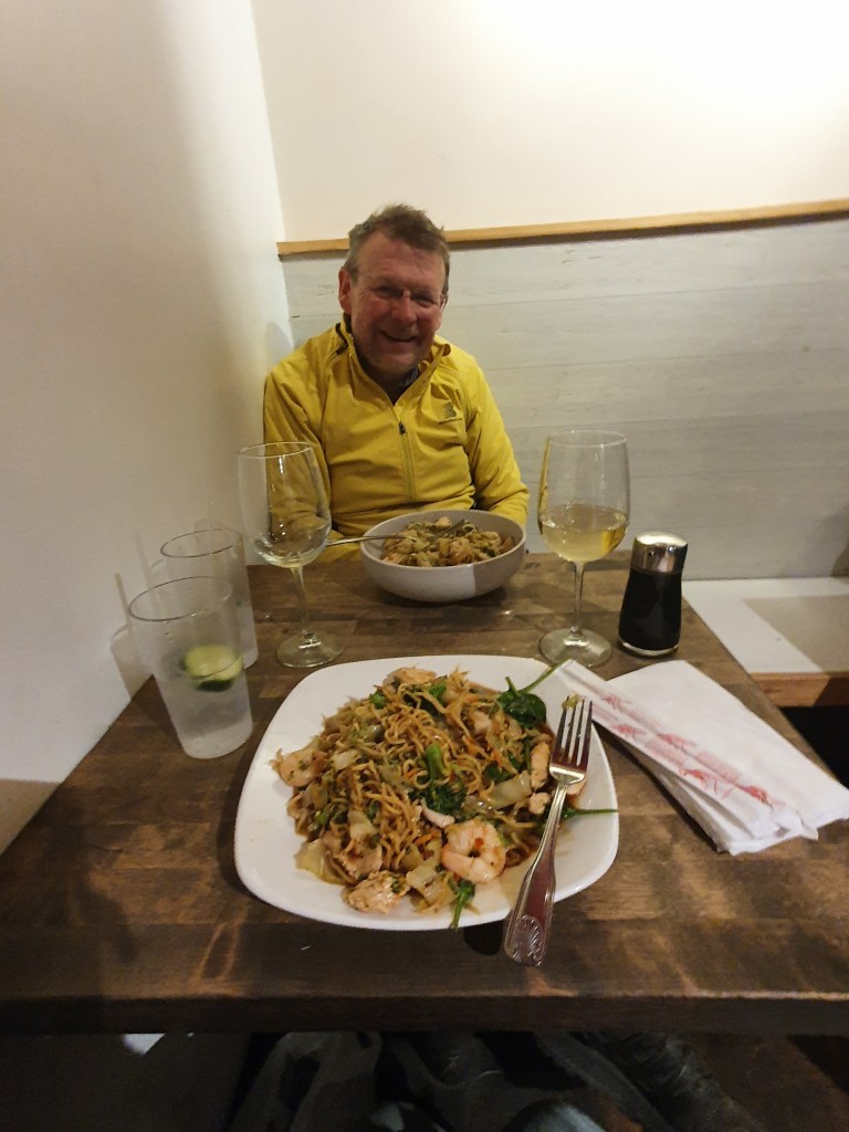
Tom, Carolyn and David
It was a tough day – 4,300 feet of climbing – and lots of slow cycling on dirt roads but the scenery was so memorable. The photos maybe do not do it justice but it will live long in the memory.
We said our goodbyes after a delicious breakfast prepared by Julie. Such a warm and generous host.
Today was a slightly odd and in parts frustrating day, but which ended with us camping at an amazing location in a desert gorge.
The greater Phoenix metropolitan area is “extensive”. The first 38 miles today were flat, suburban cycling; partly along canal paths but mainly along fairly busy roads with houses on either side. Some neighbourhoods were smarter than others, but overall it was our exposure to middle America. Very little grass here as front yards were mostly stones and cacti but there was green in the occasional park or sports field. It was low rise, low density often fairly attractive housing that went on for mile after mile. This area must have been desert a few years ago but the city has expanded to meet demand, although whether there is the water to support such a vast urban area as our climate changes remains to be seen.
Eventually we approached the foot of the Superstition mountains which marked the end of the plain. The stones above us were as red as any mountain I have ever seen. The road then swung left uphill past some “Disney themed” attractions celebrating the time when this was frontier country. We passed up the chance to visit a ghost town and gold mine; it looked antiseptically clean and far too organised to have any real ghouls. By now the road was narrow and the gadient was getting steeper, but the traffic was thinning as we headed up to Canyon Lake.
We were on the 88 state road towards Roosevelt Lake, the Apache Trail, as it was the trail used by Apache native americans in days gone by. Sections of this road beyond Canyon Lake were washed away in 2019 when there were monsoon rains, and it has not reopened to traffic as a through road. It was always a road that had a 20 mile unpaved section but now part of that is impassable for cars but is used to access Canyon Lake which is a well known beauty spot.
Canyon Lake
The Arizona State Traffic organisation confirms that, whilst the road is closed to vehicles, it remains open to pedestrians and cyclists. No one seemed to know if it was actually passable for cyclists but we have decided to give it a try.
We wound our way up the road to Canyon Lake, passing a group of locals who were packing their horses back into a trailer after an 8 miles ride into the bush.That looked a great way to explore the terrain – if you had skills on a horse (which we don’t really have). Can it be that different to a bike?
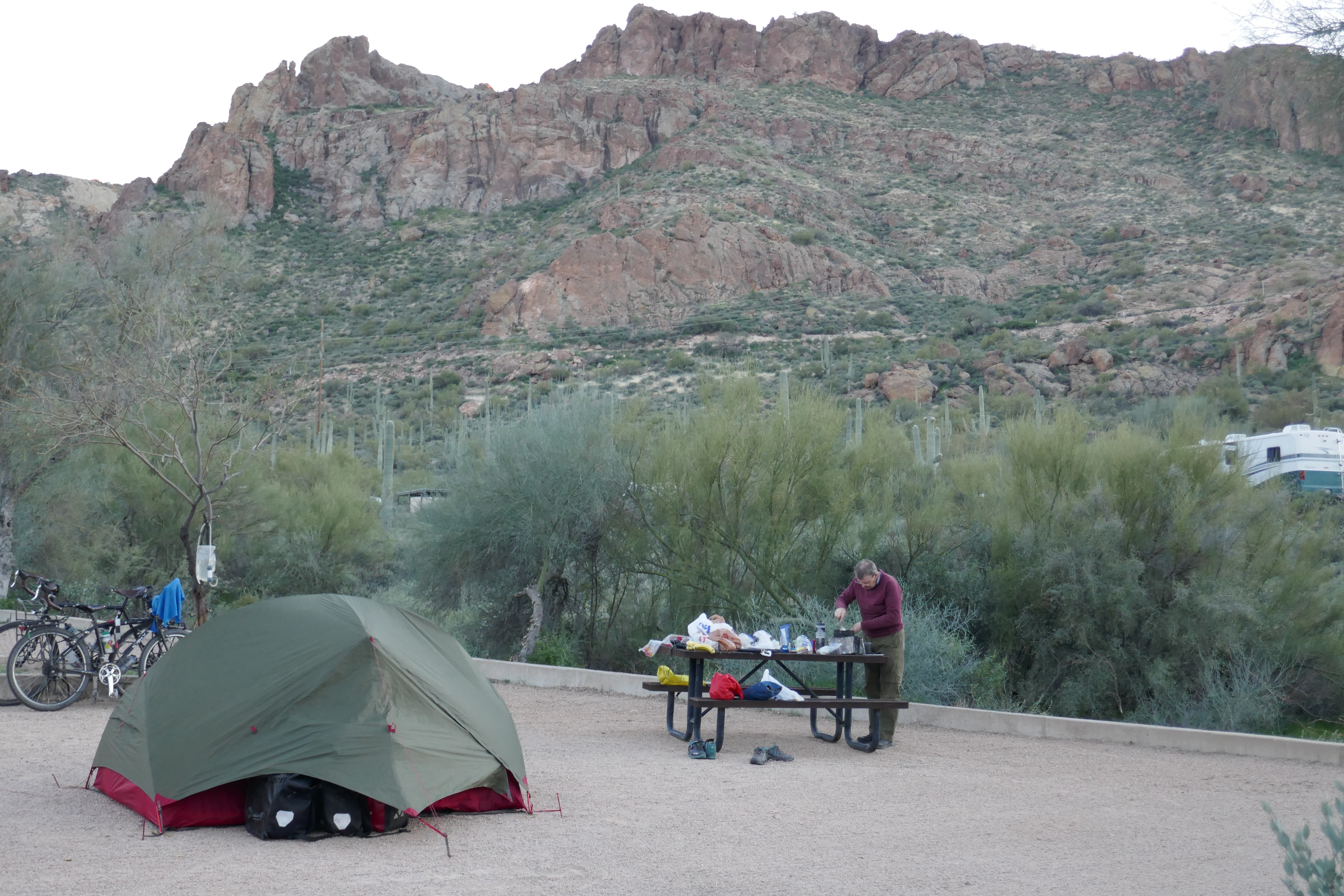
Then up and over as we swooped down to Canyon Lake. Our first attempt to find a campsite was met with a US “jobsworth” who unhelpfully insisted there was a minimum 2 day stay requirement at his campside and that would be $120 if we wanted a pitch. We demurred and he said we could go 2 miles “along” to Tortilla Flat where there was another campsite where you can stay for a single night – all said as if we should be equated to some form of species of low life for not staying more than one night. And – he added – there was no water there.
So we filtered water from the lake and cycled off fully laiden – by now it was nearly 5pm. Mr “jobsworth” was wrong on just about every point. First, it was not 2 miles but 4. Secondly, it was not “along” but a 400 feet climb up and then a 200 feet descent. Thirdly, it had water when we arrived – plenty of it. But most of all, Tortilla Flat was in a fantastic valley with spectacular views on all sides.
Out for a ride – in a different way!
We paid our $20 for the night and felt it was better than a 5 star hotel any day as the setting sun lit up the mountain tops. We spent part of the evening chatting to Terry and Cindy, the hugely welcoming campground hosts and felt really pleased to be here. But we were the first cyclists to stay at the campground and they could not tell us if any anyone had made it through. So tomorrow will be a challenge and it remains to be seen if we will make it the Roosevelt Dam along the washed out section of the road. By the time I am able to post this blog, we’ll know the answer.